Islamabad – Chillas – Tatu Village – Fairy Meadow – Nanga Parbot – Skirdu – Shigar

After a long (20 hours) and fairly comfortable flight I arrived in Islamabad at 3:35 in the morning. I traveled Business Class on Turkish Airlines and I have to give them a big thumbs up! The flight attendants were active and courteous, the food was excellent and the accommodations were comfortable.

I was surprised to find Islamabad had opened a new and very nice International Air Terminal and the immigration setup since I was here in 2019. The shiny new terminal was very well organized to move foreign tourists through rapidly. Unfortunately, Pakistanis as a rule don’t seem to follow rules. Any rules – whether driving or lining up and waiting their turn. Since I was in first class, I exited the plane first so I and the other foreign travelers reached immigration first. We were all lined up patiently waiting our turn behind the designated blue line when 200 Pakistani young men returning from Istanbul arrived and simply broke thru all the rope lines and charged in mass to every immigration window. Every window regardless of whether for Pak citizens, foreign passengers or diplomats had 15 to 20 young Pak men pushing and shoving demanding their papers be checked first.

The immigration agents tried repeatedly to explain they had to go to the domestic line but the Pakistani men would have none of it. It finally required armed security to move the rowdy rambunctious anarchist to their own lanes. But once I got in front of the agent he cleared me in less than a minute, my bags were waiting on the belt in baggage claim when I got there and customs just waved me through the green lane without even asking what I was carrying in my bags or x-raying the contents. Incredibly once the guards cleared the flash mob I was completely through the process and meeting my driver in less than 10 minutes.

By 5am I was undressed and in a king-sized bed for some real sleep. I know better than to sleep after a long haul trip that makes the jet lag worse but I was whipped and had no plans for the first day anyway. I slept from 5 to 9am then had one of the Marriott Hotel’s fantastic buffet breakfasts. I was back in bed by 10am and slept until 5pm waking again only to eat. After dinner I posted some photos on face book and posted my first blog of 2021. Then I couldn’t sleep and was up all night and morning until Manzoor picked me up to drive north at 7am.

The drive to Chillas was supposed to take about nine hours over some pretty rough roads. I have had many people ask me if Pakistan is safe. Do I worry about being kidnapped by terrorists or criminals. This is my second trip to Pakistan and I have never had a problem or even felt like I was in a compromising situation. For the most part the people of Pakistan are very friendly, open and welcoming as long as you don’t wander into some place you shouldn’t be and treat their culture and religion with respect.

The real danger you face in Pakistan are the roads and the bat shit crazy drivers. On my first day’s drive north from Islamabad to Chillas we witnessed a young man loose his life trying to out run a bus doing 160 kilometers an hour before we even left the city. And then our driver ran us into a granite wall about 5 hours into the drive.

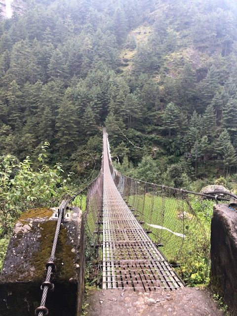
We began our trip north driving on the Karakoram Highway (and calling this goat track a highway is being extremely charitable). This road is the only ground route north to the East side of the country. The road alternates between being paved with car eating sized potholes for a quarter mile then a quarter mile of gravel/crushed rock deteriorating into first an off road jeep track then a glorified goat track. To make matters worse the road isn’t even a legitimate two lanes wide. In many places the road goes from a lane and half wide to one lane with a solid rock wall on one side and a sheer drop off with no guard rails on the other.

Add the terrible road conditions, the heavy car, bus and commercial truck traffic and the Pakistani Fight Club on wheels driving philosophy and you have created the perfect storm or death trap. In one week while we were in the north the road averaged two to three accidents per day with 6 to 7 deaths.

Pakistani drivers think nothing of passing on blind curves, into on-coming traffic or threading the needle passing a large truck on a blind curve of less than two full lanes with the right side tires barely avoiding dropping off the side of a 1000 foot drop. It occurred to me as we drove that this must be where every Pakistani taxi driver in America learned to drive. Passing Lanes – screw em, speed limits – suggestions. Traffic lights – for amateurs.

So forget about getting your head chopped off by terrorists, don’t worry about getting kidnapped by a blood thirsty gang – pray you survive a road trip with Pakistan’s Mad Max!


This slideshow requires JavaScript.


Back to our little mishap – about 5 hours into our drive north the rocking and rolling side to side of the SUV dropping into potholes and climbing over berms combined with the fact I had not slept the night before and the playlist of Etta James, Ray Charles and Sam Cooke rocked me to sleep. One minute I was peacefully dozing and the next minute I was rudely wakened by the loud bam of metal hitting granite at 40 to 50km and being thrown up and forward then sling shotted back in an instant awake.

Groggy from both sleep and shock it took me a few minutes to realize the severity of the accident. I thought we maybe blew a tire or bottomed out in a crater sized pothole. Only after I got out and looked at the SUV did I see the true extent of the damage. In short the vehicle was totaled. The impact ripped the front left tire completely off the axle, ripped the axle from the drive shaft and the motor mounts from the frame. Not to mention there were huge chunks of plastic, fiberglass and metal stretching 20 feet in all directions. Looked like we might have hit one of those IED things.

Fortunately we were able to hitch a ride with a manager of the Construction Company building this road and his driver in an extended cab Toyota pick up the rest of the way to Chillas. And this driver was even scarier than the first guy. He passed other vehicles daring them to not get out of his way.

The ride in the pickup presented three problems for a fat, old, 6 foot 3 inch American. First there is very little leg room in the back seat of these trucks. seven hours of my arthritic old knees locked in one position I was sure I would be crippled for life. Second being of man of a certain age I have made a practice of never passing up a bathroom. Since beggers can’t be choosy and the manager was running late for a meeting in Chillas I had to hold it for 7 hours of bouncing in the back seat of the truck.

And finally I had not eaten since 6:30am and the accident happened around 2pm I was starving by the time we climbed into the back seat of the Toyota. Manzoor planning ahead had stopped in Besham to pick up some grilled chicken and fries to eat along the way since all the restaurants were closed for Ramadan and had the foresight to grab the bag before we abandoned our SUV.

But I felt it would be rude to eat in front of these two Good Samaritan Muslims in the middle of their fast (during Ramadan the faithful do not eat or drink from 3:30am until 6:30pm for the full month). So I sat there for hours starving smelling the inviting aroma of grilled chicken wafting up from the bag, needing to heed the call of nature and feeling my knees screaming at me with every jolt of a pothole for hour upon hour. Finally somewhere along the highway to hell the driver stopped in a village and he and his boss jumped out without a word and left us in the truck. Turns out they stopped to go to mosque to pray. Which allowed Manzoor and I to quickly wolf down some chicken and fries while they prayed our driver wouldn’t kill us before I could relieve myself in Chillas.

Finally the guys dropped us off at our guesthouse in Chillas and I made a beeline for the bathroom on groaning and cracking knees. After an hour stretched out on a bed, a quick dinner of more grilled chicken, French fries and nan, a good night sleep I was ready for the next day’s hike into Fairy Meadow.

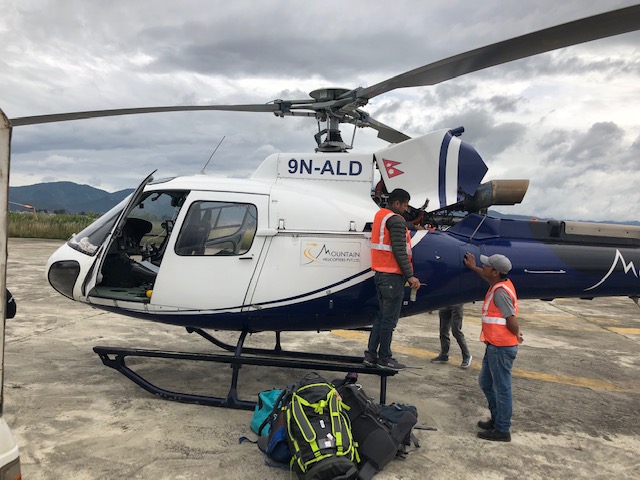
But before the trek we faced another two hours on the highway to hell, then an hour and half off road jeep ride up the mountain to Tatu Village (the trail head for Fairy Meadows and the Nanga Parbot basecamp.


This slideshow requires JavaScript.

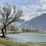
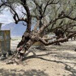
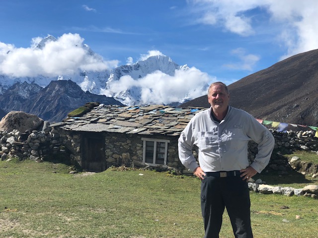
There are about 200 people that live and tend their flocks of sheep and goats and small herds of cattle in Fairy Meadow. The animals and villagers spend the winter in Chillas then in May drive the animals on foot for days along the Highway to the Riakot Bridge where we began our jeep ride then up the mountain to Tatu Village. The entire clan of 200 spend May in their Tatu homes as their animals graze the surrounding mountain sides and valley then move up to Fairy Meadow in mass in early June. They live in the Fairy Meadow village from June to October tending their animals felling trees and turning massive tree trunks into usable one inch planks of lumber which they use to build guesthouses to rent rooms to tourists.

Interesting the Villagers who used to make their living from tending animals now make more income from tourism than agriculture.  Thousands of people flock to Fairy Meadow to Escape the summer heat of the cities.  Since I wast there in early May and people are still a little afraid of Covid  I only saw three other visitors – all on rented horses.  Toward the end of the long slog up the mountain I asked Monzoor about the people on horseback.  I think he enjoyed telling me most of the thousands of visitor to Fairy Meadow ride horses up the mountain rather than walk.  By this time my legs were cramping from the six mile climb up steep uneven terrain.  I sometimes wonder if I am stupid, crazy or just punishing myself for being a nasty human being – why the hell didn’t I rent a damn horse!

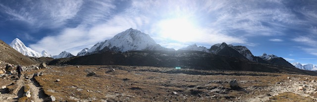
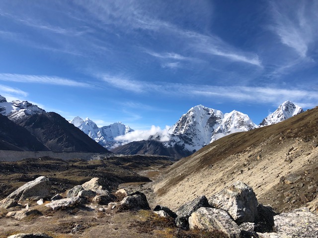
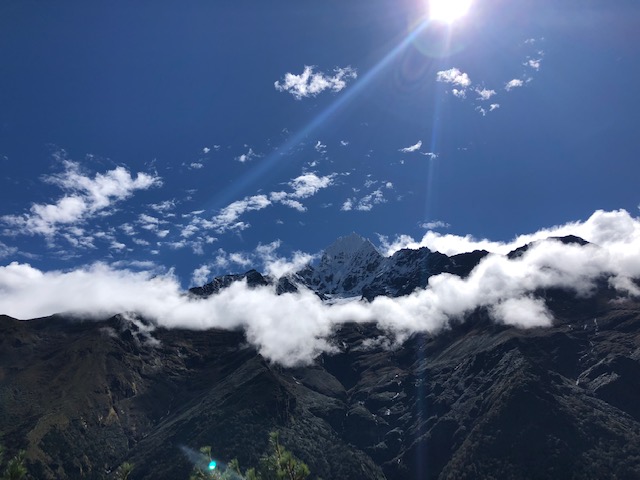
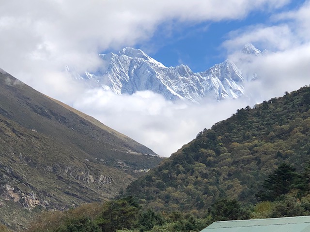
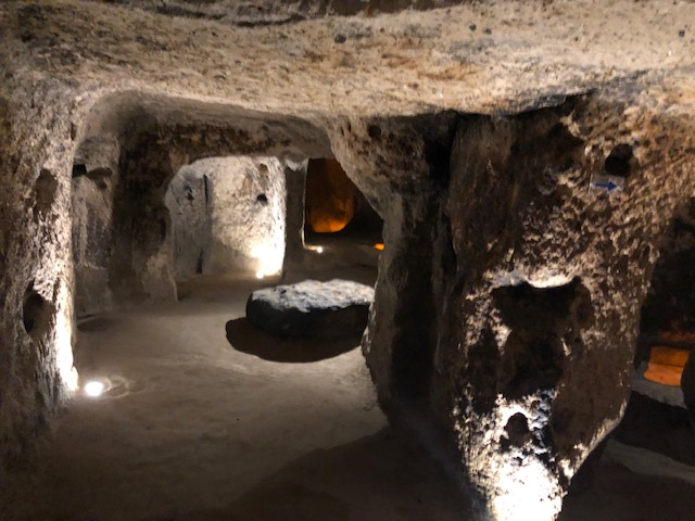
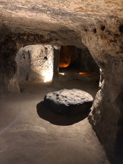
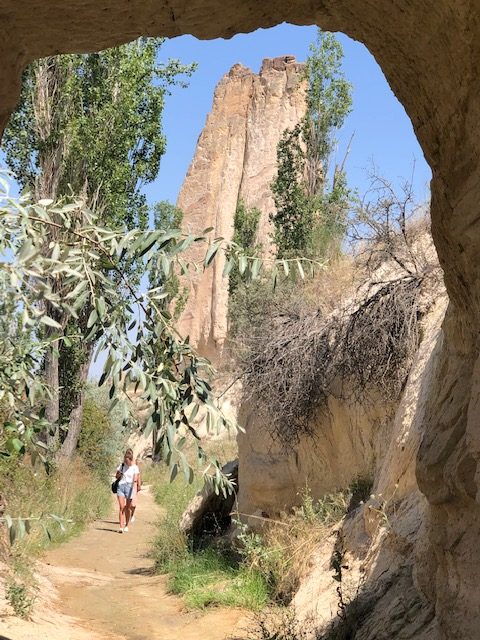
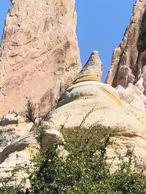
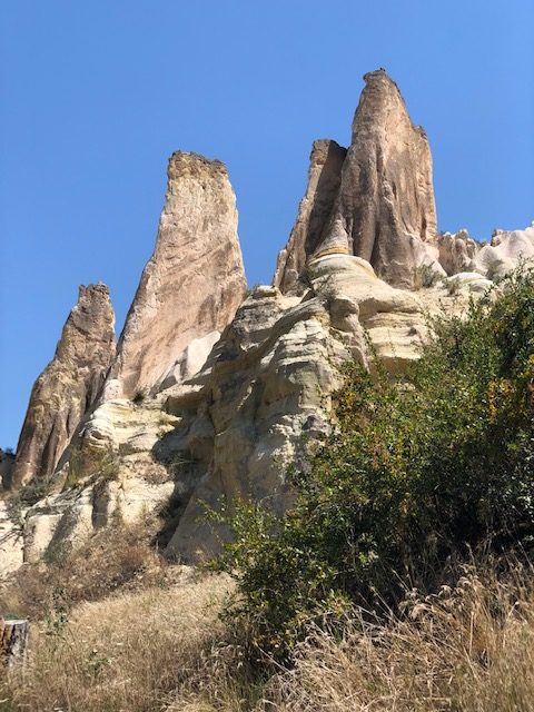
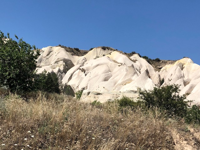
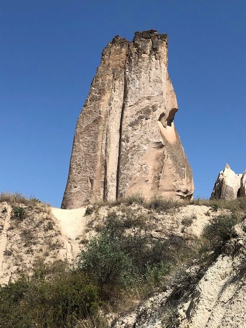
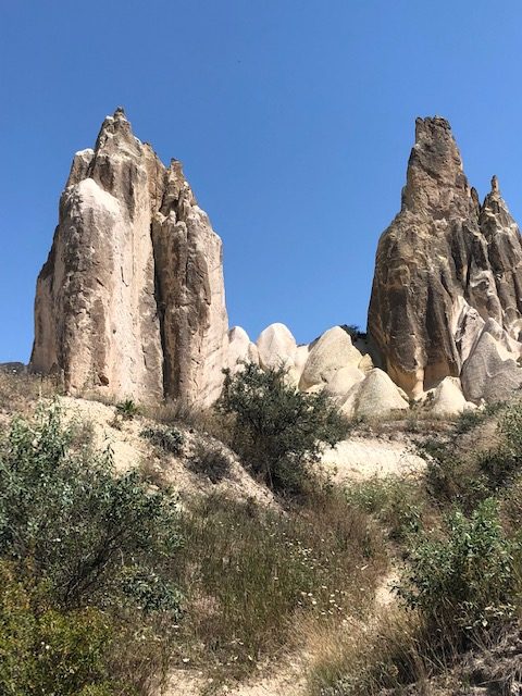
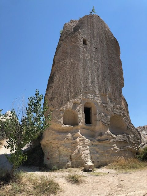
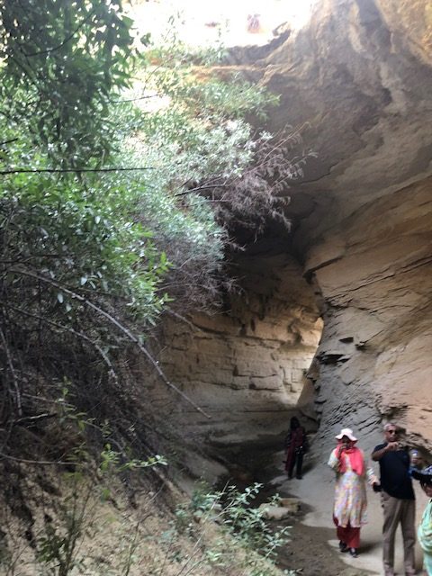
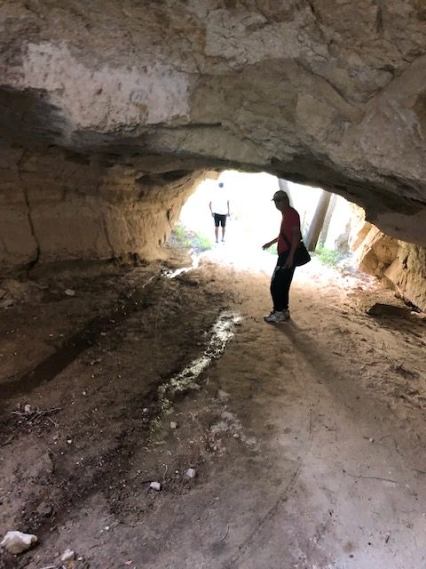
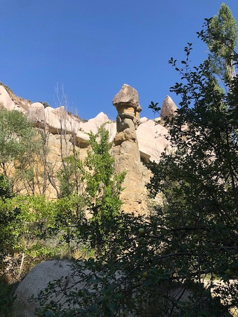
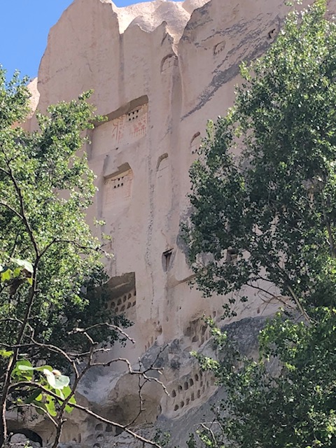
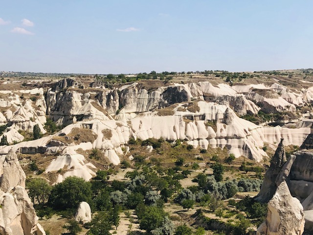
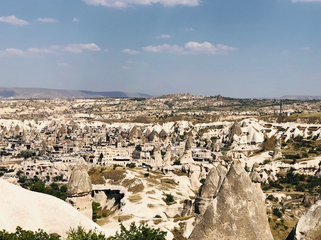
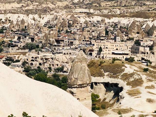
But I have to say when I reached Ferry Meadow and watched the sunset in the valley I knew every step along that trail was worth it. I hope as you look at the photos I post with this narrative you can appreciate the beauty and majesty of these rugged mountains and respect the people that have made their lives for generations in this beautiful but harsh land.

This slideshow requires JavaScript.

After more grilled chicken, more French fries and more nan I limped down to 
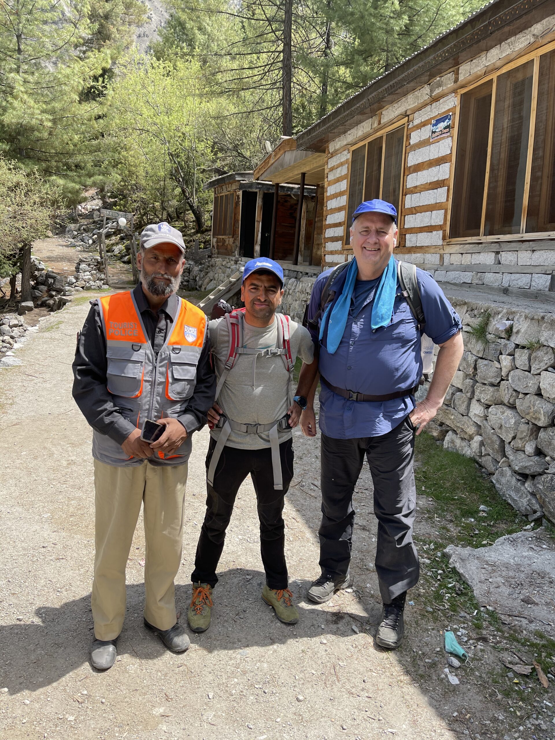
my cabin and fell into bed. Unfortunately, I did not get a lot of sleep because my legs and feet were cramping all through the night from two days of sitting in one position in cars and jeeps and 20 hours of flying in one position followed by mile after mile of trudging uphill for hours.

Next morning we hiked on up to Bayal Camp a 61/2 mile round trip. Then the final morning we hiked back down the mountain to Tatu Village,mthen took the 4 wheel drive jeep down to the bridge followed by a two hour drive to the Village of Shigar.

I stayed overnight in the Shigar Fort built in the 17th century by the Raja of Amacha that has been converted into a small hotel.

This slideshow requires JavaScript.

Sites worth visiting in or near the village included the Khilingrong Mosque, the Amburiq Mosque, Manthoka Waterfall and Blind Lake.

This slideshow requires JavaScript.

The Khlingrong Mosque just a short walk from the Fort is a beautiful wood and 
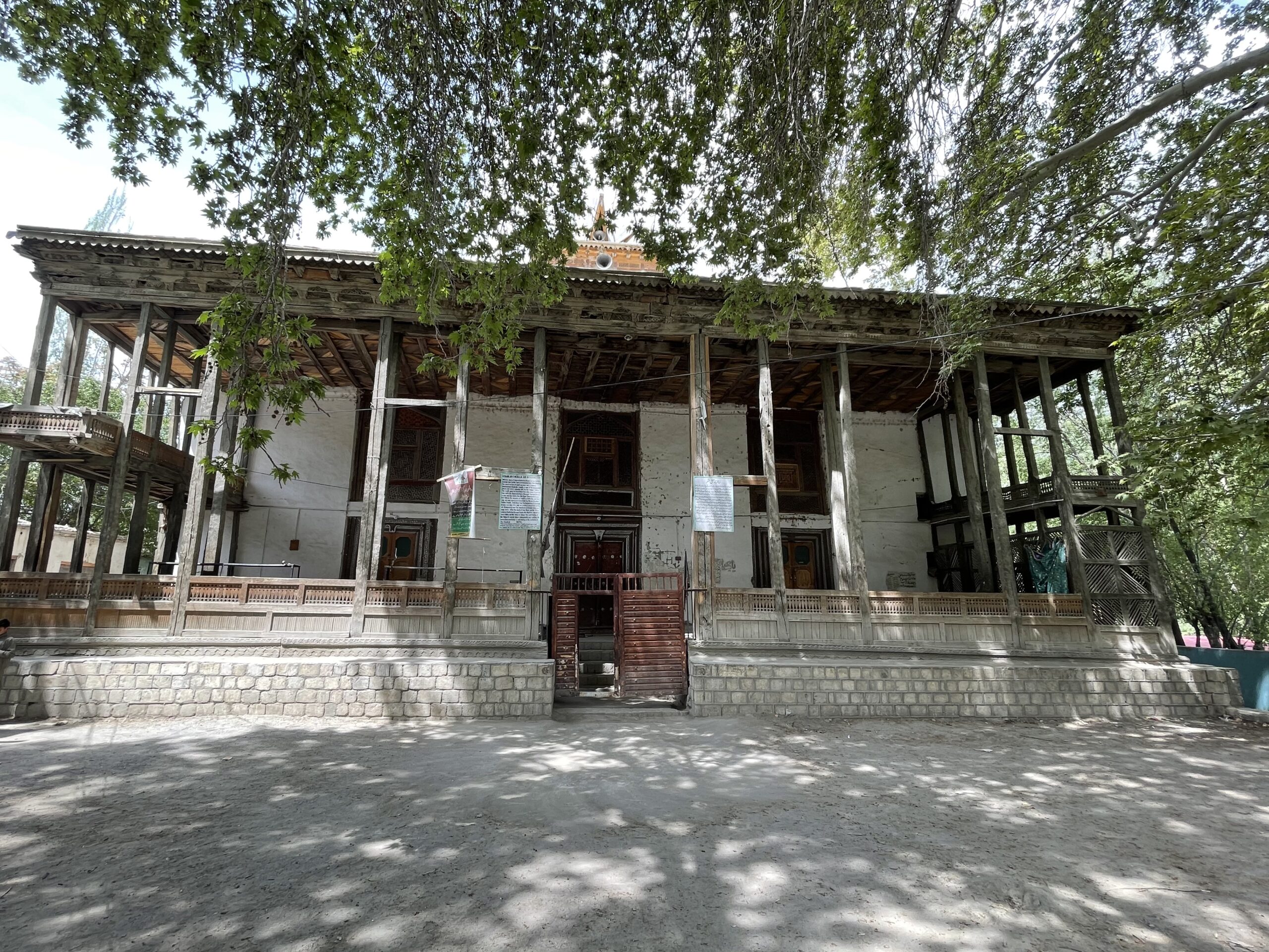
stone two story structure built in the 17th century. The ground floor was used in the winters and the first floor in the summer. The wood is exquisitely carved with geometric and floral patterns. As you can see from my photos the mosque is still in use today.

The Amburiq Mosque is one of the oldest mosques in all of Baltistan built in the 14th century by the Kashmiri preacher Sayed Ali Hamdani with the assistance of Iranian craftsmen.

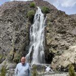
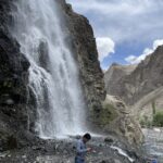
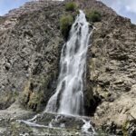
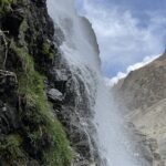
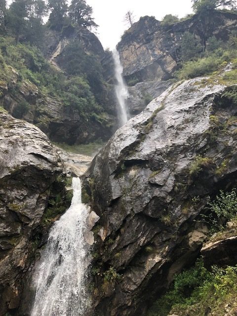
We stopped for an impromptu lunch of fresh caught fried trout and fries at the base of the 180 foot Manthoka Waterfall. The falls are located up near the head of the Kharmang valley in a peaceful meadow. And since my visit was in the middle of Ramadan I had the place to myself.

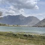
Zharba Tso or as it is better known Blind Lake, is a lake set in a spectacular location surrounded by snow covered peaks offering incredible photo options from every possible angle. The lake is fed by the Indus River and is the main water source for the Shigar Valley.


From the Shigar Valley we crossed over to the Khaplu Valley to spend two nights in the beautifully restored 19th century Khaplu Palace. Even had the valley not offered several very interesting sites, spending two nights in this incredible property would have been worth the trip. The rooms and grounds ooze of history and legend. Some of my favorite photographs of the surrounding mountains were taken from the palace’s rooftop lattice work gazebo.

This slideshow requires JavaScript.


But the Palace was just the jumping off point to visit the beautiful 700 year old Chaqchan Mosque, the Hushey Valley and village, Upper Kachura Lake, Katpana Desert Lake and Sadpara Lake.

The Chaqchan Mosque is one of the oldest in all the Gilget- Baltistan region and is similar 
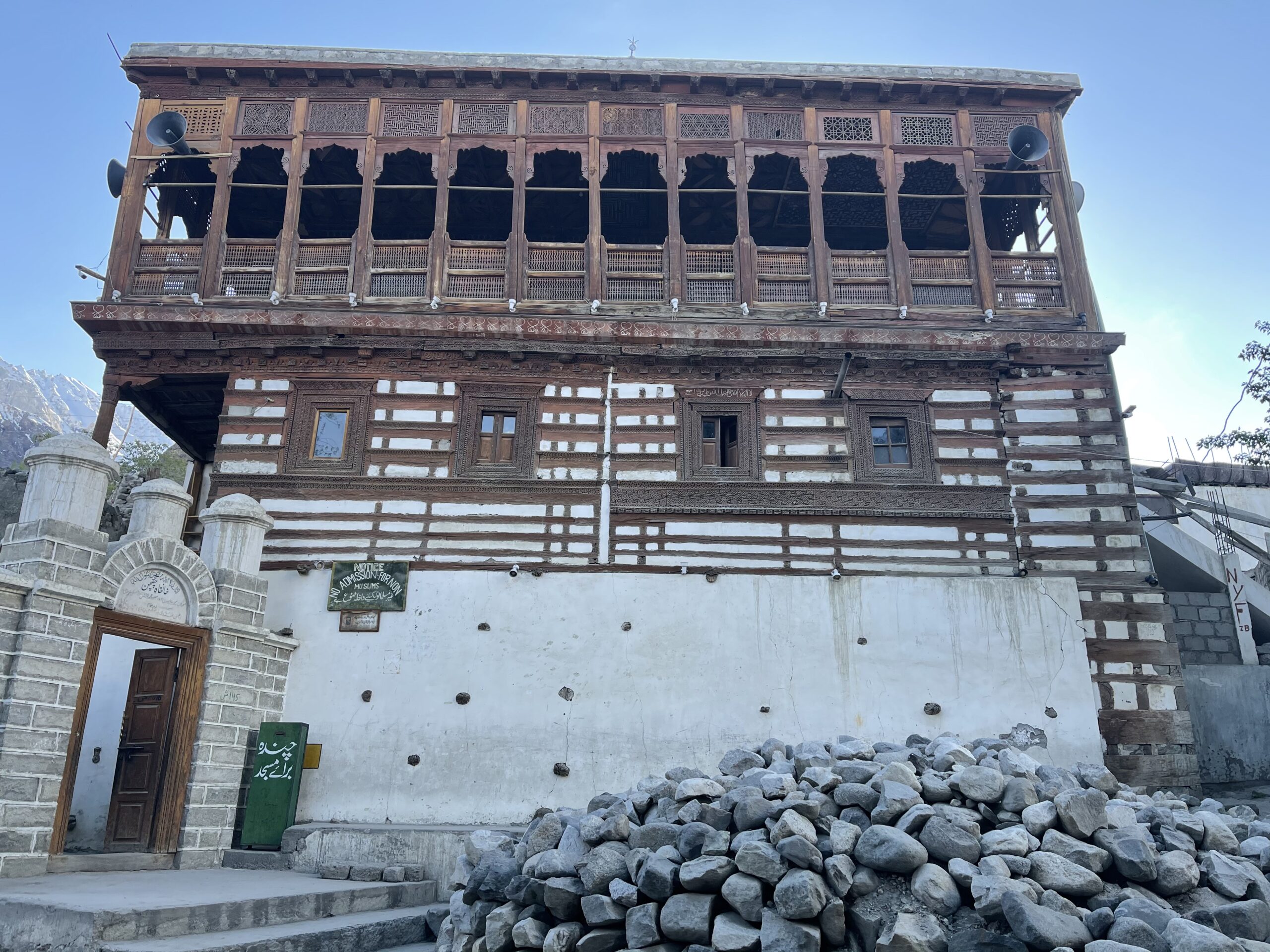
to most of the mosque of the area built as the entire population converted from Buddhism to Islam. The architecture blends the best of Persian, Mughal, and Tibetan styles and it is still in use today as the principle place of worship for Muslims in Khaplu. The interior photographs of the mosque were taken by my friend and guide Manzoor since non-believers are not permitted in the interior of the house of worship,


Our trip to Hushey Valley was particularly interesting to me as a former mountaineer. The village of Hushey is the last village before the Indian Frontier but more importantly this is the last stop before the 7 day trek to K2 basecamp. In fact four different 8,000 meter peaks are reached from this remote village (K2, Broad Peak, Mashabrum and Gashabrum). While there we ate a quick lunch of grilled chicken and French fries as we talked with a local high altitude porter about his experiences summiting all four elite technical peaks.

This slideshow requires JavaScript.

A quick aside about anytime I refer to a quick meal of grilled chicken – it was not actually so quick! As a boy I can remember my father always complaining when a meal was taking too long to remark that they must have had to go out back and kill the chicken or pig – in Little Tibet that is exactly what happens. You order grilled chicken and someone kills, plucks, cleans, chops up and cooks the chicken while you wait.

One odd coincidence occurred as I walked around looking at framed photographs of 
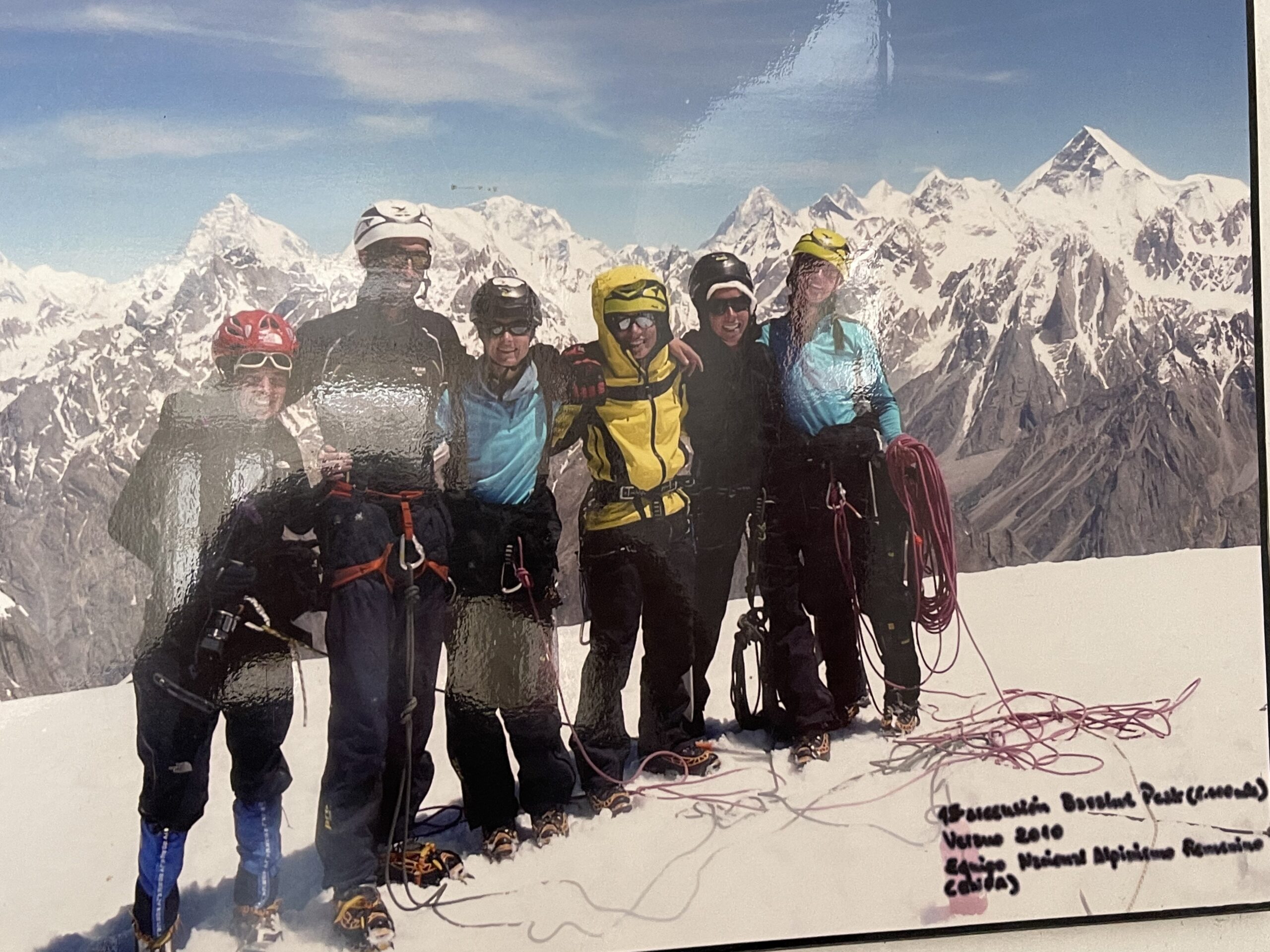
climbing expeditions on the walls of the guesthouse while I was waiting for my fresh grilled chicken. I looked at one photo and did a double take. Photographed surrounded by an entire female climbing team from a 2010 climb was an old friend and world class climber Fabrizio Zangrilli. Fabrizio was apparently the expedition guide. I have not seen him in twenty years nor thought about him recently. It was quite a shock to see his photograph in such a remote location. Just goes to show what a small world we live in.

On the way back from Hushey we stopped at a fish farm for more fresh trout, fries and tea. It may seem like I was eating my way across the countryside but these meals were hours and hours apart as we slowly bounced are way across mountains and valleys on unpaved goat tracks. Eventually, we made our way back to the Palace in Khaplu and took a nice evening walk around the village to stretch our legs.

While on the walk we passed the village polo grounds and I should mention that every 
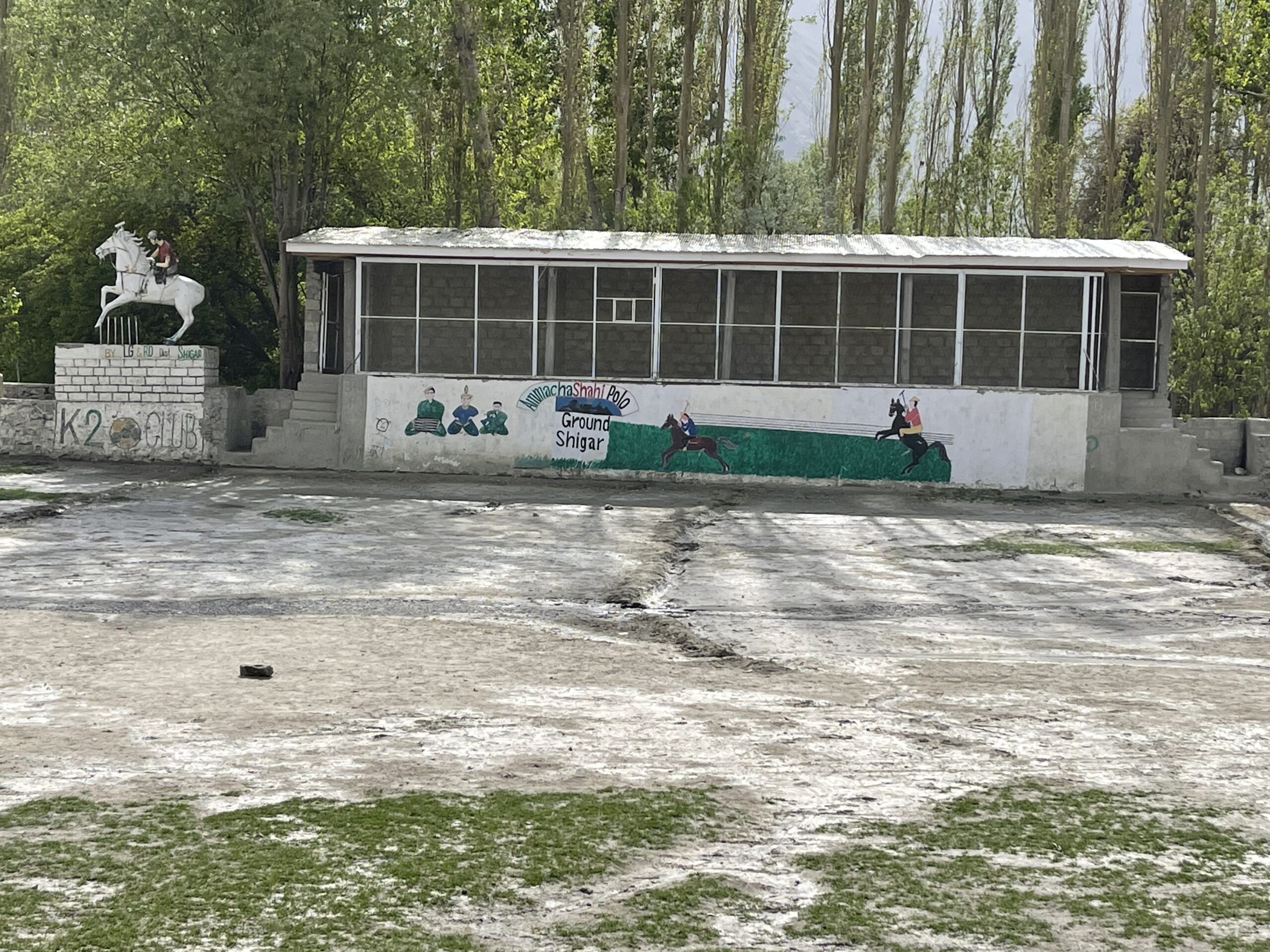
village no matter how small has a polo field. Even the remote high summer village of Fairy Meadow has their own field. These people are crazy about polo and claim they invented the sport. And I am guessing they probably did except they used a goat pelt or an enemy head for the ball in ancient times. On my 2019 trip I visited the highest polo grounds in the world at Shandur Pass playing at an elevation of 12,000 vertical feet.

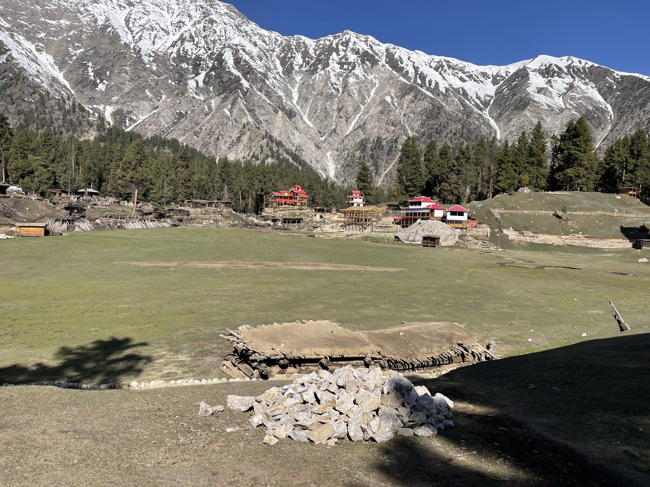
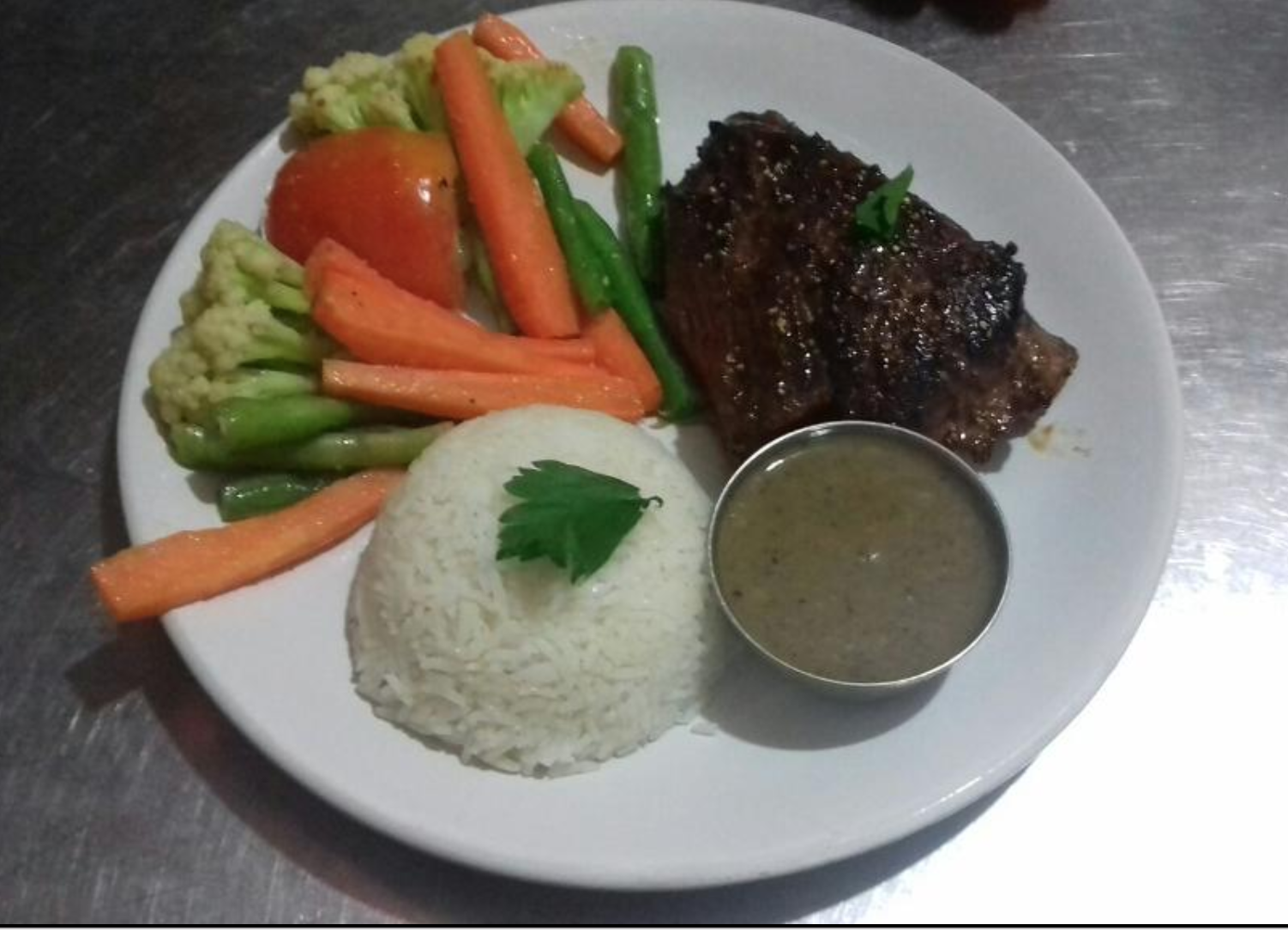
We finished the walk down by the river with fresh watermelon and tea then back to the hotel for a hot shower, dinner and a good night sleep. This might be a good place to mention some of the food from the area. One of my favorite meals was Urdong Bhaley, a simple soup, consisting of a rich beef stock, crushed barley and succulent chunks of beef or mutton. Also quite good is a dish called Chicken Biryani. The chicken is cooked in a mild curry with a tomato base and chunks of fresh vegetables served over spiced rice and served with Nan (the local name for flatbread). I was not very fond of their desserts. Their idea of deserts all involve nuts, honey, fruit and rice. I tried their Walnut Tart and was not impressed. It is basically just a slightly sweet dough baked and filled with crushed caramelized walnuts that seemed to absorb all the moisture in my mouth and grow by the second. I also tried the apricot mousse served with apricot sauce and shaved almonds – again not very sweet.

The next morning the first location on our agenda was the remote Sadpara Lake. Thisbeautiful lake was located high up a picturesque valley with a stunning snow covered mountain as a backdrop. One interesting historical sidenote about the lake is that there is a small rock island (see the photo) in the lake. Years ago one of the Pakistani Presidents was visiting the area when weather closed in and he was stranded there for several weeks. He had the military build him a home on the island for his less than a month stay and then tear it down when the weather cleared and he could return south to his palace. It is nice to be the boss!!!!

This slideshow requires JavaScript.

I am including photos of Sadpara Lake as well as the other three lakes we visited as well as many photos of the faces of Little Tibet. Speaking of the faces of Little Tibet – the people that live in this remote mountain area near the Chinese and Kashmir/India borders look nothing like most Pakistanis from the south. These folks look like Tibetans and Uyghurs and no doubt trace their linage to both ethnic groups.

If I had to sum up my two visits to Northern Pakistan in a few short sentences – I would just say the natural beauty of this harsh land is breathtakingly stunning, the simple salt of the earth people that scrape out a living in this harsh land are open, friendly and kind. They are shepherds that spend day after day sitting on rocks watching over their flocks, women that spend hour up on hour washing the family’s clothes in nearby streams pounding and rubbing clothes against rock then draping the wet clothing over nearby bushes and low hanging tree branches to dry, children here still play with a hoop an stick as children in America did 150 years ago. Life is simple in these mountains and the people have not been corrupted by modernity. They are friendly and gracious offering tea and fruit and a friendly smile to road weary foreigners invading their solitude.

And I can promise you the best possible guide in terms of both the quality of the experience and the cost is my friend Manzoor Hussain. He can be reached on Whats App +92 345 4354348.

My next blog was supposed to be from Nepal but Covid has closed Nepal as well as India my next planned stop. So I am scrambling to organize a plan B to fill up my time until I travel to Tanzania to climb Mount Kilimanjaro.

Posted in Uncategorized | 5 Comments

On The Road Again – A Seven Month Journey Thru South Asia and Across Africa

I had planned to take this trip beginning in April of 2020 but the China Virus had other plans. So instead of enjoying my first year of official retirement trapsing across the Philippines, Indonesia, Thailand, and Burma, then trekking my way through the northern tribal areas of north eastern Pakistan, Nepal, Bhutan, and Kashmir and finally finishing my journey crossing Africa – instead I spent a wasted year quarantining, eating too much, exercising too little and watching way to much TV.

And here we are in the last days of April 2021 still prisoners of the nasty little covid virus. Despite the warnings of the CDC, Dr Fauci, a senile President, and the well-meaning wishes of my family I have decided to say screw the virus I’m going on a walk about! So fully vaccinated, well stocked with N95 masks, and hand sanitizer I am finally on my way. I am currently on a flight to Los Angeles and tomorrow will leave LA for Istanbul then on to Islamabad arriving at 3:35am on the 30th.

I can already tell that traveling during a covid resurgence is going to present a whole new batch of challenges as well as amusing moments. First the amusing – have you ever tried to sneeze or spit with a fricking mask on? And I can only imagine how silly I look as I shake my head at the lady sitting across from me in first class wearing a mask, face shield and full head to toe hazmat suit including hood and booties. Quite a fashion statement in white with blue taped seams.

Hazmet Sally

The first challenge I have encountered is the mandatory PCR test required to enter almost every country. The rules are a little ambiguous. Some countries require the test to be administered and results available before boarding the plane flying into their country.


This gets old really fast!

Others allow the test to be administered before the flight but accept the results any time before you reach immigration. Some countries want the test administered within a 48 hour window before immigration, others 72 hours and still others 100 hours. And nearly all require an additional test upon arrival in the new country. So that is basically 3 test per country with tests running between $75 and $275 each.

Since this is my first foreign trip since covid I am struggling with the new rules. While the tech. had his swab so far up my nose that he was swabbing my brain he informed me the results would be available in three days. I told him that wouldn’t work because I needed the results when I board my Turkish Air flight tomorrow evening. He said it couldn’t be helped so I came up with a backup plan of also getting the rapid test with results back in 24 hours and a letter saying I have had the PCR test and the results would be on my phone by the time I landed in Islamabad.

Still worried about the logistics and getting grounded in LA without the PCR results – I googled “fast PCR test and results near the LA International Airport”. And guess what? I can get tested right in the darn airport for the low low price of only $199 if I want the results in an hour or $125 if I can wait for 4 hours for the results. So I will have received three tests in less than 24 hours and wasted $325 before even boarding the first plane of my 7 month journey.

God knows how I am going to get these test done in a timely manner in remote and far flung places like Skardu, Katmandu, Aswan, Dar es Salaam, Mombasa, Denizil, Entebbe, Kabala, Livingstone and Kigali. The logistics are going to be a nightmare. And unfortunately the fact that I am fully vaccinated doesn’t seem to carry any weight with any government in the world.

Fairy Meadow

Fairy Meadow

But despite the headaches of dealing with covid regulations I am looking forward to some fantastic adventures. In Pakistan I will travel to Chillas, Tatto Village then trek to Fairy Meadow and on to Nanga Parbat Base Camp (9th highest mountain in the world) and back.  Then on to visit Upper and Lower Kachura Lakes, Katpana Desert Lake, Kharphoco Fort and the Khaplu & Manhoka Waterfalls.  Near the falls I will visit the Khaplu Fort and the thousand year old Chaqchan Mosque.


Chaqchan Mosque

Nanga Parbat at sunset

I will end my tour of the northern Tribal area of Pakistan with visits to the Shiger Valley, the Cold Desert, Blind Lake, Skardu and the Besham Valley then back to Islamabad to catch a flight to Katmandu for 27 days of trekking in  Nepal.


Goyka Lake

My time in Nepal will be divided by a 10 day trek to Choyu basecamp (5200 meters) – trekking through the high mountain villages of Luckla, Phakding, Namchae Bazaar, Dole, Mongla Pass, Machhermo, Gokyo Lake.  Along the way I can expect fantastic views once again of  Mount  Everest,  Syangbucha,  and Cho  You  (6th  highest  mountain  in the  world).

Then after a few rest days in Katmandu, I will fly to Pokhara for a little site seeing before trekking to jhinu, sinus, deurali, Annapurna (10th tallest in the world) Basecamp, Dovn and Chhomrung before returning to Pokhara.

Annapurna


Temple of Philae

Three giraffe on Kilimanjaro mount background in National park of Kenya, Africa

After a few days of rest and celebrating in Katmandu I will fly on to Cairo for a couple of days before flying down to Aswan to visit the ancient Temples of Philae, Ombo, Khnum, and Amada, the Pyramid of Elephanine, the Aswan Camel Market, Old Cataract Hotel, Aswan Spice Market, the Nubian Museum and the Monastery of St. Simeon and Tombs of the Nobles.

From Aswan I will fly to Tunis for a few days of touring ancient Carthage and beach time before I fly to Kilimangaro airport to prepare for my trek up Mount Kilimanjaro. All of this in two short months after that I will get really serous and really busy lol…. But that is enough of the plans for now. Who knows how many will be thwarted by Covid – my 21 day trek through Kashmir has already been postponed until fall by the dramatic rise in covid cases in India in recent weeks, I will just have to stay flexible and geographically nimble then roll with the tides of covid infestations around the world.

Stay tuned for more…

Posted in Uncategorized | 3 Comments

Visiting the Hashemite Kingdom of Jordon (Part 1) August 14 – 15, 2019

Since I’ve been self-quarantining for weeks due to Covid-19 I thought I might try to complete some of my blogs from my 2019 Mideast and Asian tour that I failed to write while traveling.  This is the first of two blogs on Jordon – one of my favorite Middle Eastern Countries…   


Jordon is a relatively new country that was only formed in 1921 when Winston Churchill serving as British Secretary of State for Colonies found a box of crayons and in a drunken stupor redrew the lines of the entire Middle East totally ignoring ethnic lines and historic alignments.  And 98 years later the entire area is still living with the consequences of British hubris.


Once the new boundaries were established Hussein bin Ali, the Sharif of Mecca and a direct descendant of the Prophet Muhammad set up his sons as kings of Iraq and Jordon.  So, the son, Abkullah led his caravan of horses, camels and goats into the poor and tiny village of Amman and declared himself king and Amman the capital of a big ass desert and a population of Bedouin nomad herders. Great Briton supported Abdullah’s claim as king and the rest is history.

Fruit and Vegetable Shopping in the Amman Souk

Sheep Head – Not just for breakfast any more.

On my first afternoon and evening in Amman I wandered through the Souk el-Khondra vegetable market which just happened to be a few blocks from my hotel.  Like souks all over Asia and the Middle East this one was overflowing with fresh vegetables, fruits, nuts, spices, freshly butchered meats of all kinds, live birds, both new and used clothes, piles of used shoes to dig through to find mates, old electronics and junk of every type being sold as precious antiques lol.


Downtown Amman Mosque

Along my route through the souks I came across the Grand Husseini Mosque and the Roman Nymphaeum (ruins of a Roman two story fountain).  The Grand Husseini Mosque built in 1934 is the main mosque for the downtown area and sports a beautiful façade.  Unfortunately, the mosque is not open to non-Muslims so I could only admire the architecture and people watch from outside in the busy square.  Photos of the souks and the Mosque are attached.


Downtown Amman Mosque

The Nymphaeum was built by the Roman’s in 191 A D and is a large two story public fountain with mosaics, stone statuaries, swimming pool and multiple fountains dedicated to nymphs.  Excavation began only a couple of decades ago so all that is visible right now are some columns an archway and a few alcoves.  The rest of the Nymphaeum is still buried under all the rubble of nearly 2000 years.


The Roman Emperor Pompey conquered Jordon, Syria and Palestine in 63 BCE and controlled the area for four centuries.  The formerly Greek cities of Philadelphia (Amman), Gerasa (Jerash), Gadara (Umm Qais), Pella and Arvila (Irbid) formed the Decapolis League bonded by culture and economic ties.  Philadelphia (Amman) was a large Greek and Roman city but over the next 2000 years became lost in time and by the early 20th century all that remained of its glory days were Roman ruins and a small Bedouin village.

Roman Amphitheater from my hotel rooftop cafe


My hotel had a very nice rooftop restaurant offering a fantastic view of the Roman theater below in one direction and the Amman Citadel high above in the opposite direction.  The food was only mediocre but the views and beer were fantastic! (photos from the roof attached)


Roman Theater in the daylight

Next morning, I began my tour visiting first the very well preserved 6.000 seat second century Roman amphitheater that I had photographed the night before from the rooftop of my hotel.  The north facing amphitheater commissioned by Emperor Antoninus Pius was built so the spectators could watch plays without the sun in their faces. Amazingly, the acoustics are so good in the structure that from a point in the center of the stage you can hear a conversation all the way in the cheap seats.  As you can see from the photos I made a few new friends while roaming around the theater.


After my tour of the theater I visited the small Folk-life museum next door focusing on the lives of local Bedouin tribes through the centuries.  The exhibits included examples of traditional clothing of both men and women, jewelry, woven baskets, cooking utensils and weapons.  After the visit, I grabbed a quick lunch and rented a car and driver to take me up to the Amman Citadel.

The Amman Citadel was originally built during the Bronze Age in 1800 BCE and further fortified and repurposed during the Iron Age and by the Romans, Byzantine and Umayyads.  The most interesting things left to see are the ruins of the Roman’s Temple of Hercules, the Umayyad Palace, a Byzantine Church, and the Jordon Archaeological Museum.

All that is left of the Temple of Hercules – a few columns and one big hand.


All that is left of the Temple of Hercules is a couple of huge pillars and a giant hand the is believed to belong to a statue of Hercules.  The buildings that comprised the Umayyad Palace is the best-preserved structures in the Citadel.  Built in the 7th and 8th century the compound once covered many acres and consisted of a number-of- structures but most were destroyed by an earthquake.  Fortunately, the grand domed audience hall of the Palace is still standing and in good condition.


All that remains of the 6th century Byzantine Church is the footprint of the Basilical style plan consisting of a central nave side aisles and a semi-circular apse.  Within the footprint are a series of columns with Corinthian capitals scavenged from the Roman Temple of Hercules, and the remains of the first couple of feet of the outer walls.


After touring the Citadel, I drove north to within a few miles of the Syrian border to visit the Jerash Archaeological Site.  Jerash, an old Roman City, is Jordon’s second most visited destination ranking only behind Petra.  The Greek city was conquered by Pompeus in in 63 BC and became one of the League of Ten Cities of the Roman Empire and remains today as one of the best preserved Roman archaeological sites in the world.

It is incredible to believe that this massive complex of giant columns, paved roads, theaters, baths, temples, hippodrome, gates and cardo all remained hidden under 2000 years by sand and neglect.

The South Gate and City Wall of ancient Jarash

The best preserved and most interesting of the ancient ruins begins with Hadrian’s Arch, the entrance to the old city built to honor Emperor Hadrian’s visit in 129 AC.  The 15,000 seat Arena that hosted gladiator fights and other sporting events.  The very interesting and perfectly preserved Oval Square surrounded by Ionian Columns with two alters and a fountain in the center. The Thistle or Cardo Maximum, a paved and column lined road that ran the length of the city.  The Nymphaeum, a fountain dedicated to the nymphs with its marble and half-dome and lion’s head water spout.  The Temples of Zeuz, Artemis, and Dyionisus (repurposed as a Byzantine Church in the 4th century) all lined along the Cardo.  The Hippodrome, Forum, and Baths all nicely preserved.

This slideshow requires JavaScript.

But the most impressive of the monuments are the North and South Theaters.  The South Theater, is a two-story structure with a beautiful stage, hidden passages, seating for hundreds and excellent acoustics was built in 90 AC.  The North Theater was designed as a square surrounded by columns.  Originally there were stairs leading to the entrance and the theater was used for public meetings, important events, and theatric shows.  Unfortunately, many of the stones for the stairway and the theater were scavenged and used for nearby buildings through the ages.


Ajlun Castle built to protect the southern Levant from the Crusaders

My final stop in northern Jordan was a visit to the 12th century Ajloun Castle.  The Castle was built by the nephew of sultan and military genius Saladin atop Mount ‘Auf and provided defenders incredible views of the Jordon Valley and the surrounding desert.  Much of the castle has been destroyed by subsequent rebuilds, earthquakes and time but many of the chambers, carvings and towers can still be toured.


Photos of all the places I visited in Amman and Northern Jordon are attached.  I will provide a second Jordon blog focusing on Petra and the rest of Jordon south of Amman shortly.

This slideshow requires JavaScript.

Posted in Uncategorized | Tagged , , , , , | 2 Comments

Time to Walk Back in Time Like an Egyptian – August 7 – 14

First thing I noticed as I left the plane and entered the non-air conditioned gateway to the terminal was that Cairo is really-hot. The second thing I noticed was that the Egyptian passport control and baggage processes were very efficient.  After zipping through both immigration and baggage claim I quickly located my Coptic Christian Guide and driver to begin the commute to the Le Meridian Hotel in downtown Cairo.

Example of trash and filth in Egypt

Once outside the airport and driving through the city I was shocked by the amount of trash and filth in the streets.  I’m not talking about a few scattered pieces of paper or soda cans.  The trash and garbage lining both sides of every street ranged from 6inches high to mounds of several feet.  The city is disgustingly filthy. 

After checking into the hotel and dropping my bags, we drove on to the Egyptian Antiquities Museum.  I spent the next two hours touring the museum, viewing many of the artifacts I have seen only in books and magazines.  The museum would have been a fantastic experience except that it is un-air conditioned and sweltering.  I found it very difficult to concentrate on the information my guide was sharing while stewing in my own juices.  The good news for future museum visitors is that a huge new modern building is almost finished and the museum’s artifacts will soon be moved over to the brand-new air-conditioned facility.

I have included photos of some of the more interesting exhibits on display.  Unfortunately, many of Egypt’s most important treasures have been looted long ago by everyone from the Roman’s stealing Obelisks to relocate in Rome and Istanbul, to Venetian merchants stealing the bones of Saint Mark to market Venice as a tourist destination, to Napoleon stealing entire ships worth of precious antiquities, to the Brits stealing anything not nailed down including the famed Rosetta Stone, to the Germans stealing the 3400year-old-  Bust of Queen Nefertiti.

Egyptian Antiquities Museum

Cairo Museum

Cairo Museum

After, sweating my way through the museum we headed for the old souks and spent the rest of the afternoon and early evening wandering through the pedestrian lanes and alleys of the old quarter and stall after stall of food, spices, clothing, leather, jewelry, and art.  The highlight of the visit to the souks was the time spent at an outside café in front of a fan sipping on a nice tall glass of Hibiscus tea.

I had never tasted Hibiscus tea and thought the ice-cold concoction was the best thing I had ever drank.  It was sweet, light, ice-cold, and refreshing.  I spent the rest of my time in Egypt ordering Hibiscus tea hoping to recapture the magic of that moment when I thought I had finally tasted the nectar of the gods – only to be disappointed with every subsequent glass.  My amused guide finally told me the first place was famous for the amount of sugar they used to make their tea.  Turns out Hibiscus isn’t the secret ingredient to producing celestial nectar, it is the 5 pounds of sugar in the tea!

I was supposed to spend the evening at Wekalet El Ghouri Caravansary next to the Al Hussein mosque watching a Whirling Dervish Performance.  But once I arrived on the scene and found out I had an hour wait standing knee deep in garbage surrounded by people that had not bathed in days and accosted by a line of beggars I said screw it and headed back to the hotel.  I am quite sure if I had stood there for an hour in the heat, stench, and filth I would have eventually recreated the scene from the 1980 movie Airplane where the character played by Lloyd Bridges punches out beggar after beggar as he makes his way through the airport.

Day 2: Giza

Next morning, we headed to Giza for a full-day tour of Giza and Mastaba.  Our schedule included visits the Great Pyramid of Khufa and other Giza Pyramids, the Solar Boat Museum, the Sphinx, Valley Temple, the Mastaba and a papyrus paper-making demonstration.

Photos of the Sphinx simply can’t do the monument justice.  The mythical creature with the body of a lion and head of a human is enormous.  The face of the Sphinx is believed to be the likeness of Pharaoh Khafre minus his nose and beard which are missing due to either wear and tear of time or from Napoleon’s bored troops using the face for target practice

The Great Pyramid of Khufu is the centerpiece of any Giza tour.  You can’t look at the six-million-ton structure or marvel as you walk deep into the interior and not wonder how the hell they built this mammoth pyramid.  I always thought that all the pyramids were built by slave labor but my guide assured me they were actually built by eager volunteers wanting to be viewed favorably by the gods. 

Next to the Khufu Museum is the Solar Boat Museum.  The solar boats were built as ships to send the dead Pharaohs into the afterlife.  The boat in the museum was built for Pharaoh Khufu and first discovered in its own tomb aside the pyramid and reassembled for the museum.  The boat is suspended in the museum and can be viewed from all angles while walking along three floors of catwalks constructed around the suspended ship.  The boat was built without a single nail and was held together by rope and knots. (photos attached of both the pyramid and the solar boat)

Pyramids were reserved for the Pharaohs but other nobles were also buried in the proximity of the pyramids in Mastabas.  The Mastaba is a flat-roofed rectangular tomb with inward sloping sides made with mud bricks.  They were used before the pyramid era as tombs for the Pharaohs and throughout all three kingdoms for nobles (Old, Middle, and New Kingdoms).

We finished our visit to Giza with a papyrus paper-making demonstration and an interesting visit to a family enterprise where they make marble tables and dishes inlaid with other colorful minerals.  To make papyrus paper you use a sharp knife to strip the papyrus reed into very thin half-inch wide strips.  The strips are then soaked in water (six days for white paper and 10 days for brown paper).  The soaked papyrus is then put into a press for three days and is then ready to use.

I was surprised by how much I enjoyed the marble working demonstration.  They begin by taking the raw marble and shaping and polishing it.  They then draw patterns onto the surface of the marble in the shapes they will later etch into the surface (flowers, geometric designs, and animals).  An artist then cuts the marble just deep enough to hold the colored minerals that are shaped to make the patterns in the marble surface.  I took a lot of photos of the process and am including them with this blog.  I was so impressed with the workmanship I purchased a small table and shipped it back to Florida.

Working with Alabaster

After a full day in the hot sun traipsing through the desert looking at pyramids, mastabas, the Sphinx and the Solar Boat, I still had a little energy and spent the evening on a Nile River Boat Dinner Cruise and Show.  Which turned out to be a total waste of time.  The food was dreadful.  The scenery along both banks was just an industrial wasteland.  And the entertainment was not very entertaining.  And to cap it all off – the belly dancer wasn’t even a raven-haired Egyptian – she was a blond woman from New York!

Day 3: Alexandria

My next day was spent on a day trip to Alexandria to tour the Serapeum, Roman Theater, Roman Baths, Roman Villas, Catacombs of Kom el Shoqafa, Roman Triclinlum, the 15th Century Qaitbay Citadel and the Alexander Library.  The highlights of the day were the Catacombs, the beautiful mosaics in the Roman Villas, and the Citadel.  Photos of all the sites as well as Alexandria street and souk life are attached.

The temple dedicated to Serapis was destroyed by the Romans in 391 but a few of the original pieces like Pompey’s Pillar and two large sphinxes are still standing amongst the ruins.  The Sanctuary or Catacombs of Kom el Shoqafa are located within walking distance of Pompey’s Pillar and is the largest Roman burial site in Egypt.  The catacombs have three tiers of burial chambers/tombs and the architecture is Greco-Roman.

The 15th century Qaitbey Fort/Citadel on the Corniche Road sits on the site of the former Pharos Lighthouse one of the seven wonders of the ancient world.  The lighthouse was destroyed by an earthquake in 1303.  The fort built by Mamluke Sultan Qaitbey to fortify the port used the rubble from the destroyed lighthouse to construct the walls of the Fort.  The fort is in remarkably good shape and I enjoyed exploring its many chambers and taking in the view of the Mediterranean from the rooftop lookout. 

Alexandria Souk Scenes

Alexandria Souk Scenes

Catacombs of Alexandria

Pompey’s Piller and Sphinxes

Qaitbay Citadel

Next up was a visit to Kom el-Dikka which translates into “Mound of Rubble”.  This ancient Roman site was just another mound of rubble in central Alexandria until they began clearing the mess to construct new housing.  But once they cleared the crap off the top in 1947 they found the ancient ruins of a small Roman theater, temple, and the ruins of several wealthy Roman era villas containing mosaic flooring including one known as the Villa of the Birds.  (Photos attached)

The mosaics in the ruins of the villas are beautiful works of art with designs using floral and geometric patterns and a bird motif that look remarkably good for being nearly 2000 years old.  Perhaps the best example of first century A.D. mosaic art is in the Villa of the Birds.

Day 4:

The next day was dedicated to exploring the Pyramids, Mastabas, and sites of Memphis, Dahshur and Saqqaracolossal statue of King Ramses the Second, The City of the Dead, Step Pyramid of Djosser, Bent Pyramid, and the Red Pyramid.  The highlights of this day were the inscriptions and artwork in both the pyramids and mastabas.  I’ve included photos of scenes of both everyday life and the life of the royals.

The Step Pyramid is particularly interesting in that it was the first pyramid and, also the first large stone building in history.  The pyramid was not built all at once but rather in stages as rectangular Mastabas one atop the other.  The structure is considered a great stairway which King Kjoser would use to climb to join the sun god Ra in the sky once resurrected, was built by Imhotep perhaps the greatest architect of his time.

Memphis founded in the 1st dynasty in 3100 B.C. was the first capital of the united Egypt.  Before the unification, there were separate Kingdoms in the North and South.  The Northern Kingdom was protected by the Cobra and the Pharaoh wore a red crown.  The Southern Kingdom was protected by a Vulture and the Pharaoh wore a White crown.  Today little remains of the 5000year old capital but a fantastic Open Air Museum.

The museum includes the remains of granite statues including Ramses II Seated Statue, the Triad of Memphis, the Sphinx of Memphis, the limestone Two Column Bases. Naos Statue, Statues of Ramses the Great both standing and laying.  Photos of all the statues are included.

The Open Air Museum

City of the Dead

Dahshur, Asaqara, and Memphis Day

Next, I visited and entered the Bent Pyramid (built in 2600BC) in Dahshur.  The pyramid began with a 54-degree inclination from the desert floor then the top section (above 150ft) the inclination drops to 43 degrees making the pyramid look bent.  It is believed the inclination was reduced after the structure began showing signs of instability during construction and the change was made to avoid structural failure and collapse.

The Bent Pyramid represents the transition from the Step Pyramid to the smooth-sided pyramids.  The polished limestone exterior remains mostly in-tact.  I entered this pyramid and reach the 4600-year-old chambers through a narrow 253foot very steep 45-degree tunnel.  The climb down and then back out to the pyramid temple was hot and claustrophobic, with 4600-year-old stale air but very interesting.  It was fun playing tomb raider but I was glad when I reached the fresh air and sunshine as I climbed out of the steep tunnel.  And with my exit from the tunnel, I drove back to Cairo to prepare for my last day in the old City.

Day 5

My final day in Cairo was spent visiting the old Coptic Christian and Islamic Sites.  The sites I visited included the Church of Abu Serga, Fort of Babylon, the Hanging Church, Ben Ezra Synagogue, Masjid Amr Ibn Elas Mosque, El Sultan Hassan Mosque, Al-Rafi’l Mosque, Citadel of Cairo and the Mohamad Ali’s Mosque.

Through the ages, the Egyptians have worshiped many gods.  The ancient Egyptians of the Old, Middle and New Kingdoms worshiped multiple gods but Amun-Ra was considered the king of the gods and goddesses.  When Alexander the Great conquered Egypt in 332 BC he was welcomed as the son of the god Amun and as a smart politician accepted the old religion building and expanding temples to the old Egyptian gods.  Later the Romans also saw the utility of allowing the local population to continue to worship the old gods and built and expanded the temples of the old gods.

In the first century AD, Christianity began to take hold in Egypt and by the 5th century, the Ancient Egyptian civilization and religion was coming to an end as the Coptic Christian faith replaced the old pagan gods.  The Islamic conquest of Egypt began in 639 and today approximately 90% of the country is Muslim with the remaining 10 percent primarily Coptic Christian.

One interesting and amusing legend involving the coexistence of the two faiths involved the 10th century Egyptian ruler Al-Moez Ldin Allah.  During his reign, Muslims, Coptic Christians and Jews all lived in relative peace.  Allah would invite the Coptic Christian Minister and the Jewish Rabbi to visit his court and talk with him about their religions.  One day the Rabbi told Allah that the Christians believed their faith could move mountains.  The king brought the Christian minister before him and asked if they truly believed their faith could move mountains.

The Christian minister affirmed their faith could move mountains.  The King challenged the minister to move Mount Mokattam and prove their religion was real.  If not, the Bible’s teachings were false and the king would destroy all the churches in Egypt and every Christian would have to convert to Islam or move out of the country.

The minister went to the Coptic Pope and told him of the challenge and to seek his council.  While sleeping the Mother Mary came to the pope in a dream and told him to look for a man with a clay water jar and he would show him how to move the mountain.  When he awoke, the pope found the man with the clay water jar just outside his home– a very devout Christian by the name of Simon

According to the legend, Simon asked the entire Christian community to pray with him to move the mountain and the mountain moved. 

The king was so moved by the miracle, he immediately converted to Christianity.  That is the Christian version of historyThe Muslim history books only say that Al Moez Ldin Allah Al Fatmi lost his mind and became a Christian.  Regardless of which version of history you buy the mountain is no longer connected to the part of the mountain, the old Citadel sits upon.

The Citadel sits upon a high sandstone hill and can be seen from most anywhere in Cairo.  The Citadel was built Saladin between 1176 and 1183 to protect Cairo and Fustat from the Crusaders.  Since its original construction, every invader has added to its formidable defenses. 

Citadel of Cairo

Many of Cairo’s most impressive Medieval sites are contained within the Citadel’s walls.  The sites inside include the Alabaster (The Great Mosque of Muhammad Ali Pasha) Mosque, Al-Nasir Muhammad Mosque, Suleiman Pasha Mosque, Harem Palace, the Egyptian Military Museum, the Carriage Museum, the Stripped Palace (Al-Qasr al Ablaq), and the Suleyman Pasha Mosque.

Alabaster Mosque

Most of the Coptic Christian sites, as well as the historic Ben Ezra Synagogue, are located within a very small area of the Christian Quarter.  The highlights of the Coptic sites include the Hanging Church, the Church of St. George, Church of St. Barbara, the Coptic Museum.

The most famous of the Coptic landmarks is the Hanging Church.  The 7th century-church is called the Hanging Church because it is suspended over an area that was once a Roman gatehouse.  You enter the church through a decorated gate and mosaic-lined courtyard and then climb 29 steps to the church’s portal.  Inside the church, you find an intricately carved wooden screen over the front sanctuary, a marble pulpit and flickering candles highlighting ancient icons.

The 4th century church of Saint Barbara sits above a cave believed to be where the Holy Family (Joseph, Mary, and Jesus) is believed to have stayed after their flight to Egypt.  The church originally named for two martyrs is reached through steps that take you below street level. 

Beneath the church in the crypt the faithful drop scraps of paper with written prayers into the cave which is believed to be a healing shrine.

The round Greek Orthodox Church of St. George was built in the 10th century upon the northern tower of the Fortress of Babylon.  The church is the seat of the Greek Patriarchate of Alexandria.  The church features a relief and artwork depicting Saint George slaying the dragon and defending Christianity.  Photos of both the Coptic Christian and Islamic Sites are attached.

Coptic Christian Quarter

As it turns out I happened to be in Cairo during a major religious holiday.  There were both sheep and cattle in temporary pens throughout the city being stationed for sale to be slaughtered and sacrificed on the prescribed morning.  That morning turned out to be August 10 while I was in the Coptic Quarter and witnessed the ritual slaughter of a sheep in front of an ice cream shop mid-day.  The shop owner’s young son did the honors and was rewarded by smearing blood on his forehead and hands.  He then placed his bloody hands on the front wall of the shop and left his handprints as some sort of token for good fortune.  Photos of the animals in temporary pens and the bloody handprints attached.

Day 6: Luxor

Next morning, I flew to Luxor for my final few days in EgyptLuxor was the site of the New Kingdoms (1400 BC) and the fabled Valleys of the Kings and QueensLuxor is just over 300 miles and a short flight from Cairo and in ancient times was known as ThebesLuxor sits on the east bank of the Nile and during the Middle and New Kingdom times of ancient Egypt was the capital of the Pharaohs.

Collossi of Memnon

The highlights of my visit to Luxor included the Luxor Temple, Karnak Temple, Temple of Hatshepsut, the Valley of the Kings royal tombs, the Valley of the Queens tombs on the west bank of the Nile, Colossi of Memnon, and Medinet Habu.

My first stop was to the Temple of Hatshepsut built to honor Amon-Re (Sun God) and the female Pharaoh Hatshepsut.  As I approached this temple built at the base of a limestone cliff, I was in awe of both its grand scale and the incredible artistry of its architecture and statuary.  The temple is designed as three tiers of porticos with massive statues, pillars and hieroglyphs.  (Photos attached)

Temple of Hatshepsut

My next stop was to the Valley of the Kings – the final resting place of dozens of New Kingdom pharaohs.  The Valley holds over 60 royal tombs including the tombs of King Tut, Ay, and Ramses VI.  All the tombs sit beneath a large pyramid-shaped mountain named Al-Qurn.  The pharaohs of the New Kingdom abandoned the building of Pyramid tombs and built these much less conspicuous but still elaborate funeraries to thwart future grave robbers.

August may not have been the best time to visit the tombs or for that matter Egypt at all.  June through August is extremely hot, but if your schedule is inflexible like mine, be sure to carry plenty of water, wear a hat, sunglasses, and lather on plenty of sunblocks. 

make it rain money GIF
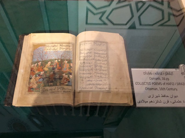
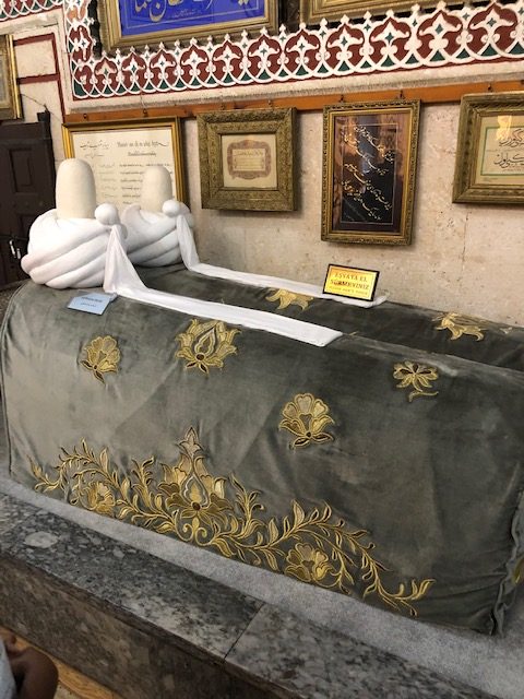
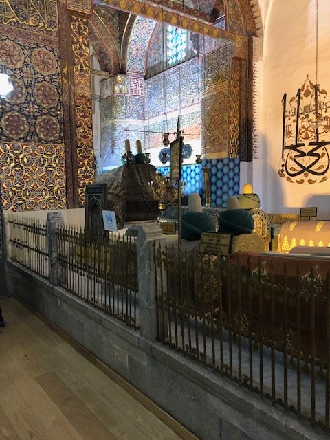
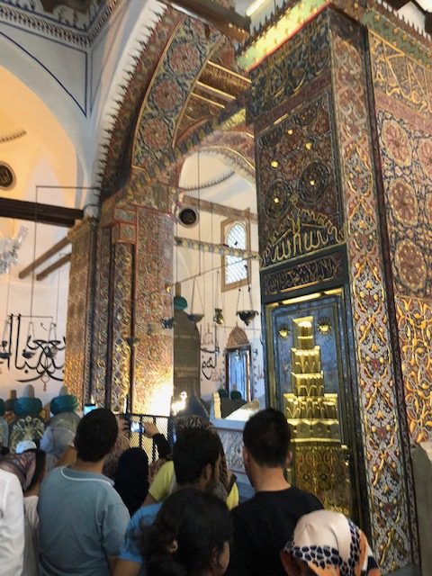
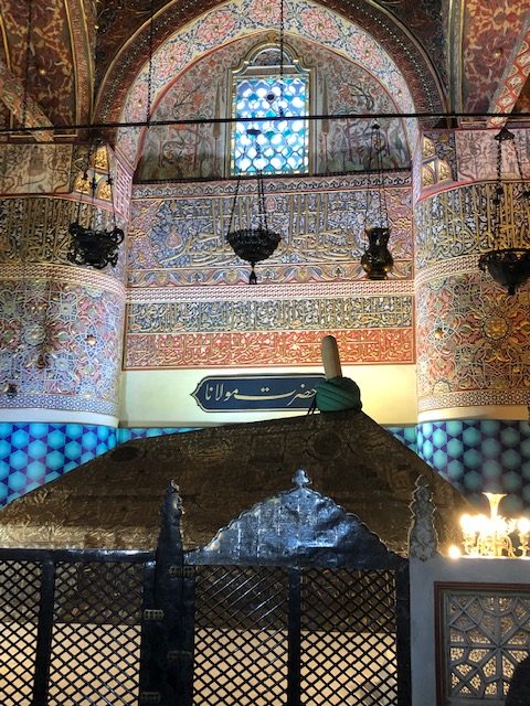
One other practical tip involves photography.  Photography in the tombs is supposed to be forbidden but if you tip the tomb attendant he will not only gladly allow you to take photos but will recommend what are the best points to photograph and will also offer to take photos of you inside the tomb (one even insisted I wear his turban for the photos lol)

Next I visited the Valley of the Queens containing over 75 tombs of queens, princesses and princes.  The highlight of the Valley of the Queens is the tomb of Nefertari which requires an additional ticket.  Many of my photos of the most elaborate and vibrant tomb wall paintings were in the tombs in this valley.

One of the most impressive sites in Luxor is the Karnak Temple Complex.  The complex has several temples, two obelisks, a forest of 70foot high columns, hieroglyphs, and a sacred lake that was used for special pagan rituals.  The 3700-year-old complex is the second-largest religious site in size in the ancient world (only smaller than Angkor Wat in Cambodia).  The complex highlights include the White Chapel, the Hypostyle Hall, Festival Hall of Obelisks, and the Obelisk of Queen Hatshepsut.   

I toured the Temple complex during the day and decided to come back for a laser light show at night.  I enjoyed the temple by both daylight and moonlight but could have done without the overproduced laser show.  The voiceover was overdone to the point that rather than dramatic came across as comical.  Photos of both my day and night visit attached.

Two miles southwest of Karnak sits the Luxor Temple.  This temple is smaller and newer than the Karnak Temple and was constructed over a one hundred year period in 1400 BC by Pharaohs Tutankhamen, Horemheb, and Ramses II.  An avenue flanked on both sides by lines of sphinxes runs from the Karnak Temple to the Luxor Temple paralleling the Nile River.

The Luxor Temple consists of a courtyard with halls and chambers beyond. In one hall is a shrine to Alexander the Great who the Egyptians thought was the son of Ra. The most impressive feature of the temple is the colonnade of 14 decorated pillars 52feet tall. Other features include enclosed halls on both sides of the hall decorated with scenes depicting war and festivals, huge statues of pharaohs, and one remaining obelisk (the 2nd one was stolen by the French and now sits at the Place de la Condcorde in Paris).  Photos of the temple and wall/column art are attached.

I am also including photos I took on a boat trip up the Nile, several beautiful sunsets over the Nile and a beautiful full moon over the Karnak Temple and my hotel. 

And next blog up is Jordan one of my favorite countries on this 9-month journey. 

Posted in Uncategorized | Comments Off on Time to Walk Back in Time Like an Egyptian – August 7 – 14

Bhutan – Land of the Thunder Dragon: October 9 – 13

Bhutan’s claim to fame is that it is said to be the happiest country in the world and measures its success by happiness instead of GDP.  And as crazy as it sounds the Gross National Happiness takes priority over material wealth.  Up until 1972, this remote Himalayan Kingdom was also one of the least visited by tourists.  In fact, it was considered the Hermit Kingdom because its doors were closed to outsiders.  Even today tourism is limited so as not to have an adverse effect on the natural environment or culture and heritage.

Unlike every other country, I have needed a Visa to visit, only Bhutan requires a tourist to hire a Bhutan resident as a tour guide and only the resident can apply for the Visa in the tourist’s name.  The country also restricts how many tourists visit the country per year (only 200,000 in 2016).

A few other quirky things about Bhutan before I talk about my experiences there – first the country is primarily vegetarian and there is not a single slaughterhouse in the entire country.  They import their slaughtered meat from India.  Second, up until 2009 both TV and the internet were banned in Bhutan.  Third, the highest unclimbed mountain in the world is Gangkhar Puensum (7,452meters) is in Bhutan and will remain unclimbed because it is a sacred mountain.  Fourth, Bhutan is the only country in the world that bans the sale of tobacco.  Fifth, Thimphu, the capital, doesn’t have a single traffic light.  Sixth, the penalty for killing a sacred black-necked crane is life in prison.  Seventh, Bhutan is the first country in the world to mandate specific constitutional obligations on its people to protect the environment.  Eighth, most people in Bhutan continue to dress in traditional clothing.

Men wear a Goa – a knee-length robe that is tied at the waist by a cloth belt called a Kera.  The Kera and Goa create a big pouch in the front which is used for carrying things like a food bowl, mobile phone, betel nuts or a small knife.  Women wear a long brightly colored ankle-length skirt called a Kira and a long sleeve high neckline blouse called a Wonju.  And women also use the cloth belt or sash (Kera) to tighten the outfit and accent the colors and patterns of the Kira and Wonju. For official occasions, both sexes also wear a sash/scarf and the color denotes status.

Traditional clothing

My arrival into Paro, Bhutan’s only international airport, from Katmandu was quite interesting.  Paro sits in a small valley surrounded by mountains which required the pilot to execute a corkscrew landing.  I had never experienced a landing like this where the plane is flown in a tight circle with each pass shedding altitude as the plane flew at a 45degree angle around and around. 

Once on the ground in Paro you immediately know you are not in Kansas anymore.  The first thing you notice is the beautifully decorated and colorful terminal.  And the second thing you notice Is the beautiful bronze statue of a kneeling and smiling warrior with hands in the prayer position smiling in welcome.  Once inside the terminal, you are greeted by a huge model of the royal palace in Thimphu in the center of the baggage retrieval belt.

You immediately pick up on the vibe that these people love bright colors and appreciate artistic talent.  I quickly retrieved my bags and found my guide Sonam Gyelshen Thai and we headed directly out of Paro and drove the 50km (about an hour and 15minutes) to Thimphu Thimphu is the capital of Bhutan and has a population of only 115,000 people.   

On the drive to Thimphu, Sonam gave me a brief history of the country and explained some of their unique customs and traditions.  The drive over was beautiful as we passed through mountains and valleys dotted with small farmsteads, Stupas, colorful billboards with smiling happy people in traditional dress extolling the virtues of happiness, and rushing rivers.

Hungry Ren And Stimpy GIF by NickRewindThe only significant disadvantage of being forced to use a government approved guide to organize your trip is that you give up all freedom and decision making.  The hotel I was assigned was miles from anything interesting to see or do at night and turned out to be totally vegetarian!  And I was imprisoned here for two nights.  The first night and next morning I passed on their buffets of grass, leaves, roots and sticks all spiced with tongue-numbing chilies and was starving by the time my guide showed up to take me to the Tshechu.

I grabbed some Oreos and a soft drink for breakfast on the way to the Dzong to enjoy the final day of the three-day Thimphu Tshechu.  The Tshechu is an annual festival held across Bhutan on the 10th day of the month of the Lunar calendar.  The centerpiece of the Tshechu are Chams or Mask Dances.  The dances are moral vignettes based on the life of the Buddha Saint, Guru Padmasambhava.

The dances are designed to promote happiness and cultivate an enlightened mind of all in attendance.  News flash – didn’t work on me!  I very much enjoyed the dancing and the crowd but find myself no happier than before and definitely, not enlightened.  Maybe I missed something in the translation.

For the Bhutanese, these sacred mask dances invoke the deities of the tantric teachings providing blessings and removing all misfortune.  All the evil spirits are banished and the word of Buddha brings happiness to all living beings.  For me, though it was enough that it offered a kaleidoscope of bright colors, interesting dancing, intricately designed costumes and masks, and monks dressed as clowns sporting two-foot wooden penises (More about this culture’s obsession with the penis later).  (video and photos attached)

Stadium crowed for the Cham

Dance of the lords and ladies

Dancing

As I understand it there were three separate sets of dancers throughout the day.  There were an entire series of sacred dances performed by the monks, then a different series performed by local lay people and finally several dances toward the end of the day performed by members of the country’s military celebrating long ago victories in heroic battles.

While all the dancing is occurring two additional things are taking place in the stadium.  First, the big-Kahuna Buddhist Monk is providing blessings to the many faithful in the stadium.  So, there is a line of hundreds snaking through the stands waiting for their moment before the great man and his blessing.  Second there are a half dozen monks dressed as clowns or Atsara entertaining the crowd and taking up a collection.

These clowns are all dressed in bright multi-colored costumes, red wooden masks, and sporting a two-foot-long wooden phallus tied with a rope hanging from their necks.  Throughout the day, the clowns circulate through the crowd acting the fool, singing lewd songs, executing crazy dance moves, collecting donations and using their big red penises to taunt and tease the crowd.  They will shamelessly shove the penis into the faces of men and women alike.  They will use the head phallus to gently tap a lady’s cheek or press to her lips or lay upon her husband’s shoulder – all to the uproarious laughter of the crowd.  And I’m told this somehow shows the true path to enlightenment.  

The instruments that provide the music for the dances includes lots of cymbals, long trumpets called dungchens, oboes (gyaling), double sided drum (nga) beaten with a curved drumstick, a trumpet made from a human femur (kandgling) a conch-shell, dungkar, a small double faced hand held drum called a damaru that is beaten with hard pellets attached by strings the drum and small bells (drilbu) which are used by the dancers.

Band with musical instruments

After a full morning of watching mask dance after mask dance and failing to achieve personal enlightenment, I decided it was time to give my numb butt a reprieve and took a brief tour of the Palace and lunch before returning to an afternoon of dances performed my local women and the military.  Photos and videos of many of the dances, musical instruments, clowns, and the faithful receiving blessings are attached.

Bhutan Palace

After the day of dance, I enjoyed a fantastic dinner at a restaurant owned and operated by a Swiss ex-pat with a western meat-based menu!  Sonam invited Mr. Nima, a member of the National Council (Bhutan’s upper chamber of Parliament) to dine with me.  And for the first time since March, I thought and talked about politics!  And I admit I enjoyed learning about Bhutan’s politics and transition from a kingdom to a democracy. 

Bhutan’s transition to democracy was actually the King’s idea.  He set up the commission that wrote the country’s constitution and turned over power voluntarily to the newly organized parliament.  The upper house of Parliament has 20 elected members serving five-year terms and 5 members appointed by the King.  Mr. Nima and I covered a lot of subjects over dinner but one interesting policy that sticks in my mind is that the Bhutanese constitution requires that 60% of all land remain held in a state of unspoiled forest and nature.  An incredible commitment to protecting the environment. 

Day 2: Thimphu & Paro

My second full day in Thimphu was spent visiting several Pagodas, a museum that focused on traditional daily life in Bhutan, and a visit to the Royal Taken Preserve.  The first Pagoda was this giant statue of Buddha atop a high mountain overlooking the city. The skyscraper version of Buddha is so huge that you can see it perched atop the mountain from anywhere in the city and for miles up and down the valley.  Sonam said the entire project which is still under construction is being funded by a billionaire from Singapore.

Stupa downtown

Museum Exhibits

The museum was very interesting and included exhibits on traditional weapons, saddles, musical instruments, winemaking, butter making, masks, dances, and a penis garden. 

Butter making and dance demonstration

Stomping grapes

Yes, you read that right! A penis garden.  The Chinese may have their Rock Gardens, the Japanese their Sand Gardens, the Indonesians their Water Gardens and the English their flower gardens – but the Bhutanese enjoy their Penis Gardens.

You will note in the attached photo that this particular garden has at least a dozen carved brightly painted erect wooden penises of various sizes displayed in a very neat and tidy garden.  The young lady conducting my tour of the museum explained that the Phallus is a very powerful symbol of not only fertility but good luck and the Penis Garden guarantees good luck.  Then she pointed to the eave below the roof of the two-story museum house and wouldn’t you know it there was another penis hanging from the eave but this one had wings for some reason.  And again, according to the young lady, this penis brings the house good fortune. 

My last stop in Thimphu was to the Taken Preserve.  The Taken is a strange-looking animal with the body of a cow and head of a goat.  The animal only exists in Bhutan and a small section of China.  Unfortunately, I visited the preserve during the Taken’s nap time so not much was going on but Taken sleeping in the shade at a distance.  One photo is included.

And from there we moved back to Paro to visit an ancient fort and watchtower, monastery, and very quaint little town of 11,000 people.  Interestingly, all of these ancient buildings; the palace in Thimphu, the Fort, and Watchtower in Paro, the Monastery in Paro and the Tiger’s Nest Monastery high above Paro were all built without the use of a single nail.  All of these great archaeological wonders built 1000 years ago were fitted together with tongue and groove like giant wooden Lego sets long before the Swedes ever dreamed of making toy erector sets. Photos of the Fort, Watchtower, Monastery and town attached.

Bridge into Paro

Downtown Paro

Paro Watch Tower

Paro Monastery

Day 3: Tiger’s Nest Monastery

My last full day was dedicated to hiking up the 2,700 vertical feet above the valley floor to the famed Tiger’s Nest Monastery.  The 12km round trip takes about three hours plus the time spent in the monastery in either prayer, meditation or simply soaking in the spiritual aura of a place of pure beauty and grace.

The legend is that the great Buddhist Saint Padmasambhava (Guru Rinpoche) flew to this lofty perch on the back of a tigress back in the 8th century.  And once there meditated in a cave for three years, three months, three weeks, three days, and three hours without food or water.  Once he concluded his meditation he then brought Buddhism to Bhutan.  The monastery was built over and around the saint’s cave centuries later. It is amazing that such an elaborate complex could be built on this narrow ledge. Every piece of lumber, every bell, every statue of Buddha, every butter lamp, every prayer wheel all had to be carried up 2,700 vertical feet on the backs of the faithful.  Now that is a lever of faith and commitment that seems supernatural to me.

Photos of the hike up and down, as well as the time I spent in the monastery lighting a butter lamp and receiving a blessing for Jackie Barksdale’s healthy recovery, are attached.

And with my successful hike to the Tiger’s Nest behind me, I packed my bags and headed for a month in India

Posted in Uncategorized | Tagged , , , , , , , , , , , , , , , , , , , , , , , , , , , , , | 1 Comment

Lebanon Part II: August 4 -7

After visiting the old Roman Quarry in Baalbek, we drove 4-hours over the mountains and back along Lebanon’s coast to the northern port city of Tripoli.  I had been advised by both the U.S. State Department’s website and people in Beirut not to travel to Tripoli because of its serious crime problems – but nothing ventured nothing gained!

I checked into the El Mina Boutique Hotel in the heart of the El Mina Historic District just off the city’s Cornish and enjoyed a very nice lunch in the hotel. After lunch, I spent the afternoon and evening sightseeing with absolutely no problems with any criminal element.  In fact, I lucked out befriending the super nice day manager of my hotel who arranged my lunch and a local driver to show me the sites at a very reasonable rate.

We began our tour of Tripoli with a couple of sites not on my list or in any of the websites I researched for the trip.  First, we visited an old abandoned train depot and rail yard.  The old abandoned buildings and train engines sat weathered and long discarded baking in the relentless sun and heat – a silent testament to a long-forgotten time when Lebanon was a top tourist destination and Beirut was called the Paris of the Middle East.

Today the massive old locomotives are rusting away and the formerly beautiful buildings are falling in on themselves and of little use to anyone besides teenagers looking for a place to hang out and oddly, couples using the decay as a backdrop for wedding photos.  Not sure of the intended symbolism with that but I’ve seen some pretty strange weddings and marriage customs on this trip.

Next up was a very Spartan Coastal Crusader Fort that was a simple cubed structure with two large halls (one over the other) and rooftop fortifications.  Unlike many of the grand fort/palaces I have visited all over Europe, Asia and the Middle East, this fort was built strictly for defense. I have included photos of both the fort and the train depot.

Next up was the real reason I came to Tripoli – the Castle of Saint-Guiles.  The castle sits high up on a hill overlooking present day Tripoli.  The drive to reach the Castle was a little depressing.  This part of the city is in an advanced state of decay.  The buildings, roads, and even the automobiles all look like they have suffered decades if not centuries of benign neglect and disrepair.

The castle on the hill, however, has retained its luster from her glory days.  The castle was built in 1102 – 1103 during the First Crusade by Raymond de SaintGiles, Count of Toulouse to control the coastal road and reinforce the siege of Tripoli (what is now the El Mina District). The city of Tripoli became the principle city of the State of Tripoli throughout the Crusader Period (1099 – 1289).  The State of Tripoli extended south to the border of the Crusader Kingdom of Jerusalem and north to the Principality of Antioch.  Years later after the Franks abandoned Tripoli the Fortress was used as a citadel by the Mamluks and later the Ottoman Empire as a city barracks.

Tripoli has a long and rich history dating back to the Bronze Age and its port has been a prize coveted and captured by many through the millennia.  The first I remember learning of this small piece of the world was in a world history class while studying the Hellenistic-Period.  During this time, the people who lived in what is now Lebanon were known as Phoenicians and were renowned as traders and sailors throughout the Mediterranean.  Oddly the moniker, Phoenician, was not how these people referred to themselves.  The Greeks named them Phoenicians because of the purple dye they used in their clothing. 

After exploring the castle, I traveled thru the city to the old souks and wandered the narrow lanes aimlessly until I stumbled on an ancient hammam that was still in use.  Since I hadn’t had a good steam, massage, and sandpaper body scrub since Istanbul I decided to treat myself.  And it turned out to be a great treat!  I spent several hours there moving from hot baths to very hot steam rooms to cold water baths to a body scrub from a big harry guy with a grit covered mitten he used to peel the dead skin from my body to a nice massage then to a final bath.  And once I was scrubbed pink, had all the impurities sweated out in the steam room and relaxed from my massage I wrapped myself in a towel and enjoyed relaxing with a pot of piping hot tea and fruit flavored smoke from a hookah pipe.

I made it back to the El Mina district just in time for a sunset walk along the city’s Cornish where I took several photos of the sun setting over the Med.  After my walk, I joined my new friend from the hotel for a couple of beers and dinner.  Turns out the day manager of the hotel is a Greek Orthodox Christian married to a Russian woman and has worked in hotels throughout Asia during his long career.

Day 2

The following morning my Hotel Manager friend had arraigned a driver for me to visit the coastal cities of Batroun and Byblos before dropping me at my east Beirut Hotel.  First stop of the morning was just north of Batroun to explore the Mussayiha Fort.  This imposing and hulking sandstone fort is built on a long, narrow towering limestone rock near the Nahr el-Jawz River.  The walls (6 feet thick) are constructed with sandstone blocks built into the sides of the limestone.

The fort consists of two separate sections built separately and then connected.  To reach the fort you must climb a long path/stairs that hugs the outer southern side of the bedrock. The fort, built by the Druze Emir Fakhr ed-Dine II, sits high above the valley on its limestone pinnacle at a choke point between steep hills protecting the valley and the cities along the coast from invasion.  (photos attached)

Mussayiha Fort

After exploring Mussayiha we moved on to Batroun and explored the very beautiful Sayet al Bahr (Lady of the Sea Church), the old Phoenician Sea Wall, St. Stephan’s Cathedral, the old Batroun Souks, the city’s small Roman Theater (situated in a local hotel’s back yard) and enjoyed a simple but tasty seafood lunch before driving on to Byblos

Lady of the Sea Church

Batroun Old City

Old Phoenician Seawall

St Stephan’s Cathedral

Batroun’s Roman Theater

Byblos Archeological Site

Byblos is the oldest continuously inhabited city in the world and was founded over 7,000 years ago.  This was the first city built by the Phoenicians and was the birthplace of the Phoenician alphabet which our current alphabet is based upon.  The most remarkable thing about this city is civilization after civilization has built their buildings and culture beside and over past civilizations.  The medieval town intra-muros’ old homes, city wall, cathedral, castle and donjon sit alongside the Ottoman town’s souks, khans, mosques and houses.  And from the ramparts of the Crusader Castle, you can see the ruins of Bronze Age Temples, Persian fortifications, the old Roman road, Byzantine churches, Egyptian and Phoenician structures.

The Crusaders scavenged the cut stones from ancient structures to build their castle.  So, as you look out across the plain towards the Sea or back toward modern Byblos you see a lot of ancient foundations and columns but no buildings as all were razed and their stones repurposed as Castle walls, ramparts and flooring.

As you stand atop the castle walls you can see nearly 8,000 years of successive inhabitants imprinting their religion, culture and building styles upon the previous fallen civilizations.  There is the 2700 BC. L-shaped temple foundation of Resheph, the Obelisk Temple foundation, the Temple of Baalat Gebal, the 4,000-year-old tomb of a long-dead king of Byblos, Roman temple foundations, a Roman Theater, Roman streets lined with colonnades, the remains of the footprint of a Persian Fort, and Phoenician homes and tombs all bearing silent witness to both the march of time and the fragility of civilizations.

Byblos Sea Castle

Roman Ruins

After exploring the castle and walking amongst the architectural bones of 7,000 years of life and death in old Byblos, I moved on to wander thru the old souk and medieval lanes within the old city walls.  And finally, I drifted down to the old port for a walk thru the Crusader’s sea fort and a seafood dinner overlooking the little harbor.

Byblos Souks

Byblos Old City

After dinner, I made the short 40km commute to eastern Beirut to my hotel for the next two nights.  After checking in I secured a driver for my trip south the next day and hit the bed early after a full day in the hot sun.

Day 3

Next morning I was up and out early headed south to Sidon.  My driver turned out to neither speak any English nor have any experience driving tourists to sites in the South.  I could never make him understand that our first stop should be the Temple of Eshmun.  And even had I been successful in communicating my priorities he had absolutely no idea where any of the sites were located.  So, we blew right past the Temple of Eshmun and our first stop became the very interesting Sidon Crusader Sea Castle.

The Crusaders built the Sidon Sea Castle as a fortress on a small island connected to the mainland by a narrow 300foot long road.  The island was formerly the site of a Temple to Melqart.  Just across the Cornish from the Sea Castle stands the 17th century Khan al-Franj.  Unfortunately, none of the rooms were open to the public so the only photographs I took were of the courtyard and arched exterior hallways.  The elegant two-story limestone Khan would be called a caravanserai in central Asia and was designed a one-stop-shop for traders from across the known world to come and sell their fabrics, leather goods, metal works, spices, produce, gems and other treasures.  The bottom floor rooms were used as stores and shops while the upstairs rooms for used for sleeping quarters for the traders.  Horses and donkeys were stabled in the courtyard but camels were not allowed in the gates.  The term Khan al-Franj roughly translates to a place of the French (the Arabs of the day called all Europeans French).

After the disappointing visit to the Khan al-Farnj things got much more interesting as I wandered through Sidon’s old Souks and stumbled upon an old four-story mansion that has been decorated in elegant period pieces and turned into a beautiful museum.  Photographs of the souk, interiors of the mansion and exterior shots from the mansion’s upper windows and roof are attached.

Sidon Souks

Merchant Mansion

Our next and final stop in Sidon turned into a comedy of errors.  The driver couldn’t understand that I wanted to visit the Crusader Castle of Saint Louis.  Then once I managed to make myself understood he drove aimlessly around in circles unable to read my GPS map or follow my instructions. 

Finally, I convinced my corpulent navigationally challenged driver to move to the passenger seat and let me take the wheel.  I quickly found my way through the heavy and chaotic traffic only to find the castle was on the opposite side of the street and a traffic barrier prevented left turns for miles.  At the first opportunity, I executed a swift tire screeching U-turn to a chorus of horns and Arabic curses from on-coming traffic and made my way back to the Castle and parked the car.

As I passed into the Castle entrance I was immediately met by panicked workmen rushing to block my progress.  Turns out the damn Castle was closed for major renovations and totally unsafe to be in.  And I must admit it did look like the old crumbly brick ceilings and walls could come tumbling down with the slightest breeze.  Interesting that the entrance gate was wide open and there was no signage warning of the danger and prohibiting entrance.

So, after wasting hours finding then passing on Saint Louis Castle I gave the wheel back to my clueless driver and we headed for Tyre.    

My visit to Tyre, another of ancient Phoenicia’s great port cities, was to explore the Al Mina Archaeological Site.  This huge complex of ancient Roman and Byzantine ruins include; a well preserved colonnaded Roman Road, Arena, Roman Bath House, Residential Quarters, Triumphal Arch and Hippodrome.  And interestingly, just next to all the Roman ruins is the ruins of a large Crusader Cathedral.  Photos of all are attached.

Tyre Roman Ruins

Christian Church

My final site to visit in Tyre was the old Christian Quarter with its narrow lanes, old stone church, and brightly painted old buildings.  Attached are photos of the quarter as well as a photo of a Volkswagen with a window decal that I particularly enjoyed.

Tyre

Tyre Christian Quarter

And with the very insightful auto decal commentary that “Bartenders see more assholes than doctors do” fresh in my mind I headed back to Beirut to catch my flight to Cairo.

Posted in Uncategorized | Comments Off on Lebanon Part II: August 4 -7

Lebanon Part I: August 1 – 4 On My Own (a little late lol)

I arrived in Beirut late on the evening of the 1st and caught a taxi to the Alexandre Hotel in an old Christian neighborhood in Northern Beirut and checked in for 2 nights.  Next morning, I set about getting organized.  This was something I had not had to do since early June because I had used guide services thru China, Tibet, Tajikistan, Uzbekistan, and Turkey and they provided door to door transportation as well as expert guides to make sure I understood what I was seeing and to provide local color and commentary.

I chose to do Lebanon on my own and had prepared an ambitious schedule of sites and activities.  My travel plan began in Beirut, then on to the ancient Roman city at Baalbek on the Syrian border for a night, then from Baalbek, on to Tripoli’s El Mina district for a night, Next day traveling on to tour Batroun, and Byblos before driving to eastern Beirut and checking into the Assaha Lebanese Traditional Village for two nights.  My final excursion in Lebanon would be south to Tyre and several sites in Siden on the way before making my way back to Beirut.

I had researched and booked all my hotels in advance as well as creating a list of sites to see in each city.  The only thing left open to do once I hit Lebanon was to figure out how I was going to get from place to place.  I began my first day with a taxi to the Greek Orthodox Cathedral of St. George.  Fortunately, most of the sites that interested me were in the immediate area. 

So, after spending a lot of time exploring the Cathedral I visited the Al-Omari Grand Mosque, the Cardo Maximus and Decumanus Maximus – the two major colonnaded streets that crossed in what was once Roman Berytus, the Roman Baths and Cisterns, the Cathedral of Saint-Louis des Capuchin, and the Zawiyat Ibn ‘Arraq al-Dimashqi prayer corner ruins.

What I didn’t visit that was on my list was the National Museum, the Archeological Museum, nor the Souks.  I walked all around the area the maps indicated the souks were but all I found were modern stores and no old traditional vendor stalls.

Of all the sites that I visited the most interesting was the Cathedral of Saint George.  The Cathedral was first built in the 14th century and was known as the Saint George Convent.  In the early days, the complex included the seats of the Bishop and priests, a hospital, school, library, and the first Arabic Printing House in Beirut.  The Cathedral is all that survives.

The Cathedral has been damaged or destroyed several times by both earthquakes and civil war.  Each time it has either been rebuilt or restored.  Archeological excavations beneath the Cathedral unearthed the remains of earlier churches, ancient buildings, a corner of the Cardo Maximus and a Medieval Necropolis below its Crypts.

The Cathedral was beautiful but the Crypts and excavations beneath were what held my fascination.  The curators have done an incredible job of excavating the site and posting signs pointing out not only the important periods and ruins (Hellenistic, Roman, Byzantine, Cemetery of the Mamelukes, Medieval, Ottoman) but explaining exactly what I was seeing and how it all fit together in a timeline.  I am including not only several photos from the crypt but also a couple of examples of the narrative provided on large placards that I found helpful in understanding this site’s uses thru the centuries.

Cathedral of St George

St George Crypt excavation

The Al-Omari Grand Mosque is both huge and beautifully designed.  The imposing structure overshadows the Cathedral and Roman Ruins which are both next door.  I arrived during the mid-day services so I could only admire the outside of the structure but that was enough for this day.

After the mosque, I visited the Old Roman Ruins of the Cardo Maximus.  The Cardo Maximus was the main north-south road of Roman Berytus and 100 meters of the paved Roman Road was once flanked by two rows of limestone pedestals.  These pedestals once supported 20-foot-high columns that held up roofed colonnades on both sides of the street.  The oldest of the colonnades dates back to the 2nd century with a newer one dating to the 4th century.  Many of the columns were later scavenged for use in later structures built over the Roman Street leaving only a small portion visible today.

Notice in several of my photos five columns standing alone.  This marks the spot where the two main Roman Berytus Colonnaded Streets Cardo Maximus and Decumanus Maximus intersected. 

The second set of Roman ruins I visited were the Cisterns and Roman Bathes.  The Romans loved their bathhouses!  During the time the Roman’s controlled the city they built a 10-kilometer aqueduct to supply water to several large cisterns dedicated to filling the needs of four huge public baths.  From the cisterns, a maze of clay and lead pipes and channels directed water to the various pools within the baths.

Roman bathers would go from the first of the baths(warm) to successively hotter pools and rooms until properly cooked and then enjoy a nice hot oil massage.  The water and rooms were heated by huge wood burning boilers that would heat both the water in the pools and air flowing underneath the slate floor of the baths.

I have also included photographs of the beautiful buildings from the French Colonial period in Beirut.  Walking thru these streets you could very easily think you had been transported across the Med and Alps to a French city.  Also included are photos of a small domed structure that is all that remains of Zawiyat Ibn ‘Arraq al-Dimashqi and the Cathedral of Saint-Louis des Capuchins.

French Colonial Buildings

Zawityat Ibn Arraq al- Dimashqi prayer corner Ruins
Cathedral of Saint-Louis des Capuchin

After wearing myself out walking the streets of central Beirut, I caught a taxi back to my hotel.  During the drive, I secured the driver for the 90km drive to Baalbek in the Bekaa Valley (the northern terminus of the East African Rift Valley and Jordon Valley) on the Syrian border the next morning. He was a little surprised that I wanted to even go there telling me the town was a hotbed of Hezbollah activity.  But I assured him I would be fine and we agreed to meet at 8 am the next morning for an early start.

I was in the lobby of the hotel at 8 am as scheduled but there was no sign of my taxi or driver.  I was getting a little concerned by 9 am but shortly after he drove up and apologized that he was late and would not be able to drive me.  His car was overheating and could not make the trip up into the mountains.  However, he had a plan B.  He said there were minibusses that made the trip daily. He offered to drive me to catch the bus, negotiate my fair and instruct the driver where to drop me in Baalbek.

We drove to the on ramp of an interstate and parked.  Concerned I asked what we were doing and believe it or not this was where you caught the bus.  These buses pull up at these ramps ask where you are going and if it is along their route you climb in and off you go.  The 15- passenger minibus I caught was a wreck.  The leather seats were torn and covered in dirt and grime, the exterior was covered in dents and scrapes, and there was no air conditioning.

scared roller coaster GIFThe driver was even a bigger mess.  He looked like he was coming off a three-day bender, had been wearing and sleeping the same clothes for days, and drove with a cigarette in one hand and a cup of coffee in the other.  He seemed to rarely look at the road as he talked to a guy sitting in his passenger seat or intermittingly stuck his head out his window to shout at passing vehicles.  He ran the van flat out with his foot pressed hard on the accelerator.  At one point, we passed a truck full of soldiers and as we passed he was hanging out the window wildly gesturing and screaming what seemed to be a stream of curses at the soldiers sitting in benches in the back of the truck.

Then one of the soldiers recognized him and started shouting and gesturing back.  Turned out the guy was the driver’s brother and they kept this up for mile after mile.  But as crazy as the driver seemed he did get me to my hotel without killing me and an hour quicker than the Rome2Rio site said it would take.

Baalbek

In Baalbek, I quickly checked into my hotel and headed out for a quick lunch on my way to the Roman Ruins on the other end of town – 2kilometers away.  These may be the most complete Roman Temple ruins anywhere.  The highlights are the Baalbek Temple, Great Courtyard, Temple of Jupiter, Temple of Bacchus, and Temple of Venus.  There are other ruins but these four huge temples are the best preserved in the old Roman City.

You enter the Temple Complex up a large set of stone steps, thru an imposing portico of gigantic columns, thru the massive Baalbek Temple then into the Temple of Jupiter’s Hexagonal Courtyard.  Once thru the Courtyard, you find yourself in a semi-circular forecourt which is the entrance hall for the temple of Jupiter.

You are now standing at one end of a long rectangular hall which had a row of 12 columns to your left and right.  During the 3rd century, these columns’ capitals, as well as the façade, would have been covered in bronze and gold.  Throughout the photos of the ruins notice intricate carvings of eggs, lion faces, flowers, birds, geometric patterns and human faces.

The most intact building/temple is devoted to Bacchus – God of Wine and good times!  The temple foundation, flooring, columns, and façade are all intact and standing.  In fact, the structure is so sound and beautiful it is used to stage musical performances throughout the summer.  I was fortunate enough to be in Baalbek and to get a ticket to the final performance of the 2019 Summer Baalbek International Music Festival.

In the accompanying photos, you will see the Temple of Bacchus by both daylight and moonlight during a wonderful performance of both traditional Arabic music and jazz performed by Iraqi/Hungarian, Omar Bashir and his band.  The backdrop of the temple’s sandstone walls combined with the acoustics reverberating off the massive columns and walls made for a memorable evening.

Baalbek Temple

Temple of Bacchae

Baccus temple at night

Bashir invited performers from previous shows to join him on stage creating an even more complicated and interesting sound and show.  From the rich and soulful lyrics of Lebanese born singer and Oud player Marcel Khalife to the powerful performance of Lebanese singer and poet Jahida Wehbe to the rapid staccato taps of a single flamingo  dancer on the huge stone blocks above, behind, and in front of the band – the night was an absolute magical feast for both the ears and eyes.  Easily my best memory of my time in Lebanon.  And had I listened to the timid wring their hands about Hezbollah, terrorists, and the Syrian border – I would have missed this rich cultural experience.

And my 2km walk back thru town to my hotel in the middle of the night?  Absolutely no problem!  In fact, there must have been 200 of Lebanon’s finest soldiers armed to the teeth all along my route and I could not have felt safer.

Next morning, I hired a taxi to drive me across the country to Tripoli.  Before we left Baalbek, I had him drive me by the old Roman stone quarry to see the megalithic stone of Hajjar al Hibla.  Massive cut stones like the one in my photos were cut from this quarry and transported via complex pulley systems and brute force of 500 men across ancient Baalbek to the site of the Jupiter Temple complex to create the foundation and floor supporting the huge columns and temple façade.

Next stop and next blog… Tripoli

Posted in Uncategorized | Tagged , , , , , , , , , , , , , , , , , , , , , | Comments Off on Lebanon Part I: August 1 – 4 On My Own (a little late lol)

Nepal Part II – From Loboche to Everest Basecamp and Back (10/4 – 10/9)

Day 6

After another night of tasteless rice, a cold and restless sleep in an unheated cell, and crappy breakfast we hit the trail by 6:30 am for first Gorakshep for a quick lunch and bag drop then on to Everest Basecamp. The first hour and a half was cold and I could finally feel the altitude’s effects on my body as I trudged along a little slower and with a little less authority.  The trail began with a fairly easy hour walk along the right edge of the Khumbu glacier then a harder ascent up on to the glacier and across to Gorakshep’s four primitive guesthouses.  It took me nearly 4 hours to hike what should have been a two and half-hour walk. 

Once at Gorakshep, we checked in to our cells, dropped our packs, had a quick lunch of more rice and rested for a couple of hours.  Then we were off to claim the prize – Everest Basecamp

The trail began with an easy km walk over flat terrain but then quickly turned more difficult as we climbed up the Khumbu glacier gaining elevation as we scrambled over grit, pebbles, rocks, and boulders.  We crossed boulder field after boulder field requiring hopping from rock to rock on rocks and boulders from the size of volleyballs to mini coopers until finally we topped out on the ridge and could see basecamp across the glacier boulder field 1000 feet below.

My thoughts in quick succession – Aw Sh_t, we have to give up all this elevation I worked so hard to climb!  Then, not another damn kilometer boulder field to navigate, and finally, oh man, I’m going to have to climb all the way back up here in a few minutes!  But then I just put my head down and as Mao once said every journey of 1000 miles begins with a simple step (or some such bullshit) took my first step and then many more to reach the prize!  And, all the sudden all the pain in my feet, my knee, and quads, my sweat, and my burning lungs all went away as I stood before the giant bus size boulder spray-painted in red – I had made it!  And I felt equal parts joy, pride, and amazement that I had managed to drag my tired old fat body all the way up here.

Adult Swim tired walk old lets go GIF
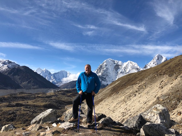
On both this trek and the trek up Rakaposhi in northern Pakistan I could feel the differences in my body at 67.  I am clearly slower and haven’t the stamina I had in my 40s and 50s.  But, the most concerning change is in my balance.  I have always had excellent balance and could comfortably hop from boulder to boulder for hour upon hour without hesitation or misstep.  Now at 67 I am no longer so sure footed and depended heavily on my trekking poles to keep me upright and moving without stumbling. 

I clearly have some issues to discuss with Dr. Popa upon my return to Florida.  I need to have both my left knee and hip examined either by MRI or X-ray to see if I need joint replacement(more on this later), my feet examined by a podiatrist and x-rayed, and my balance checked to see if this is just a condition of advanced age or something more serious.

We hung out at EBC taking photos and talking with everyone else who completed the trek around us enjoying the comradery.  I am not sure why but you never seem to meet a stranger in the mountains.  Conversations with people you have never met or will ever meet again seem totally natural and unfold as if you have known each other a lifetime. 

And no matter where on earth the mountain – as you look around and see the majesty of the mountains around you in every direction there is no doubt in your mind that this was no accident nor spontaneous Big Bang.  These mountains and this big blue Orb were created by a conscious being with a hell of a flair for the dramatic!

But as much as I was enjoying basecamp and dreading the trip back across the boulder field and up the ridge – it was getting late and cold.  Time to start back for Gorakshep and another crappy plate of rice and a cold bed.  On the trip back across the boulder field, my left knee that had been hurting a little for days really started aching. 

I don’t have any cartilage in that knee having shredded it in an accident in 2003 – so it is just bone on bone.  Sometimes the bone and kneecap get a little out of alignment and it creates a great deal of pain when I put weight on it as the two grinds against each other.  Usually within a few minutes something will pop and things go back into alignment.  Unfortunately, the knee joints stayed out of alignment throughout the long walk back to Gorakshep and every step sent shockwaves of pain up my leg and every time I had to hop from a boulder to another landing on my left foot I could see an explosion of stars.

Puppy Ugh GIF
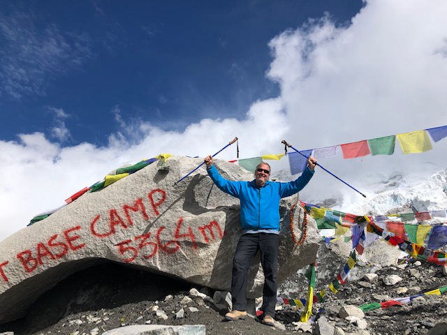
But with enough time we hobbled into the guesthouse and a rest for my throbbing knee.  As I forced down my fried rice Karan tested my Oxygen absorption level – it had dropped all the way down to 78%.  Time to get down the mountain!  So off to bed I went to take some Chinese Advil and Massage my knee, quad and hip with Tiger Balm and rest for the long three days ahead.

Day 7

Disney Sleeping GIFThe original plan was to get up at 3am to climb mount Kalapatthar 2000 feet above Gorakshep to take sunrise photos of the Everest mastiff.  But between my knee issue, the fact that I had not brought a base layer of warm clothes or warm hat, and the fact that we were planning on descending 26 km to Pangboche Village in one long day, I decided not to push myself and slept in.  I had already abused my body enough by completing an 8-day trek to basecamp in 6 days and decided it was time to act my age.  Karan asked if he could take my iPhone up the 2000 feet and take photos for me – so the sunrise photos were taken on my camera but not by me! Lol

Sunrise photos by Karan

I awoke at 6 am and was ready to start the long trek back down the mountain by the time Karan returned.  My knee was feeling better but still tentative.  We left Gorakshep(16,990ft) at around 7:30 am and retraced our steps from the previous days down past Loboche to Thokla Pass.  My knee was holding up pretty good so far and when we reached Thokla Pass I took the time to find Rob Hall’s memorial cairn to pay my respects and shed a tear for a great climber, guide and human being.

For those of you that are not mountaineers or never read Jon Krakauer’s “Into Thin Air” – Rob Hall was a central figure in one of Everest’s worst climbing disasters.  Back in 1996 Hall, a Kiwi, was the owner and chief guide for a commercial climbing guide service.  Scott Fischer from Seattle was the owner and chief guide for a competing commercial guide service.

They were both leading a bunch of inexperienced and unfit peak baggers that had no business on a mountain up Everest for $50,000 a piece.  Some of these dumbasses didn’t even know how to strap on a pair of crampons or tie into a rope but money talks.  A break in the weather and both groups made a dash for the summit. 

But there was a series of problems and errors in judgment – the most important and fatal was that Fisher had instructed his strongest and most experienced Sherpa to short rope a rich New York socialite up the mountain (a short rope is when a strong climber ties a 3 to 5 foot section of rope to himself and then to a weaker climber and tows them up the mountain) instead of leading the Sherpa team in fixing ropes over the Hillary Step just below the summit.

The remaining Sherpas refused to fix the ropes in protest and when the two climbing parties reached the Step everyone sat around for hours getting cold and burning their bottled oxygen while Hall and Fischer got the Sherpas back to work. 

A second contributing factor to the tragedy was that both parties ignored the preset turn-around time.  A hard and fixed rule of mountaineering is set a time to turn back no matter how close to the summit.  This is done so that the ambition of the moment doesn’t override good sense and put your life at unnecessary risk.  Both climbing parties ignored this most fundamental rule!

And finally, a storm blew in quickly late in the day and caught the exhausted climbers high on the mountain as they ran out of bottled oxygen and their oxygen-deprived bodies began feeding upon themselves and shutting down.  Eight of the peak baggers died that day as well as Fisher and Hall.

Rob Hall was helping one of the stragglers down the Hillary Step when the man ran out of bottled oxygen, strength, and heart.  The man just sat down at the base of the Hillary Step to wait for his body to figure out his brain and will were already dead – he had given up!  When Hall couldn’t rally the man to fight on – rather than leave the client to die alone Hall sat down with him knowing that he was sacrificing his own life by staying with his client.

Some may believe Hall’s final decision was foolish, and some may claim he was selfish to sacrifice his life and leave his wife and unborn child back in New Zealand to carry on without him, I prefer to see him as a noble and honorable man and the ultimate professional that refused to let a client die alone.  So, Rob Hall and his client’s frozen and lifeless faces met the sun’s first weak rays together the morning after the tragic storm high up on Everest’s pitiless pinnacle. And today Hall’s memorial sits along with many others of both men and women that have lost their lives pursuing their passion on Everest at the top of Tolka Pass.

After my brief moment of silence and reflection at the memorial Karan and I descended on down to the Tholka Guesthouses for lunch and a short rest.  After another plate of fried rice and time off my knee, we were ready to push on.  Our route from Tholka required a steep descent across a glacier fed stream then down a knee punishing steep boulder field.  Then 5 kilometers of flat walking over uneven boulders and rocks along the river to the village of Pheriche. 

chris hemsworth thor GIFThe 1,700 vertical feet steep descent over uneven boulders then the long flat walk balancing on river rocks to Pheriche took its toll on my knee and I wasn’t sure I could make another 10km.  I finally bit the bullet and sent Karan on ahead to Pheriche to see if I could rent a horse to take me the rest of the way to PangbocheUnfortunately, someone had already rented the village’s only horse!

We stopped at a teahouse in Pheriche for some tea, rest, pain killer, and to tightly wrap my knee for lateral support and then pushed on for Pangboche.  The pain killer, wrap and short rest all helped to take some of the edges off the pain and things were bearable but slow.  Our route now required us to climb back up out of the valley, cross the river again on a suspension bridge and then up over Pheriche Pass.  

After the pass the route simply followed the contours of the mountain up and down until we reached Pangboche a couple of hours after dark.

And my reward for 12+ hours of painful walking – a big ass Yak Steak and fries!  My first decent taste of real meat in 7 days.  And I savored every last bite!  Then dog tired, foot sore, and knee aching I crawled into my sleeping bag for a very deserved rest.

Day 8

We descended from Pangboche thru Deboche, Tengboche to Namche Bazar another 20 km day.  The route descended 2,300ft over 15 km before re-ascending 1,000ft and finally dropping back down a few hundred feet below the ridgeline to Namche.  After a night of rest, my knee was feeling much better and this day’s trek was bearable and uneventful.

Day 9

My final day on the trek just 23 short km from Namche to Lukla.  The walk was long and tiring but much more interesting than the first day in the rain.  I probably spent too much time taking photos and stopping to rest my knee and for tea because I managed to stretch a 7 hour trek into a 10 hour trek requiring the last hour be finished by headlamp in the dark. 

Throughout the day, we crossed 6 different suspension bridges over the Dudh Koshi River, passed Buddhist monasteries, stupas, colorful mani-wall, prayer wheels, and Buddhist engraved stones.  We passed thru the colorful and interesting little villages of Monjo and Phakding and by countless stone walled farmsteads of fall crops and pastures.

Upon finally reaching the guesthouse in Lukla I finally enjoyed my first shower in 9 days, a celebration dinner of chicken breasts, fries, rice, and steamed vegetables and a full-size bed (really just a concrete slab with a thin pad).

Day 10

We began our journey back to Katmandu with a short early morning flight to I’m not sure where – but it wasn’t Katmandu.  We landed then sat by the side of the road for nearly two hours until a bus from Katmandu came by and picked us up for a 5 hour drive to the city.  The roads in Nepal are atrocious and even more scary than the Lukla airstrip!

Unfortunately, the day was some kind of major holiday and most of the restaurants along our route were closed.  We eventually stopped at a roadside diner catering to locals without a menu.  Our lunch choices were pots one, two or three or any combination.  So, I tried the spicy lentil curry soup, some kind of eggplant and tomato-based vegetarian curry and mutton curry all washed down with copious amounts of Gurka beer to extinguish the fire from atomic chili in every frikken dish!

We finally arrived back in Katmandu a little after 4 pm and checked back into my hotel, retrieved my bags from storage, turned all my trekking clothes into be cleaned and gave myself a good scrubbing. 

Karan came back to collect me at 7 pm and we feasted on traditional Nepalese food and beer while watching a cultural show.  The following morning I was packed and headed to the airport for a new adventure hiking up to the Tiger’s Nest Monastery in Bhutan.  But that is a story for the next blog….

Posted in Uncategorized | Tagged , , , , , , , , , , , , , , , , , , , , , | 1 Comment

Nepal 9/26 – 10/3 – Visiting the Roof of the World (Part 1)

I arrived in Kathmandu mid-day and after checking into my hotel in the Thamel (Historic) District, set about exploring my surroundings and renting/buying equipment and trail food I would need on my 13-day trek to Mount Everest Basecamp and back (130km).  It’s a shame I couldn’t haul my own higher quality equipment from Colorado but dragging a sleeping bag, base layer, down coat, fleece, waterproof pants, gloves, water bottles, headlamp etc.  across 34 countries and 9 months for a 13-day trek simply wasn’t practical.

So, I rented a sleeping bag with a faulty zipper which opened constantly thru the night ensuring I would wake up cold repeatedly, trekking poles (which were a lifesaver), and a very nice warm North Face down jacket.  Purchased a cheap fleece jacket that I threw away at the end of the trek, one pair of Wolfskin pants that turned out not to be waterproof, sized incorrectly and too small, a quart water bottle that leaked and kept everything in my day pack wet, gloves that were a bit too small which I gave away at the end of the trek, and a headlamp that was pretty much useless.

All in all, I had a great first day wandering around the Thamel District which I found both quaint and exotic at the same time.  The bustling cramped streets were filled with both local and foreign pedestrians, bicycles, motorcycles, peddlers’ carts, cars, and rickshaws.  All competing for room to progress along the busy lanes to a symphony of car horns, motorcycle beeps, bicycle bells, pedestrian shouts, shop owners’ pleas to examine their merchandise and faintly in the background of it all – the sound of traditional Nepalese music.

The buildings throughout the district are all two to five-story and look centuries old.  The store owners manage to use every square inch of space inside their cramped stores and encroach into the street with their trekking and climbing wear, traditional Nepalese wool and silk clothing, Nepalese souvenirs, and tea houses.

The cramped lanes assault your nose with a complicated mixture of incense, roasting corn, grilling meat, exotic spices, body odor, cow and horse dung and God knows what else – but not unpleasant!

I enjoyed three meals in Kathmandu while waiting for my flight to Lukla to begin the trek.  My first was a pizza at a place called Fire and Ice.  I learned quickly that people in Nepal like spicy hot in everything they eat – a simple mushroom and pepperoni pizza required me to grow a new layer of skin on my lips and gums.  Thank God, they sell their Everest beer by the quart!

My second meal was a steak and chips at a place called Fat Belly’s.  and again, they ruined a good thing by marinating the steak in some- kind of radio-active tongue eating chili juice.  Which probably explains why they sell their local beer by the quart.  It takes a lot of beer to extinguish a five-alarm mouth fire!

I was supposed to fly to Lukla on the morning of the 27th but sat at the airport (along with hundreds of other trekkers and climbers) surrounded by chaos and absolute bedlam from 7 am until 2 pm waiting for weather in Lukla to clear enough to take off.  I learned later that Lukla is one of the most dangerous airports in the world.  Apparently, pilots are specially trained to fly this route.  In order to land the pilot must skim the plane over a steep hill then drop down onto a very short runway that is tilted more like a ramp than level ending in a sheer drop off a cliff if you don’t break in time.

Any fog or cloud at ground level that could obscure the pilot’s ability to see the hill or runway, or lack of runway at one end closes the airport (which happens frequently).   And once I saw the airport for myself – I appreciated the caution!

So back to my Kathmandu hotel for another night in the big city.  And I enjoyed a great night wandering around before stumbling upon the interesting little New Orleans Grill.  This café offered both local and western menus, a good selection of beers, and a house band/trio that played both traditional Nepalese music and American Blues/Jazz.  I had a great Steak, potato, and steamed vegetable dinner, sampled both Gorka and Everest beer by the quart, and the band was great – couldn’t ask for a better night if you had to be stuck in Kathmandu.

To Lukla

Day 2 found Karan (my fantastic guide) and I back at the Kathmandu airport bright and early but with the same result 8 hours of waiting for the weather to clear in Lukla.  When they finally announced that all flights were no longer being delayed but were now canceled it was time for plan B.  I sent Karan to find a helicopter we could charter.  He found three other trekkers to join us and we chartered a flight that cost me $1,000.  An hour later we were loaded up and lifting off for Lukla.

And just like that we were flying thru the clouds and rain over mountains, rivers, waterfalls and steep valleys in route to our jumping off point for Everest Basecamp.  As we approached the small village of Lukla I could see the reason for all the caution.  The landing strip, built by Sir Edmond Hillary and friends, was short (1,660ft) and steep with a hill jammed up against it on one end and a cliff/sheer drop-off of 2,400 feet on the other end.  And just to complicate matters there seems to be a consistent strong crosswind.  Landing vertically was obviously the safer alternative.

Flight to Lukla

The small village of Lukla (9,333 ft elevation) is home to about 1000 residents who all seem to make their living catering to trekkers and climbers.  The folks are either porters, guides, horse/yak wranglers, guesthouse or café owners, trekking, climbing or souvenir shopkeepers or small grocery store owners.

The nearest road is a two day walk down the mountain – so you either fly in and out or you take a five-hour bus ride to the end of the road and walk for two days to get here.

I ate my first meal of the day – fried rice/egg/vegetables at 5 pm and by the time I finished, it was dark and too late to hike the three hours to our planned first night’s lodging.  The guesthouse in Lukla was just a simple unheated 7 by 6 Spartan unit with a small wooden cot covered in a sheet of plywood and a three-inch sleeping pad.  The bathroom with an eastern hole in the floor toilet was down the hall. 

And for the next ten days all my meals would be either fried rice, fried noodles, or fried/roasted potatoes (no meat or recognizable vegetables) and apples Karan brought along as a treat for me.  And my lodgings were pretty much a repeat of the unheated cell of the first night.

Day 1 Trekking

We were up bright and early for a long day of trekking that would cover two-days trek in one long day to make up for our late start.  Unfortunately, we woke to a miserable day of persistent cold rain and fog. After a quick breakfast, we broke out our rain jackets, waterproof pack covers and off we went – and for the next 12 hours we hiked 22 km in the constant rain. 

The route began with a steep descent of over 1000 vertical feet then for the next 12km it was up and down following the contours of the river and mountain track.  We crossed over a series of 6 different very high suspension bridges over the river which never failed to get my heart racing as I looked down at the roaring river far below my feet. 

The route took us thru the villages of Phaksding and Monju, past small vegetable farms, Buddhist stupas, chhortens, and Buddhist text rocks, lush green valleys and all along the trail – a riot of wild rhododendron and ancient dense pine forests.  

And finally, we came to the final hard push – several hours of a constant climb up to Namche Bazar – a trading center for the many villages along the trek.  The map shows an elevation gain between Lukla and Namche of 2,600ft but in truth between all the ups and downs following the contour of the mountains the total climbed is probably three times that.  And I was beaten when we hobbled into Namche at 11,316ft!

After a quick boring dinner of fried rice and a quick check of my Oxygen absorption rate (95%) we made the decision to skip the rest/acclimatization day scheduled for the next day and push on to Tengboche.

Day 2 Trekking

Woke up to clear skies and beautiful vistas in every direction – Namche clings to the side of the mountain ridge just below the crest offering spectacular views of the Thamserku, Kongde, Kusum, and Kangaru mountains across the valley, distant waterfalls, stupas, terraced pastures of vivid greens, small stone farmhouses and a maze of stone fencing built over centuries of shepherding yaks, sheep, goats and cattle in this harsh environment.

The trek out of Namche Bazar began with a short steep climb up over the ridge and then a fairly easy 31/2 hours (7.6km) trek thru the village of Sanasa to the riverside village of Phungi Thenga

All along the route we enjoyed views of yaks grazing in mountainside meadows, local farmers hard at work gathering their crops, drying chilies, beans, tomatoes, apples, other assorted foodstuffs for the winter, cow and yak dung(used to fuel their stoves) and a constant flow of donkey, horse, porter, and yak trains ferrying supplies along the route from village to village.

Everything from the outside world from food to propane to building supplies to furniture to appliances all have to be carried on the backs of either beasts of burden or porters.  Incredibly, men that weigh no more than 110 to 120 pounds carry their body weight on their backs and attached to them by a strap and canvas strip across their foreheads up and down these mountains without breaking a sweat!  I saw many porters carrying as many as 4 sheets of ¾inch 4 by 8 plywood sheets and saw even one guy carrying a full-size refrigerator on his back up a 1000 foothill.  These people are incredibly strong and seem to have superhuman endurance.

After another boring flavorless meal of rice fried in way too much yak grease we were back to the trail.  From Phungi Thenga the trail became a steep heart pounding quad burning two hour climb to the Tengboche Monastery where we would spend the night.  After checking into the guesthouse, I made a quick visit to the monastery and temple, made a small offering and prayer for Jackie’s speedy and complete recovery, then returned to the guesthouse for another tasteless dinner and cold night in my unheated cell.  Oxygen absorption still holding in at 95%.

Day 3 Trekking

I awoke to another beautiful blue sky day for our trek from Tengboche to Dingboche (14,080ft). This day’s trek was 11 km and took about six hours to complete.  The trail took us through rhododendron forests across the wild Imja River, past yak pastures, small potato patches, and buckwheat fields.  We passed thru the villages of Deboche and Pangboche with spectacular views of Lhotse and Ama Dablam.

Lunch and dinner were both tasteless noodles and cheese washed down with weak black tea.  Oxygen absorption rate holding steady at 95%.

Day 4 Trekking

Even though my Oxygen absorption was still near perfect, we made the decision to take a rest/acclimatization day rather than risk pushing my body any further and then paying a price later.  So, today we took a short 3.5 km hike up about 2,000 vertical feet and back to give my cardio system a little kick and then spent the rest of the day  drying clothes and enjoying the views of Lhotse (4th highest mountain in the world), Ama Dablam and Makalu (5th highest mountain in the world).

Day 5 Trekking

Today’s trek took us from Dingboche up a steep ascent onto a long flat bench (5.2 km) following along high above a river fed by the Khumbu Glacier.  We stopped for lunch at a small cluster of guest and tea houses known as Thokla just across the terminal of the Khumbu Glacier.

After another boring lunch, we had a short 650 foot climb up a headwall to Thokla Pass.  As we crested the pass stretched out before me was one of the most moving vistas I have seen. Rock Cairn after Rock Cairn built as memorials to climbers who lost their lives while pursuing their passion on the broad shoulders and pitiless face of Everest.

I managed to find Scott Fisher’s monument but could not locate Rob Hall’s.  I will try to find his on my way down and pay my respects to the great man.

From Thokla Pass the route follows the Khumbu Glacier’s moraine on in to Loboche a cluster of five or six guest houses at just over 16,000 feet elevation.  All together, we trekked 10 km and gained over 2000 feet of elevation throughout the day.  Today was the first day my Oxygen absorption rate dropped – 85%.  This represented a 10% drop in efficiency from 14,000ft to 16,000ft.

Tomorrow we will trek on to Gorakshep drop our gear at the guesthouse then trek on across the glacier to Everest Basecamp but I will save that narrative for the next blog…. Stay tuned!

Posted in Uncategorized | Tagged , , , , , , , , , , , , , , , , , , , , , , , , , , , , , , , , , , | 1 Comment

Touring Turkey Part 3: Pamukkale/Hierapolis, Konya, and Cappadocia (July 27 – 29)

The first stop on this part of my tour was to the UNESCO World Heritage Sites of the ancient city of Hierapolis, Pamukkale Springs and the Travertine TerracesPamukkale is Turkish for “cotton castle” and that is exactly what these incredible terraces look like from a distance.  The geological terrace formations are 8,860 feet across, 1,970 feet wide, 525 feet high and can be seen from across the valley 12 miles away. 

The terraces are formed by calcium carbonate that is suspended along with other minerals in the water flowing from 17 hot mineral springs high up on the mountain.  The springs with temperatures ranging from 95 to 212 Fahrenheit create a continuous water flow that delivers the minerals to the head of the terraces and deposits calcium carbonate that becomes a soft gel which in time crystallizes into travertine.  Attached are photos of the milky white terraces with their milky blue and green mineral pools. 

North Terraces

North side travertine pools

At the end of the 2nd century B.C., Attalids, King of Pergamon established the thermal spa of Hierapolis. Later Greeks expanded on the city and still later the Romans added their two cents.  Pergamon, Greek, and Roman ruins of baths, temples, huge city gates, a monument arch, nymphaeum, necropolis and theater stretch across the area just above and surrounding the travertine terraces. 

Later in 330 A.D., the site became a religious center for the Eastern Church under Constantine so there are also ruins of early Christian churches including a cathedral, baptistery, Martyrium of St. Phillip, and lesser churches on the site as well.

Channels to direct the mineral water

The Greeks and Romans built a network of canals, tile pipes and channels to direct the hot mineral water to pools for swimming and basins/baths for soaking in the therapeutic waters.  The Temple of Apollo was built over a vent which leaked noxious vapors believed by the ancients to have healing powers.  The ancient city must have been spectacular in its day with ornate city gates and a long columned colonnade. 

The first photos of ruins you see after the Southern Gate are a few marble columns that are all that left of the gymnasium.  The original structure was 270 feet long with a 20 foot high portico, was built in the 1st century and stood until it was destroyed by an earthquake in the 7th century.  In the 1300 years since the earthquake, the remains have been covered by a thick calcareous deposit from the runoff of the springs above. 

Southern Gate and Gymnasium of Hierapolis

The next series of photos are from the south side of the Travertine Terraces and channels created to direct the mineral waters thru the city and into the terraces.  Unfortunately, my photos do not do the beauty of the terraces and mineral pools justice.  Seeing the terraces up close and personal is an unforgettable experience. 

Travertine Terraces on the south side

Most of the travertine pools are off-limits but you can swim/wade in one small section just below the Roman Baths/Museum with 10,000 of your closest friends.  I passed on swimming in the terraces and chose instead to take a dip in what is known as Cleopatra’s Pool.  If you believe the legend Cleopatra bathed and swam in this Roman built pool.

Cameras are not allowed in the pool itself so I don’t have a selfie but I did take some photos from the apron of other swimmers in the hot spring fed pool after my quick dip.  Notice the marble columns and other stonework scattered in the pool by an ancient earthquake.

Despite the rules to protect the pool from modern chemicals and bacteria (everyone must shower before entering the pool, no sunscreen, makeup, water shoes, food, drink or cameras are allowed in the pool) the experience is still very cool and worth the price of admission and a sunburn.

Cleopatras pool

Just up the hill from Cleopatra’s Pool sits the ruins of the Temple of Apollo.  All that survived the earthquakes are the foundation, a few columns and marble statues.  Further up the incline is the crown jewel of Hierapolis – the huge TheaterUNESCO has helped with funding to restore the theater and I have included a series of photos beginning with Cleopatra’s Pool, then the Temple of Apollo, and finally the Theater.  After this series of photos, there are photos of the northern section of the terraces including the small section open to swimmers and waders.

Temple of Apollo

Theater

Next are a series of photos taken as I walked along Frontinus Street (the main North to South street thru the city).  These photos include shots of the remains of the Agora, Nymphaeum of Tritons, Latrina, Frontinus Gate, Basilica Baths, Christian Basilica, and the Northern Necropolis including several ornate tombs.

The ingenuity, architectural and engineering acumen of the ancients is simply amazing.  They built incredible buildings and monuments that have survived for thousands of years without the benefit of modern machinery or building materials.  I wonder how long our modern buildings will stand and if 1000 years from now people will look back and ask, “how did they build that stuff with such primitive tools and materials?”

Frontinus Gate and Street

Agora and North Gate

Basilica Baths

Tombs

One last set of photos show how nature eventually wins out over man’s structures.  These photos show how the minerals from the hot springs have covered and imprisoned marble columns and stone walls forming a kind of petrified forest of columns and capitals.

Columns and walls over run and covered by mineral deposits

Central Turkey: Konya

Next stop on my tour thru central Turkey was KonyaKonya is one of Turkey’s oldest continuously inhabited cities.  The city served as the capital of the Seljuk Turks during the 12th and 13th centuries and is considered one of the great cultural centers of Turkey.  The city boast a host of historical treasures including the 12th century Alaeddin Mosque, the old citadel, the remains of the Seljuk Imperial Palace, the Karatay Madrasah museum, Ince Minareli Madrasah, Sircali Madrasah, Sahip Ata Complex, and Archeological Museum.

But I passed by all of these sites because I came to Konya for one purpose.  I wanted to visit the Mosque, Mausoleum, and Museum of Mevlana Celaleddin-i Rumi the great Sufi mystic and poet.  Rumi founded the Sufi order known today as the Whirling Dervishes.  But the dervish cult doesn’t really interest me.  What peaked my curiosity about this man was his poetry.

A friend of mine had sent me a link to his poetry read by Deepak Chopra, Madonna, Demi Moore, Martin Sheen, Debra Winger and others all set to some very haunting music.  I had never heard of Mevlana (Rumi) or his poetry but thought the audio beautiful and calming so decided to go learn more about this 12th century mystic myself and added Konya to my itinerary for Turkey.  Photos of the Museum, Mosque and Mausoleum are attached.  If you are interested in hearing the poetry readings you can find them on YouTube “A Gift of Love” Deepak & Friends.

Poetry and writings of Rumi

Mausoleum of Mevlana Celaeddin-I Rumi

Mosque complex in Konya

Dеераk & Friеnds "A Gift Оf Lоvе "Мusic Insрirеd Вy The Lоvе Pоеms Of Rumi

Cappadocia

After spending several hours exploring the mosque, mausoleum, and the museum (photos attached) I drove on to the crown jewel of my Turkey tour – Cappadocia.  My home for the next two nights was a very nice luxury cave hotel suite which included my own in-suite whirlpool tub and hammam. 

People have continuously inhabited Cappadocia for over 4000 years.  But what makes this place so unique and fascinating is how the people burrowed underground and adapted to survive.  The local Hitites began building their underground cities to hide from the invading Egyptian army in 2000BC.  The underground cities were needed again and expanded in 500BC to evade the invading Persians.  And the final persecuted group to use these cave cities were the early Christians hiding from the Romans and later Arabs converting people to Islam at the point of a sword.

Persecution of the Christian minority finally ended in the 12th century once the Turks arrived and became the dominant political and social force in what is now Turkey.  Since then the underground chambers have been used for storage and in the 20th century as a tourist attraction.

I began my exploration of Cappadocia by air before dawn.  I left my hotel at 4 am bound for a launch site for a sunrise hot air balloon fly over of the underground city and its many ferry towers and rock formations.  I was surprised to find not just a few balloons being inflated in the predawn quite but hundreds of crews using propane tanks to heat and inflate their giant balloons. And each balloon had 40 eager tourists chomping at the bit to hop on and lift off.

I was assigned to a balloon with 39 Taiwanese.  They all spoke English and although not part of their group they made an effort to make me feel comfortable which I appreciated.  The flight only lasted an hour but it was spectacular.  We flew over stunning rock formations carved and shaped by wind and rain thru tens of thousands of years.  We had a bird’s eye view of many of the cave communities.  Watched several young couples sharing wedding vows in outdoor sunrise ceremonies from 500 feet above.  But mother nature provided the headliner with an incredible sunrise

Pre-dawn balloons prep

Lift off

Sunrise

Flying over Cappadocia

Dawn weddings

Landing

I consider myself very fortunate to have scheduled the balloon trip this calm cloudless day.  The next two mornings the entire balloon fleet was grounded due to high winds and there were thousands of very disappointed tourists who missed one of the best experiences of my life.

Once the balloon landed we were treated to a champagne breakfast then returned to our hotels to prepare for the rest of our day.  My day included a full-day tour of South Cappadocia.  Thru the day, we hiked the length of the Red and Rose Valleys, the Cavusin Village (one of the oldest settlements in the region) and explored several of the cave houses, hiked thru Love Valley and Pigeon Valley, visited Kaymakli Underground City and Uchisar Castle

Red valley

Rose valley

Overlook

At the end of the day, I was tired but very pumped up and not ready to quit so I attended a dinner and traditional folk show in one of the large cavernous underground restaurants.

Next morning was devoted to touring North Cappadocia.  We began by visiting the Goreme Open Air Museum which consists of five incredible Byzantine Orthodox churches artfully carved out of the earth by hand.  These churches were started by St. Basel and his brother St. Gregory who built both churches and monasteries. 

After visiting Goreme we moved on to Devrent Valley and Pasabag where we marveled at nature’s handy work of rocks carved by rain and wind into animal shapes and fairy-tale like rock formations.

And we ended the day by visiting the ancient towns of Urgup and Avanos famous for their red clay pottery.

I have included photos of my incredible sunrise balloon tour, my hikes above ground, my explorations underground, the traditional folk show, and other assorted photos.  Cappadocia concluded my Turkey Plan B Tour so next morning I was off to Beirut to begin a week in Lebanon.  But that excursion will be the topic of my next blog.

question mark wtf GIF
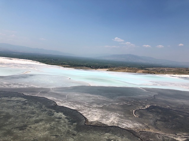
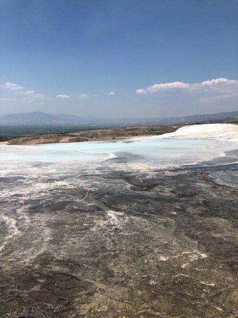
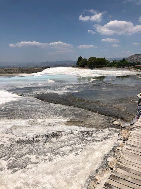
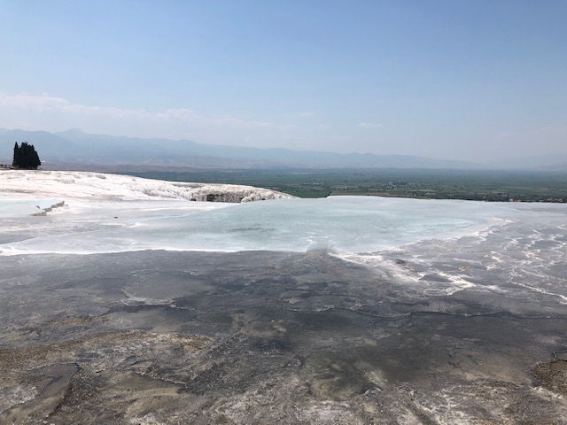
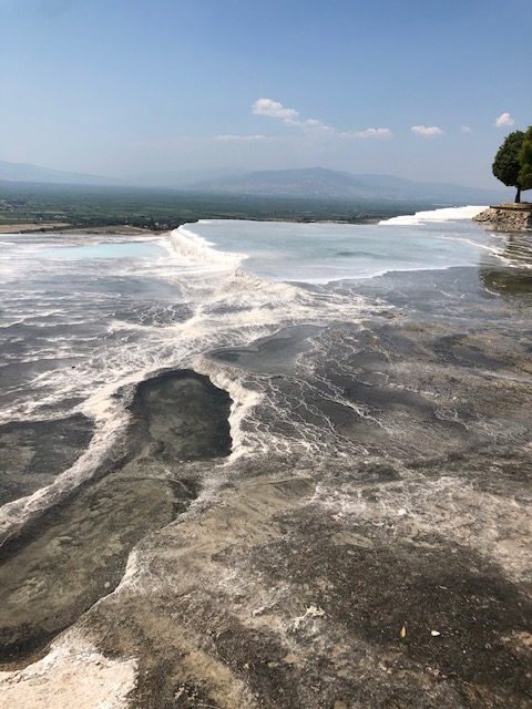
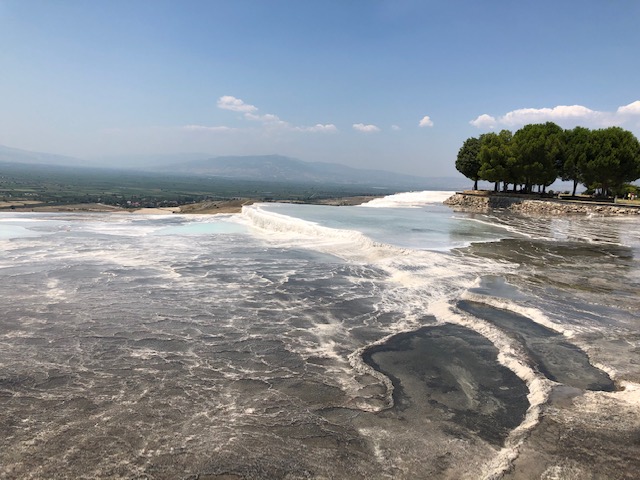
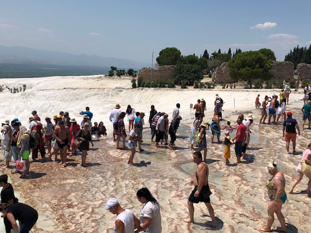
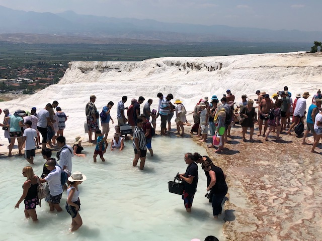
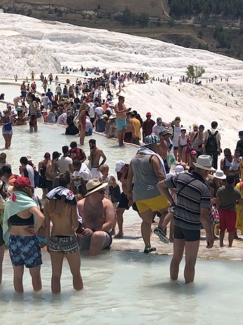
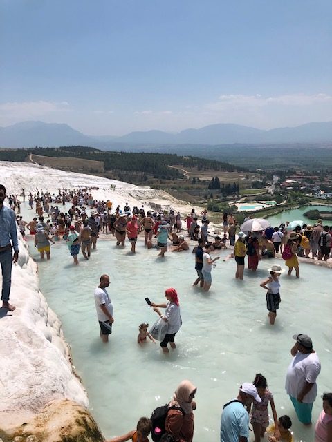
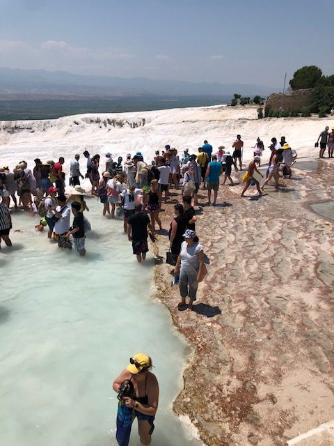
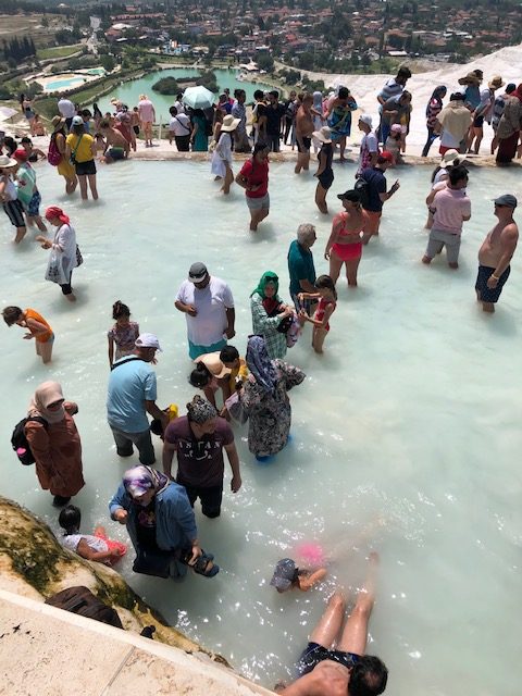
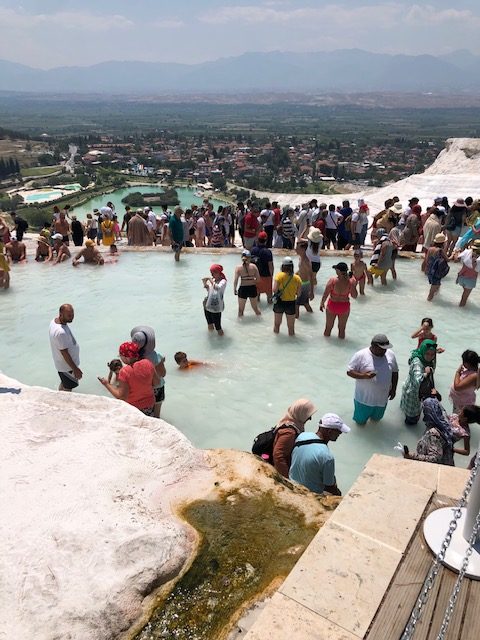
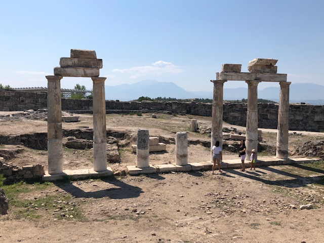
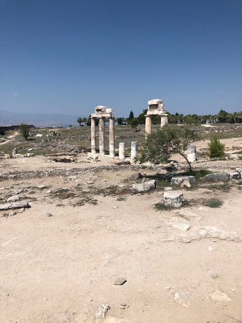
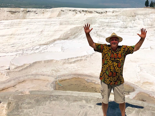
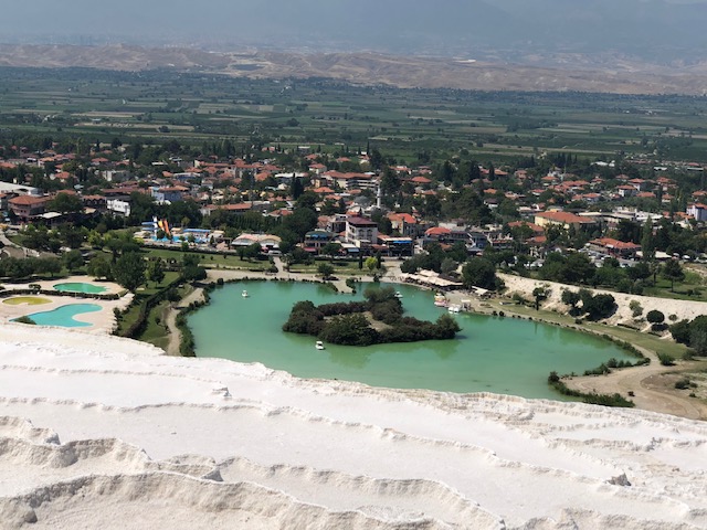
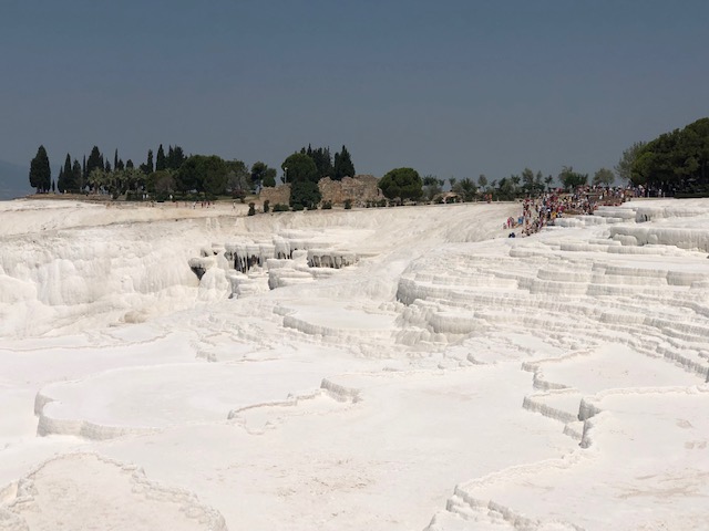
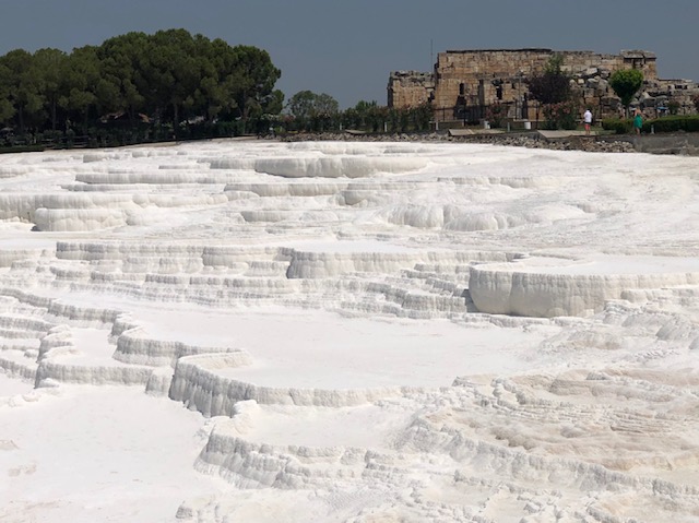
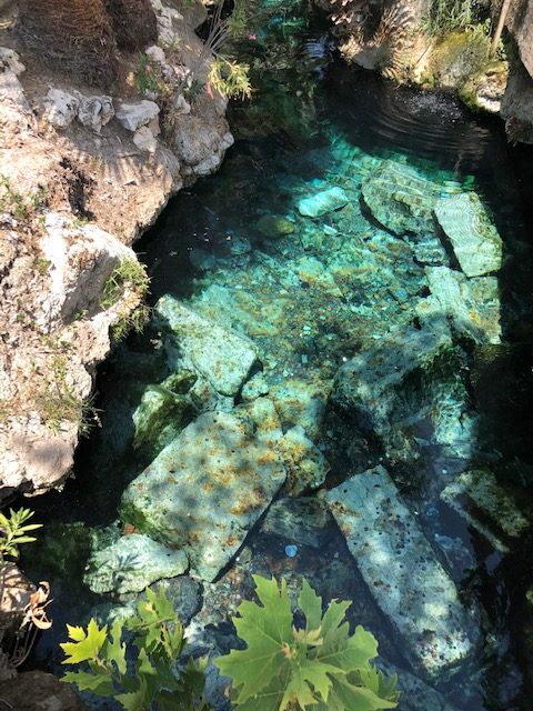
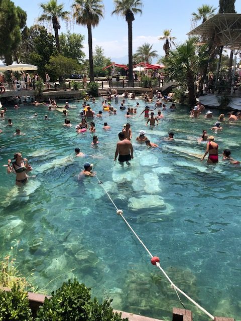
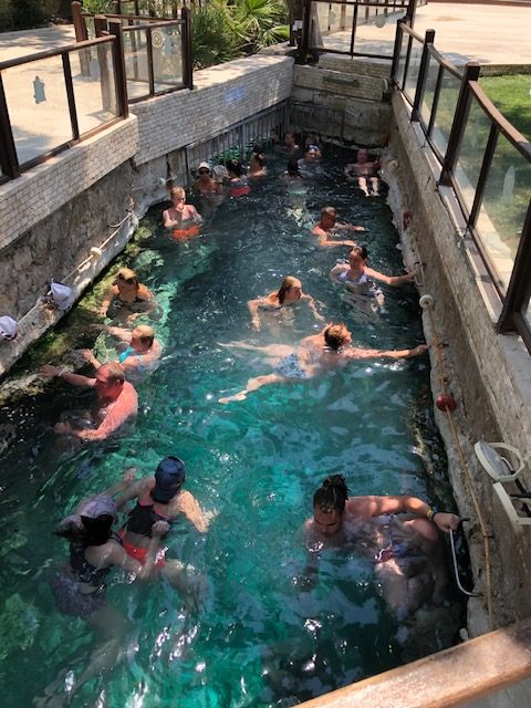
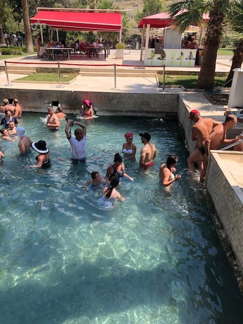
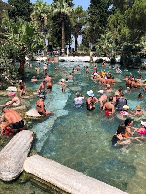
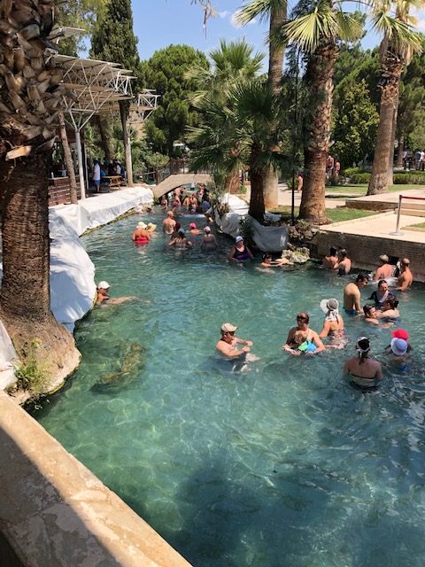
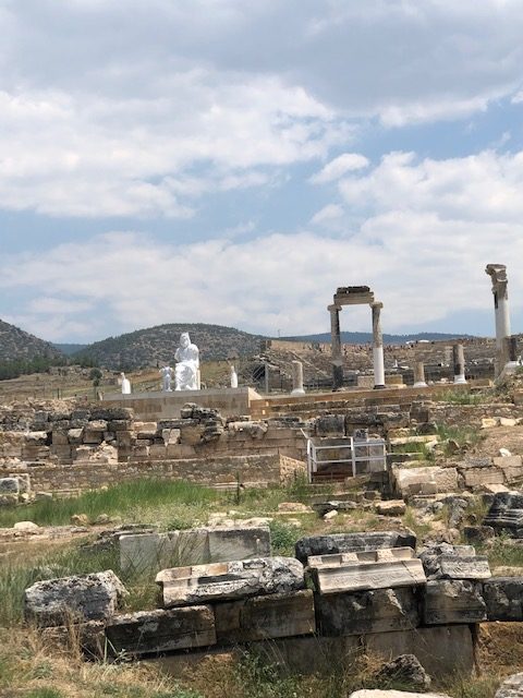
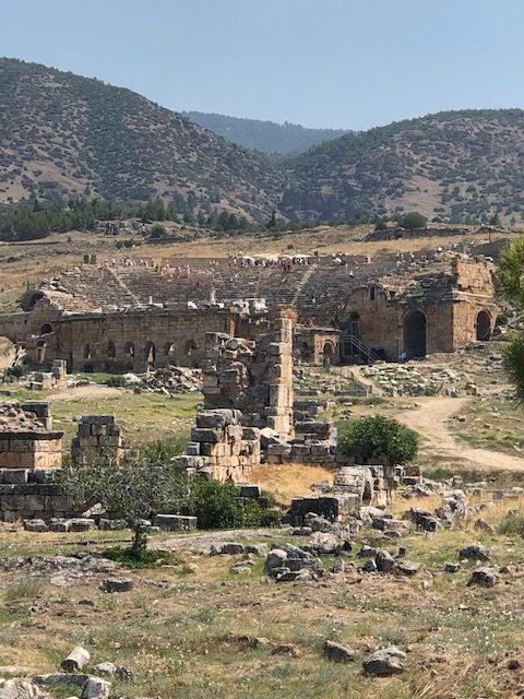
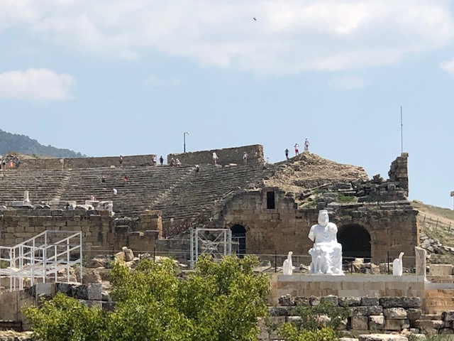
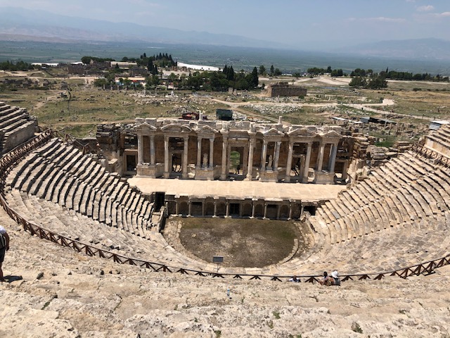
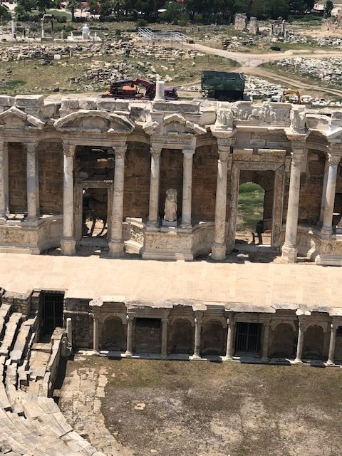
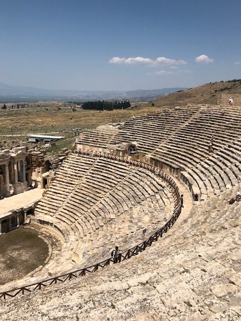
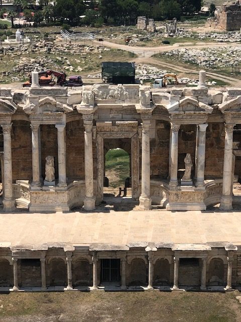
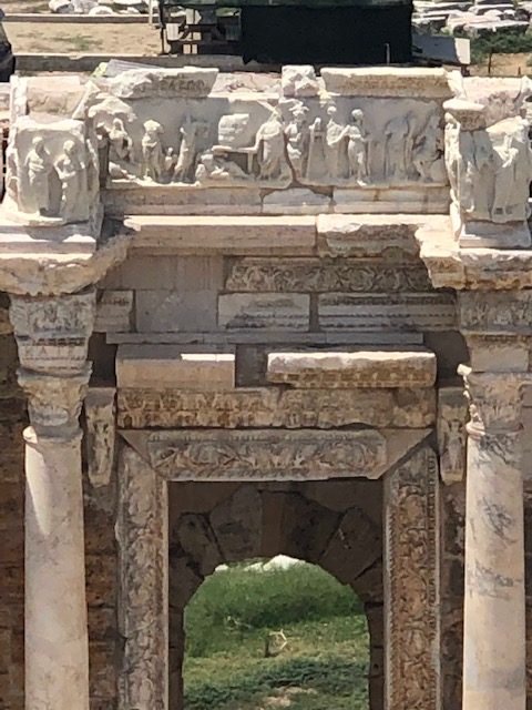
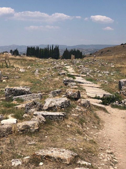
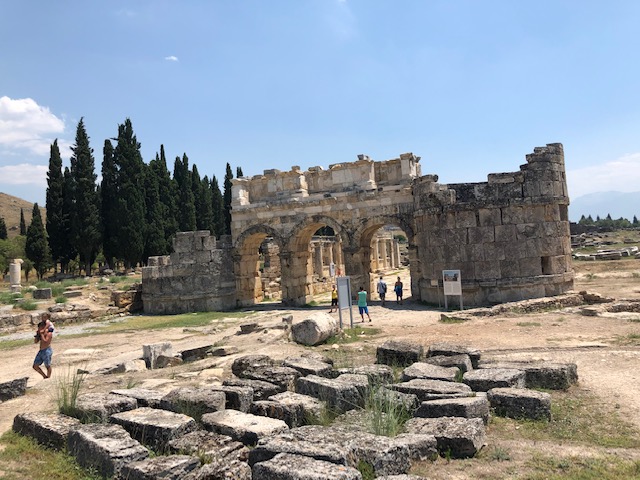
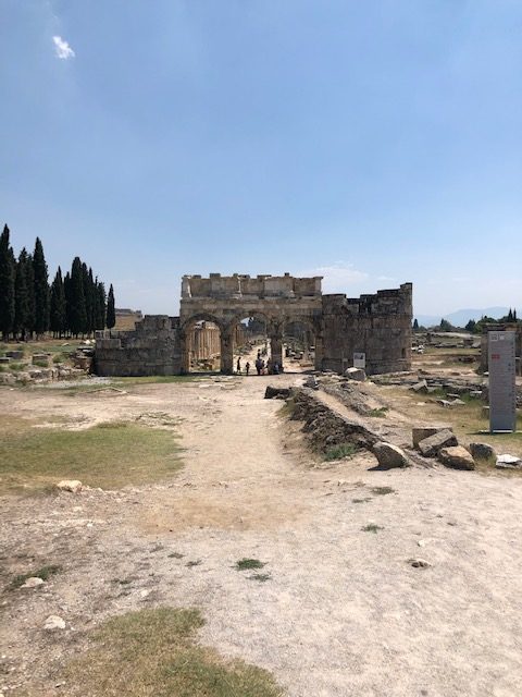
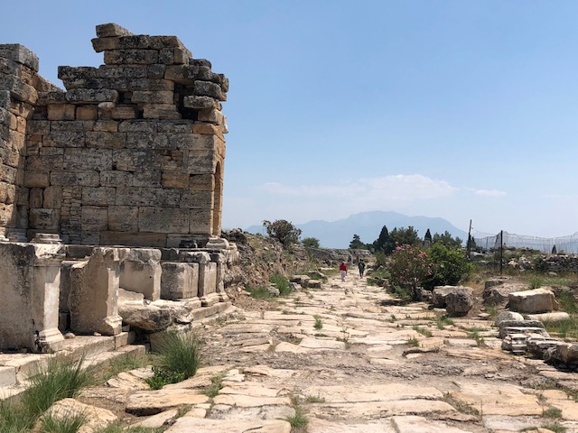
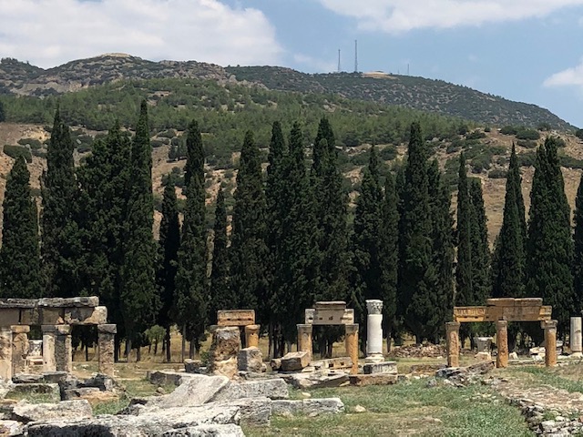
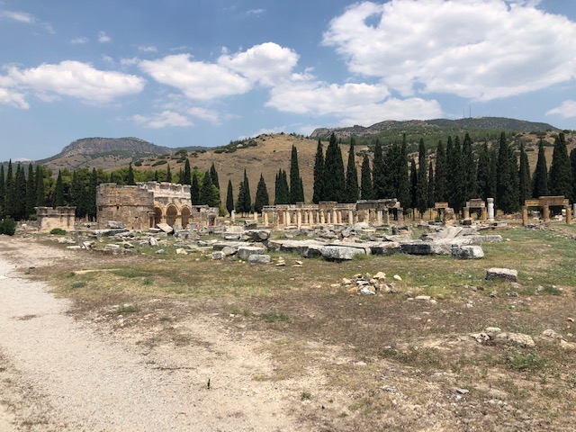
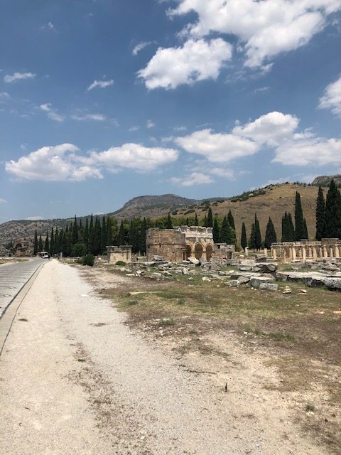
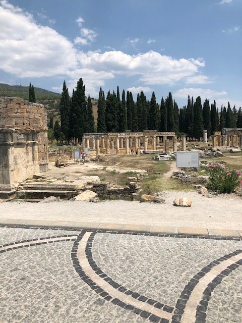
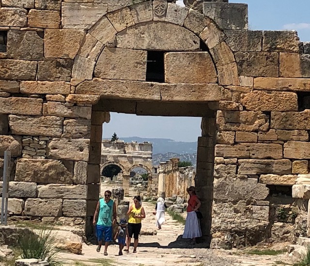
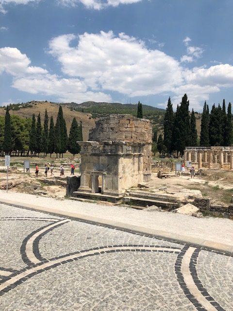
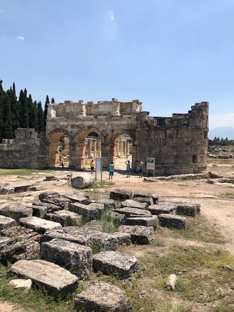
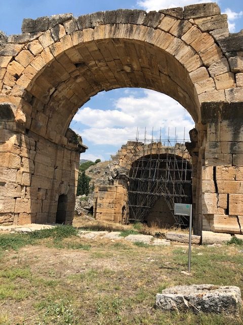
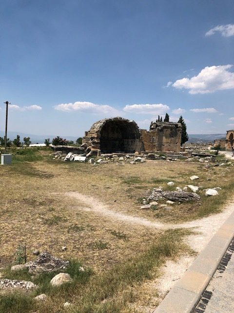
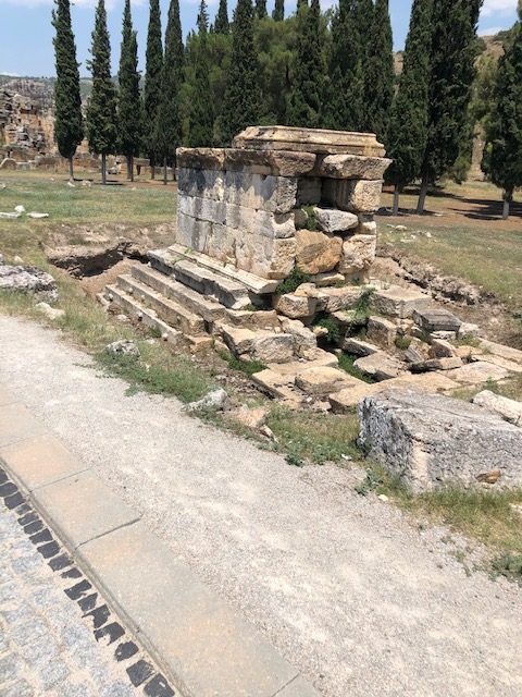
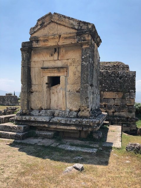
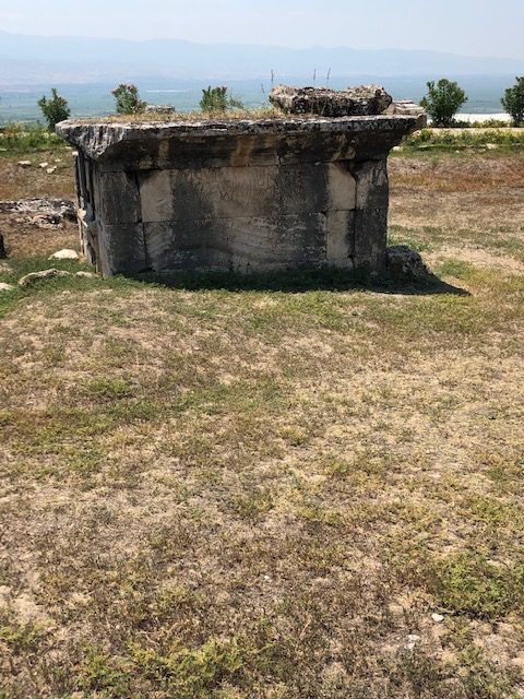
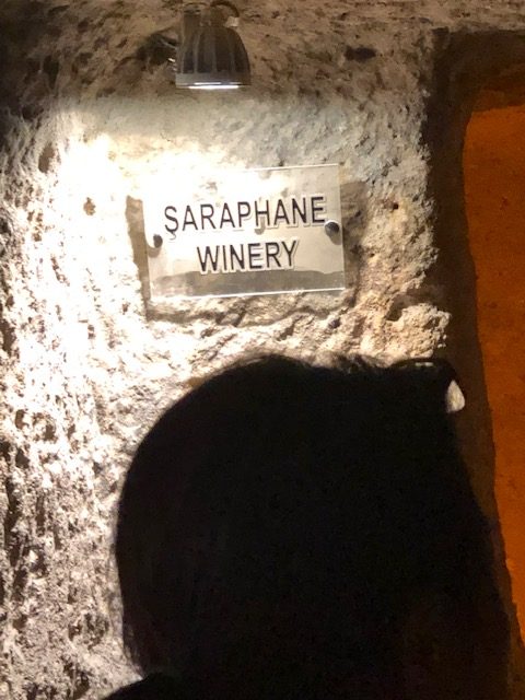
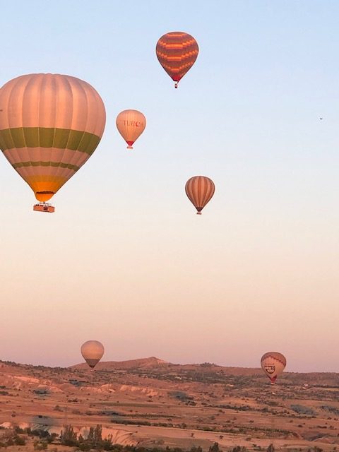
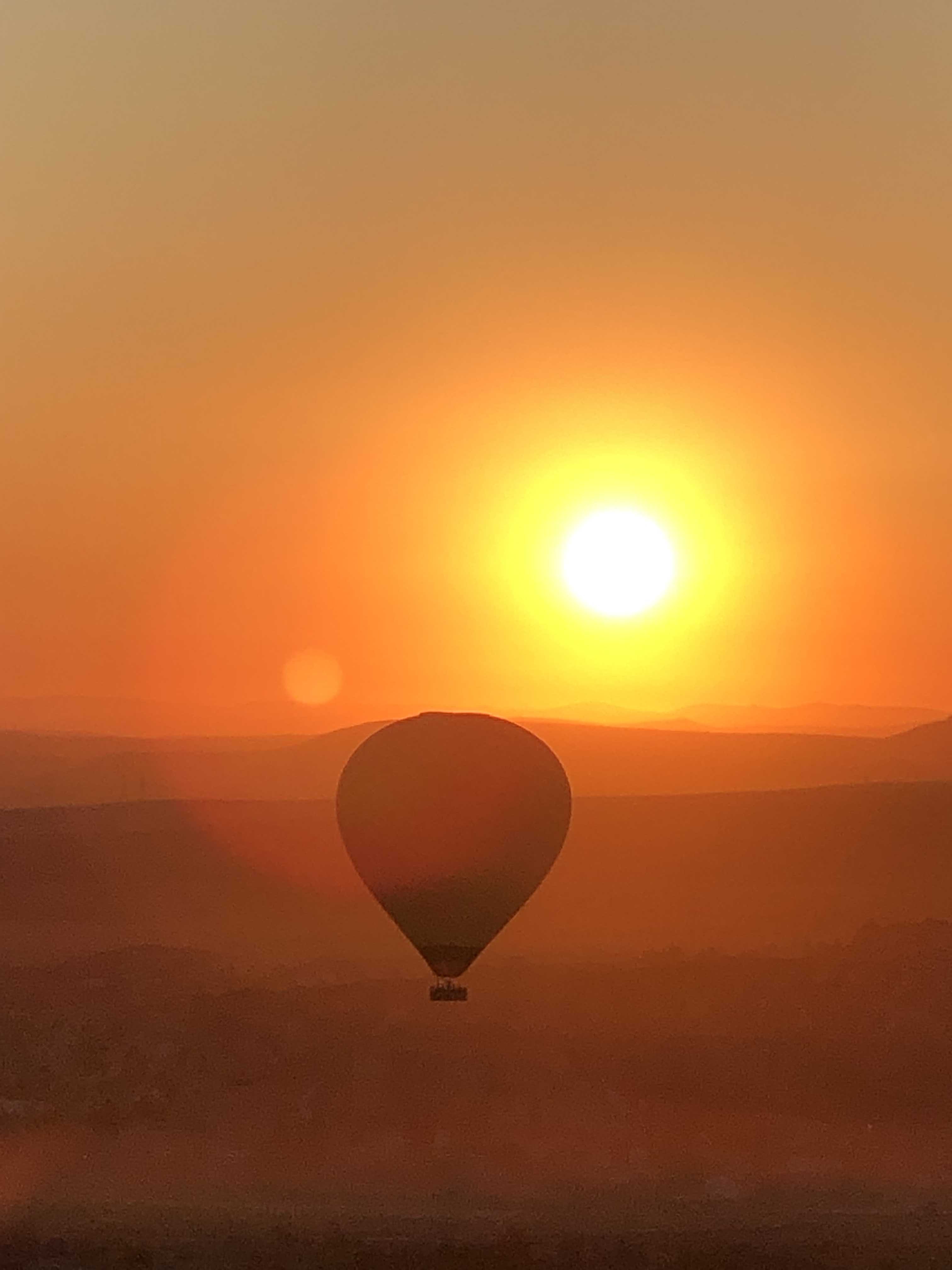
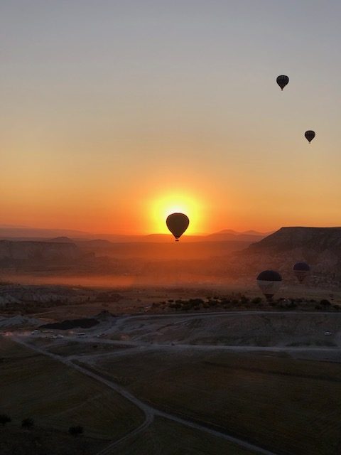
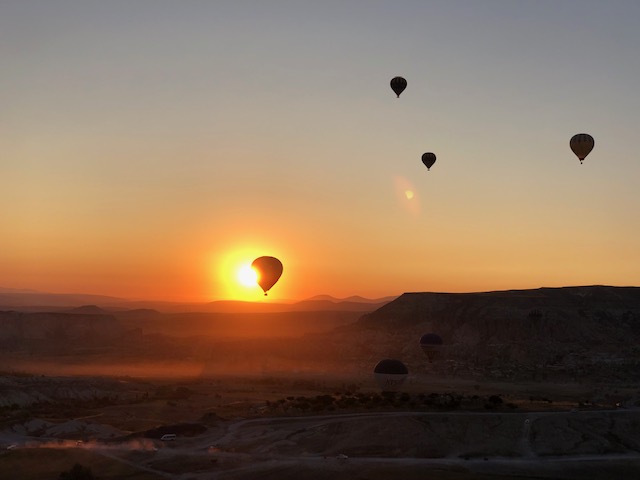
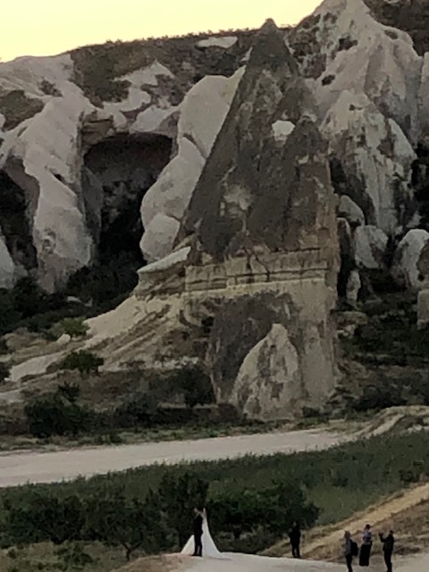
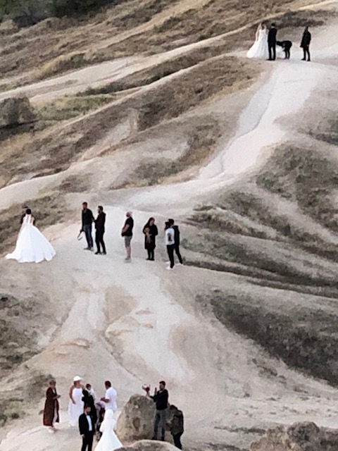
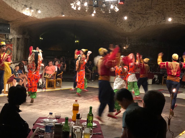
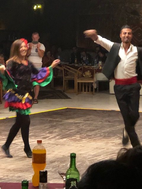
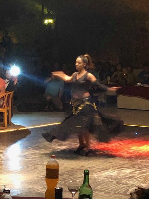
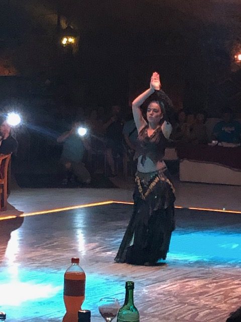
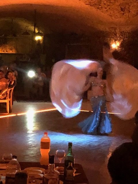
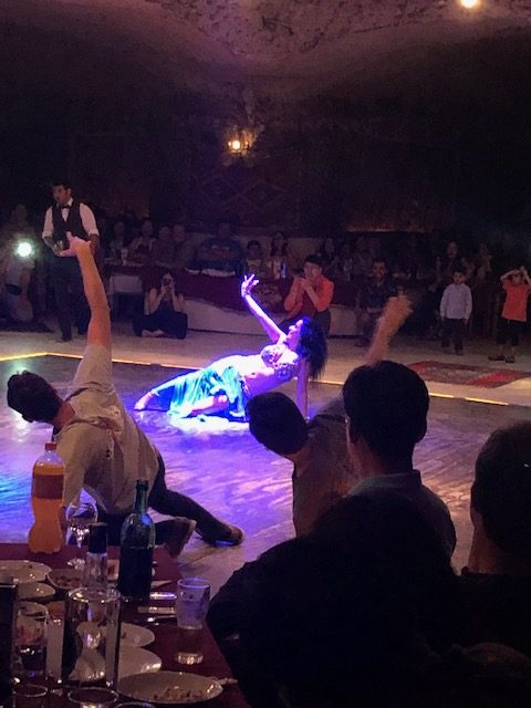
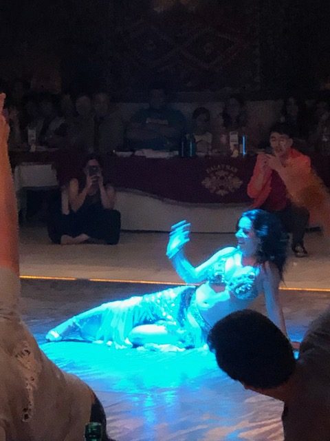
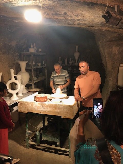
One last amusing moment during this leg of my Turkey Tour involved a small language misunderstanding.  After dinner in Pamukkale, I stopped by the garden bar of my hotel for a beer and to watch the entertainment provided by a wedding party.  As I was placing my order for a beer the waiter said “one beer Rockie?”  And I said, Yes and wondered how he knew my name?  He came back and asked for clarification, “Beer, one or two Rockie?” To which I said, I may drink two but let’s bring them one at a time.  Which seemed to confuse him but he spoke very little English and I speak no Turkish.

After a few minutes, he delivered my beer and two shot glasses of a clear liquid spirit (one a single shot the other a double shot).  I looked at the beer, and shots sat before me and asked, “What are these?” to which he replied “Rockie”.  Yes I am Rockie but what are these?  He pointed to the shots and said Rockie.  And I shook my head and pointed at myself and said no I’m Rockie and I didn’t order these shots.

We both figured it out at the same time.  He didn’t know my name he was asking me if I wanted to try Turkey’s signature drink which they call Rocki (not sure of the spelling) and when I nodded that yes I was Rockie he thought I was agreeing to try a shot.  Then when he asked one or two he was referring to a single shot or double of Rocki not beer.  Language can be a little tricky sometimes.  But not to be impolite I downed both the single and double shots.  And learned that Turkish Rocki is actually Greek Ouzzo

Posted in Uncategorized | Tagged , , , , , , , , , , , , , , , , , , , , , , , , , , , , , , , , , , , , , , , , , , , , , , , , , , | Comments Off on Touring Turkey Part 3: Pamukkale/Hierapolis, Konya, and Cappadocia (July 27 – 29)