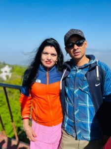
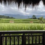
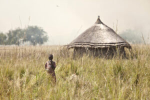
The New Journey Begins -2023

Well once again it is Spring and I have that all too familiar pull to explore and see what’s on the other side of the mountain. To find new places where the grass is greener, trees are taller, mountains higher, rivers wider, food more tasty, people more generous with their smiles, and cultures more interesting. In short – I have that lifelong yearly itch to lace up my old worn boots, pack my bags, and do on a little walk about.

This slideshow requires JavaScript.

This year’s version will take me across two continents and the island paradises just north of Australia. Packing as a minimalist this year was a little challenging considering on the one hand; I will be trekking in the Nepalese Himalaya up to 17,575 feet elevation,

the ungoverned tribal area of Northeast Pakistan’s confluence of the Himalaya, Karakorum, and Hindu Kush Mountains to trek up to Shimshal Pass 15,534 elevation,


Shimshal Valley Pakistan


Mount Kenya


upKenya’s imaginatively named Mount Kenya (Africa’s second highest peak at 17,057 feet) Morocco’s highest peak Mount Toubkal (13,671 feet) in the Atlas Mountains and finally across the spine of Papua New Guinea’s Mountain range crossing the island from south to north.

and all of these little jaunts will involve cold mornings and evenings at altitude and even colder nights in a sleeping bag. Trekking boots, heavy socks, Gaiters, base layer, trekking pants, technical shirts, light weight parka, heavy goose down parka, rain gear, light gloves, heavy ski gloves, baclava, hat, glacier glasses, trekking polls, and sleeping bag all have to be carried in and across all 9 months.

On the other hand I will be exploring Saudi Arabia’s desert offerings of The Edge of the World, Hidden Valley, Maghaer Shauib, Bajdah Desert, Al Nafud Desert in June and Tunisia and Morocco’s scorching hot Sahara Desert in July traversing sun baked sand dunes on foot, camel, ATV, and Dune Buggy will require much lighter weight clothing but still long sleeves, long pants, hat and scarf for protection from the sun and wind blown sand.

This slideshow requires JavaScript.

And if I had a third hand, on this hand, soaking up the sun in the tropical paradises of the Philippines Boracay, Coron, and Siquijor, the Seychelles, Borneo, Papua New Guinea, and Thailand. And since there are no clothing optional beaches I will still have to bring along a pair of swim trunks, tee shirt, sandals and Panama Hat.

And of course on the forth hand, dressing for experiencing the Cherry Blossoms of Spring, palaces and temples in Japan and South Korea, the nightlife of Katmandu, New Delhi, Kolkata, Islamabad, Riyadh, Bangkok, Nairobi, Tunis, Casablanca Dakar, Accra, Addis Abba, Khartoum and Mania requires a pair of Merrell Walking Shoes for day time touring and a nicer dress loafer for evening activities, more appropriate shirt and pants for nice restaurants and night clubs .

So you see my dilemma. How do you dress for extreme cold, extreme heat, beach, city tours, nightlife, visiting holy places and just generally trying to stay comfortable with only one carry on? Clearly three pairs of pants, 3 shirts, swim trunks/shorts, trekking boots and sandals just wouldn’t cut it.

So this trip – between trekking/mountaineering gear, desert appropriate attire, city site seeing clothes, evening appropriate attire and of course 9 months of medicines for a broken down old diabetic with high cloistral and an enlarged prostrate I ended up with my large duffel of outdoor gear and medicines weighing in at 63 pounds, my carry on weighing in at 30 pounds, and my backpack/computer bag of electronics (laptop, two phones, two power banks, go pro, WIFI Hotspot, personal speaker, one bag of adaptors, charging cords and accessories as well as a month’s worth of medicines in case my checked bag gets lost weighing in at 20 pounds.  

113 pounds of gear to drag in and out of airports, ferry ports, train stations, taxis, tuk tuks,and ric-shaws, in and out of hotels, guest houses, tea houses, Berber Tents …. Well you get the picture – a recipe for disaster daily. Fortunately I devised a system of move and drop that will allow me to leave most of my gear in central locations and come back for it as I make my next big move.


I will leave all but one bag weighing about 20 pounds in a hotel in Cebu City for the month I am touring around the Philippines. I will leave everything except my trekking essentials in hotel storage in Katmandu while I drag my old bones up to Lake Goyka and back. I will leave all but a small bag in hotel storage in New Delhi while I explore the source of the Ganges, the birthplace of the Hindu and Buddhist religions, the former British Hill Stations of northeast India and old Calcutta. I will leave all but my trekking gear in hotel storage in Islamabad while I trek to Shimshal Pass and back. Leave most of my gear in Riyadh as I travel around Saudi Arabia. And leave anything not needed for Mount Kenya in hotel storage in Nairobi and then again anything I won’t need crossing north Africa and west Africa in Nairobi to be picked up on my way back east through Asia. Hopefully this system will save a bunch of money on overweight baggage fees as well as wear and tear on my old body lugging it all around.

I’m excited to see my daughter and grandsons in Japan, old friends in the Philippines, Nepal, Pakistan, Kenya, and Tunisia and to make new friends in every place I visit. I have found that travel not only educates the traveler but broadens the mind, opens the eyes to new ways of seeing things and opens the heart and allows a person to appreciate other cultures and ways of life.

Lol, when I was young and stupid, I was convinced that America could do no wrong. That if the rest of the world would just conform to our way of life and governance the world would be a better place. But through my travels I have learned that America is far from perfect and we have done our share as a nation and people to create hardship and suffering for others around the world. I still see America as Reagan’s Shinning City on a Hill but also see for all the good we have done over the last century we have also created chaos and strife pursuing our national interests.

Overall I believe we have been a force for good but must accept our failures and over reaches. And I have come to realize that our way is not the right way for all cultures and all peoples. Christianity need not be forced upon people who have worshiped their deities and have their own moral compass based upon practices far older than the birth of Christ.

As an elderly Buddhist Lama and head of an ancient Monastery on the Tibet Plateau told me over a decade ago “a man’s religion does not matter. Christian, Catholic, Protestant, Islam, Hindu, Seik, Buddhist or Zoroastrian – only one concept matters. One word – Kindness! Kindness to your fellow man, kindness to animals, kindness to insects and even kindness to plants. Live a life of kindness and what you call yourself or what deity you believe in is irrelevant.

And I have learned democracy is not the perfect fit for every culture or every society. I have seen many failed democratic experiments in Africa and Asia where either the politicians are too corrupt or the people lack the education and information infrastructure to provide free, enlightened, and fair elections. Perhaps over time as countries develop a national education system and a large middle class functional democracies can grow but not in the interim in many of these nations kings, dictators, Generals and faux democracies will continue.

Well enough of my preaching and pontificating! As I sit comfortably in business class on

This slideshow requires JavaScript.

this long eleven hour flight from Los Angeles to Tokyo obviously I only have a couple of uninteresting photos from airports and the plane to share. So since I have been lazy and have not written blogs on my travels from July through October of last year I thought I would share some of my favorite photos from Africa last year.

Last year I saw the good, the bad and the ugly of Africa as well as the beautiful, exotic, and strange. I loved Madagascar, Mauritius, Seychelles, Cape Town, Nelspruit, Krueger National Park, Maputo, and South Sudan. Johannesburg, Lesotho, Congo, and Malawi not so much.

Madagascar
The highlights of Madagascar included seeing the famous Avenue of the Balboa Trees, the Tsingy National Park, trekking over the mountains to visit a remote village and being honored with an evening of drinking moonshine rum with the 80+ chief and learning about their interesting religion of worshiping their ancestors’ spirits and not a deity and culture, and way of self-sustained life.

This slideshow requires JavaScript.

The low lights included the shit hole capital city, tourism infrastructure, rough travel conditions.

Mauritius
Highlights included beautiful beaches with unspoiled pristine waters, magnificent waterfalls up in the mountains, incredible seafood, interesting nature, a bizarre but very interesting Hindu pilgrimage.

This slideshow requires JavaScript.

Lowlights included a mediocre tea plantation tour and tea tasting and the worst haircut in 70 years lol.

Cape Town
I loved everything about this city except for my lazy 350 pound tour guide that mostly wanted to eat not only everything he could think to order but also everything on my plate that I did not finish lol. And of course getting my IPhone stolen and losing all of my photos of Robbins Island (Nelson Mandela’s prison home for decades) and my first visit to Table Mountain my cable car.

Loved a very nice lunch and wine tasting at a Costantia Vineyard, returning to Table Mountain and hiking to the summit instead of taking the cable car for fat lazy tourists, whale watching in Hermanus, visiting the Cape of Good Hope and hiking to the old Cape Hope Light house, visiting Cape Agulhas where the Indian and Atlantic Oceans meet.

This slideshow requires JavaScript.

Nelspruit
I enjoyed seeing my dear friend Sharita Patel again and meeting her fantastic husband Pranay and two beautiful daughters, attending a Conch Cleansing and Gong Bath with Sharita, sharing a bottle of wine and an afternoon matinee showing of Humphry Bogart’s Classic Casablanca with Sharita, a day safari with Sharita and Pranay to Krueger National Park, and an incredible day exploring Blyde River Canyon with guide Andrew.

This slideshow requires JavaScript.

South Sudan
This new country was a very pleasant surprise. I had not expected much here but had several of my very favorite experiences here visiting with several remote tribes and seeing how they live day in and day out pretty much apart from the modern world. They still live in small mud, dung and stick huts with dirt floors sleeping on the hard ground and cooking from a small fire pit using scavenged wood,

They have very little in the way of modern possessions but seem totally happy with their simple lives dealing with feast or famine as the weather dictates.

This slideshow requires JavaScript.

I’m looking forward to many more highlights and bracing myself for hopefully fewer lowlights. Regardless you are invited along for the ride. Stay tuned for next report from Japan/South Korea along the Cherry Blossom Express with Fen and Parker my dinosaur wanta be grandsons …

Posted in Uncategorized | 1 Comment

Namaste – Nepal 2022 – The Annapurna circuit Trek Part II

Day 6:  Siri Kharka (13,200 elevation) to Tilicho Base Camp (13,361 elevation) 6 Kilometers

Day 6 was a very short day trekking and again we were blessed with good weather and a beautiful blue sky day. Though the trek was short we had to stay alert for falling rocks and potential landslides. Our views along the route were spectacular with glimpses of Tilicho Peak, countless unnamed snowcapped peaks and interesting rock formations.

Though the official elevation gain was only 288 feet we easily had to climb over 1,000 feet in the ups and downs of the trail. The trail this day was one of my least favorite. Most of the day we were walking on scree (small loose rocks) that shifts beneath your feet. Going uphill you slide back six inches for every 24 inch step and going downhill you have to constantly be on guard for the scree shifting beneath your foot and sending you on you backside or worse off the side of a 1000 foot drop.

This slideshow requires JavaScript.

The route crossed several large landside zones which required vigilance both looking for falling rocks and foot placement on the narrow scree paths. Interestingly, I crossed paths with three lunatic mountain bikers. I watched mouth agape as they carried their heavy bikes up one steep section only to then hop on and ride down a steep section no wider than three feet over scree and slide the back wheel around a hairpin turn over a 1000 foot drop.

This slideshow requires JavaScript.

Eventually we arrived at Base Camp and upon reaching the guesthouse I ordered a big

This slideshow requires JavaScript.

plate of fried potatoes and onions and an order of steamed vegetable MoMos. The MoMos were surprisingly good! After dinner I decided to try a drink I had seen all along the trail – Seabuck Thorn Juice. It tastes a little like apricot but was so concentrated it was too strong for my taste.

Day 7: Tilicho Base Camp (13,361 elevation) to Tilicho Lake (16,400) elevation then back down through Base Camp to Siri Kharka a 20 mile day.

This would turn out to be the toughest but most interesting and rewarding day of the entire trek. My morning began with a 3am alarm and 3:30am breakfast of tomato soup and black tea. By 4am we were beginning our 20 mile trek to Tilicho Lake and back down to Siri Kharka in the dark by headlamp.  The morning was cold and I began the trek in my heavy down parka, knit hat, and my leather spring ski gloves.

But I run hot so within 30 minutes I had stripped down to a t shirt, no hat and no gloves. Lol everyone else on the trail stayed bundled up. The trek was demanding in that it required traveling 4.5 miles straight up without flat areas for 2,464 vertical feet. But with sunrise I got my first hint that the pain would be worth it.

This slideshow requires JavaScript.

The rising sun burst upon the white peaks creating a brilliant alpine glow of pinks, golds and reds reflecting off not only the white peaks but also through the hanging clouds. We marched on as the sun continued its climb until we reached a massive hanging valley sandwiched between massive mastiffs on all sides.

As we traversed across the valley there were several small and unimpressive lakes and I fleetingly wondered if Tilicho Lake would live up to its hype. After a mile of trudging the length of the valley and dodging unmelted snow drifts we finally crested a small ridge and I had my answer.

Tilicho not only matched the hype it surpassed it in spades. This lake sits at 16,400 feet above sea level and is the highest lake on earth. It is huge and so blue it is beyond words. Fortunately I took plenty of photos and video and I will let my camera speak for my loss of words.

This slideshow requires JavaScript.

The lake is surrounded by a combination of beautiful white covered mountains on one side and stark brown and gray on the others. The dramatic contrast of stark whites and browns and grays surrounding the lake only adds to the shocking blue of the lake.

Upon arriving we joined other trekkers just sitting and enjoying the view as we ate a breakfast of boiled eggs, Chapati and an ice cold sprite. After breakfast we spent another hour taking photos and video, and offering a quick prayer to both Buddha and Shiva thanking them for allowing me this phenomenal experience and asking for them to deliver me safely back down the mountain.

Raju suggested that we should consummate the experience with a traditional Nepalese Dance Circle. He found what he claimed was the perfect Nepalese song and briefly demonstrated how people in Nepal dance in this circle. Lol the young ladies from Spain and Germany picked it up pretty quick. Claus (German) and me – not so much! And of course all the locals were very proficient with the dance.

But I figured if I could look like a fool dancing with forest pigmies, why not make an ass of myself with the backdrop of the world’s highest and maybe most beautiful mountain lake? As we danced I could hear several avalanches high up on the mountains and briefly wondered if I was amusing the mountain Gods and the avalanches were belly laughs brought on by my pathetic attempt at an ethnic dance. My dance style has been described by friends in the past as looking like a zombie being electrocuted.

After our impromptu 16,400 foot dance off it was time to pack up and begin the long descent first to the Tilicho High Camp for lunch and to pick up our gear. Then to continue on to Siri Kharka. In all we would trek over 20 miles this day and arrive in Siri Kharka foot sore, muscles screaming and cramping, sunburned, eyes aching from the bright sun but with smiles plastered on our faces and a warmth filling our hearts that only sharing such an incredible experience can bring.

Day 8: Siri Kharka (13,200 elevation) to Leder (13,600 elevation) 10 miles

Today would be a short day only 10 miles and no long pulls up hill. Instead today would mostly be devoted to following the contours of the mountain traversing high above the valley floor below and the villages we trekked through on our way up to Lake Tilicho. Far below us we could see the Tibetan settlement of Khangsar, then Manang, Barge and Geru.

This slideshow requires JavaScript.

We had one scary moment along this portion of the trek. The two girls that had been walking with us for days pulled about 5 minutes ahead of us. And as we rounded a bend in the trail we could see basketball sized boulders raining down on them from above. Raju immediately assessed the situation and began frantically whistling as loud as he could while waving his arms like a madman.

It took me a moment to realize the boulders were not falling naturally but were being thrown down the mountain from above by careless workmen building a new trail 500 meters higher up the slope. I say careless because no one in the 20 person work crew was watching the trail below to see the two girls and the three of us.

While Raju was trying to get the workers attention Taron and I were gesturing for the girls to run back to us and safety for their lives. Had one of those boulders hit anyone the force of the weight and gravity would kill instantly if making contact with the head or the momentum of the projectile would have knocked a person off their feet and to their death a thousand feet below.

Once Raju got their attention the crew took a break while we cautiously crossed the scree field then waited for a French couple about 15 minutes behind us to cross before he gave the crew the all clear signal to resume boulder bowling.

Eventually our ridgeline ended as another tributary emptied into the larger river valley forcing us to turn up this watercourse and descend down to the valley floor to Thorongia Khola and cross another suspension bridge to reach the far side of the valley. After a cup of tea at a river side tea house it was back on the trail, up the ridge to the trail to Yak Kharka.

This slideshow requires JavaScript.

Once on this trail we followed it for several miles before reaching Yak Kharka and lunch. Yak Kharka was packed with Nepalese in search of a medicinal root that only grows at a certain high elevation that is used in Chinese medicine that sells for ridiculous rupees per kilo. After lunch we once again shrugged into our packs to make the final 45 minute sprint to Leder and a welcome night’s rest.

This slideshow requires JavaScript.

Day 9:  Leder (13,600 elevation) to High Camp (16,010 elevation) 6 kilometers

This slideshow requires JavaScript.

This day would take us from 13,320 feet to 16,010 feet at High Camp. 2,700 grueling feet straight up without a break. Though a very challenging day we were rewarded with beautiful views of Mt. Syagang, Mt. Gudang, Mt Thorang and Thorang Phedi. Once at High Camp I caught my first sighting of the elusive Blue Sheep grazing just above the guesthouse.

This slideshow requires JavaScript.

This would be a short night because we would have to be up at 3am and on the trail by headlamp by 3:30am. So an early dinner of Dal Bhat (rice, lentil soup, vegetable curry) and chapati it was off to bed for a few hours rest.


Day 10:  High Camp (16,010 elevation) to Thorangla Pass (17,769 elevation) then down to Muktinath (12,188 elevation) and over 20 long grueling miles

This day would take us from 16,000 feet above sea level to the Pass at 17,769 feet before dropping down to Muktinath at 12,188 feet all in just over 20 long miles. Who knew the trek up to the pass would be the easy part of the day. We trudged most of the way to the pass in the dark arriving at the highpoint just after sunrise.

This slideshow requires JavaScript.

We stayed at the pass just long enough for photos and to eat a quick Snickers Bar and Oreos then began the long painful descent down to Muktinath. By this time my toenails were all black and bloody from pressing against the fronts of my boots, my knees were screaming from the constant battle with gravity and loose scree, my stomach was growling and howling from lack of food and my muscles were threatening to go on strike from lack of replacement calories in nearly 24 hours.

This slideshow requires JavaScript.

On and on we trudged mile after mile. We could see Muktinath far below. It looked so near but never seemed to get any closer. I sort of felt like the thirsty hallucinating French Legionnaire crawling through the sands of a desert seeing mirage after mirage of cool oasis and beautiful naked dancing girls. Except my mirage was a tea house with an ice cold drink and piping hot meal or a nice warm cot to rest my aching old bones.

Eventually we made it to a tea house about an hour and half from Mukinath and I enjoyed a nice hot meal and cold sprite to drink. After a long rest we limped on the final hour and half into Muktinath and made a brief stop at a famed joint Buddhist and Hindi Temple complex.

I was honestly disappointed in the twin temples. We could not enter the Buddhist Temple because of a local ceremony in progress and the Hindu side was littered with trash, empty plastic bottles and animal droppings. There was a small pool which is purported to contain special holy water the faithful were waiting their turn to totally submerge themselves under the waters to be healed of whatever ails them.

There was also a series of 87 spigots pouring ice cold mountain spring water from a stone wall into a trough at a height of about five feet. The spigots were each about two feet apart. The faithful would run the length of the rectangular shaped stone wall stopping briefly under each spigot to let the freezing water run over their heads and down their body before running to the next 86.


Again this ritual is supposed to cleanse their souls and bring good luck. My guess is the only thing it brings is at best a bad cold and at worst a case of pneumonia. So after a few minutes of watching the faithful run the spigot gauntlet I headed on down to my guesthouse for the night.

Day 11:  Muktinath to Tatopani by Jeep

We loaded our packs into a jeep and rode to Tatopani. The six hour drive took us through lush forests, one of the deepest gorges in the world, and a small village famous for their apple orchards and a local brandy made from apples. Unfortunately apple season doesn’t begin there until October so I could not taste the much ballyhooed apples but I did buy a bottle of the apple brandy to send home for sampling at Thanksgiving.

This slideshow requires JavaScript.

Tatopani was billed as a spa town where we could relax and soak in the hot springs. Unfortunately, the Nepalese version of a spa leaves much to be desired. The hot springs spa looked to me like a concrete water trough for horses or cattle with absolutely no ambiance or creature comforts like towels or lounge chairs, or waiters offering wine or beer or snacks – so I passed on the horse trough.

This slideshow requires JavaScript.

The guesthouse also turned out to be the worst one of the entire trip. My unairconditioned room was on the second floor above a courtyard. All night long men sat in this courtyard smoking and talking loudly filling my room with second hand tobacco smoke and noise until after midnight. And worst of all I woke up the next morning with nasty insect bites on my left hip and thigh and no hot water for a shower or shave.

Day 12:  Tatopani to Pokhara by Jeep

I climbed back into a jeep unshowered, unshaved, clothes smelling like tobacco, and itching from the bedbug bites for the five hour drive to Pokhara. The drive to Pokahara was long, hot and dusty but offered spectacular views of the Annapurna Range and beautiful raging rivers tumbling down narrow rugged gorges.

This slideshow requires JavaScript.

Day 13 and 14 I spent relaxing and recuperating from the trek in a nice but somewhat isolated resort hotel. The hotel was very nice but since it was a little out of the way I did not get a chance to see the city which is supposed to be the most beautiful in Nepal. But I did get all my laundry done and much of this and my Thai blogs written.

Day 15 I flew back to Katmandu, checked back into the A Loft Hotel and retrieved my stored bags. I spent two final days in Katmandu relaxing, preparing paperwork to enter India and getting another PCR test. I did enjoy a very pleasant dinner with my friend Pohara and his lovely wife Ruby. It was great seeing him again and meeting Ruby. Hopefully I will get to return the favor and host them in Colorado next winter.

Next stop New Delhi…


Posted in Uncategorized | Comments Off on Namaste – Nepal 2022 – The Annapurna circuit Trek Part II

Namaste – Nepal 2022 – The Annapurna Circuit Trek Part 1

Arrival in Katmandu

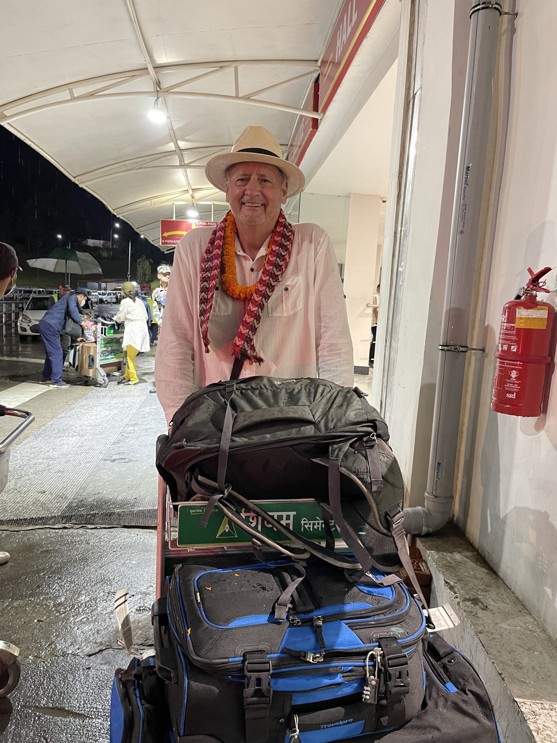
By the time I had deplaned, passed through COVID protocols, immigration, baggage claim, customs, and hit the ATM I found by good friend and guide from my 2019 Everest Base Camp Trek waiting patiently for me as I exited the airport. Karan Gurung’s beaming face and broad grin greeted me with the traditional Namaste, and presented me with a yellow flower garland necklace, a beautiful scarf and matching Nepalese hat. A little self conscience, I allowed the garland necklace and scarf to be placed around my neck but since it was raining a little and I was already wearing my trusty Panama I stuffed the Nepalese hat in my pocket and off we went.

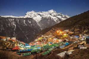
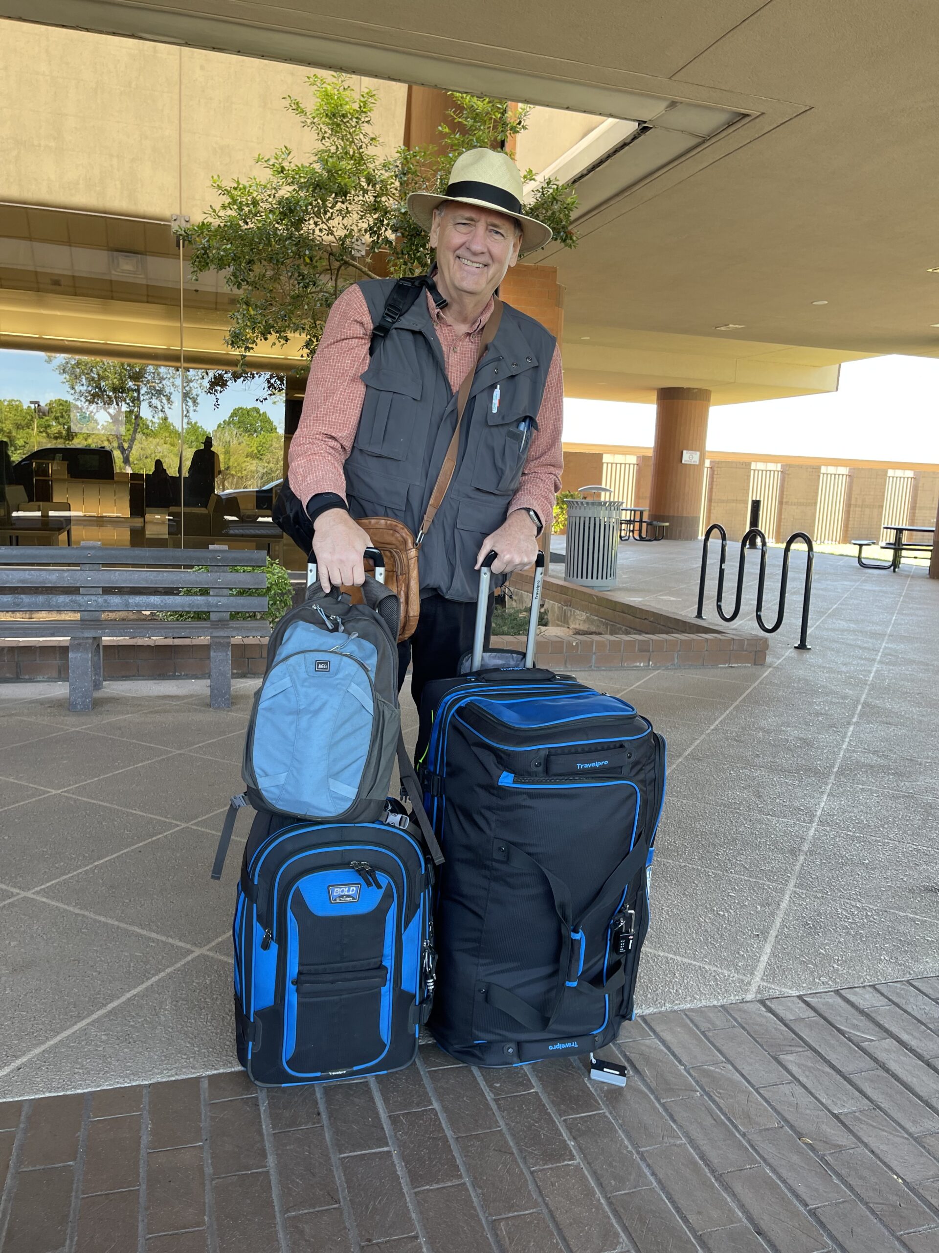
After fighting our way through the choked streets of Katmandu we finally arrived at the Marriott A Loft Hotel in the Thamel District. Karan and his brother Raju joined me in my suite for a quick review of the details of the Annapurna Circuit Trek and a gear check. The trek would last 13 days and cover over 230 kilometers reaching altitudes of over 5400 meters. Turned out there were a few items I had brought that I would not need and I failed to bring dry bags and a warm knit hat. Both items I could easily pick up within a few blocks of my hotel.

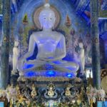
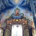
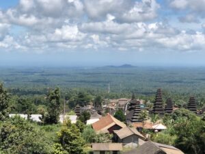
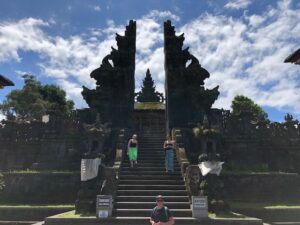
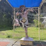
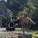
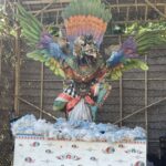
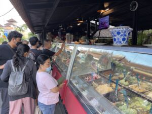
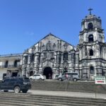
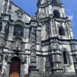
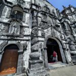
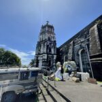
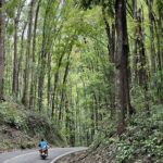
I spent the next two days wandering through the Thamel District’s narrow streets, lanes and alleys exploring and taking in all the sites, sounds and aromas of the bustling old town. Day or night the Thamel District of Katmandu is like a scene out of an Indiana Jones movie. The narrow streets are crowded in on both sides by a jumbled mixture of ancient and last century unmaintained 3 and 5 story buildings seeming to lean into the teeming street traffic. Overhead are Buddhist prayer flags criss crossing the street and a rats nest of hundreds of electrical wires snaking along above the crowds connecting in mass at various weathered poles with no apparent rhyme or reason. And on nearly every corner there is either a Buddhist or Hindu Shrine

This slideshow requires JavaScript.

Walking the streets is like finding your way through a mine field. the narrow passages are choked full of fellow foreign wanderers, local shoppers, shop keepers hawking their wares, street pitchmen offering drugs, currency exchange, the best happy ending massage parlors in Nepal, or escort services. And if all the human mass of people weren’t enough to contend with you also have to share the space with Rickshaws, bicycles, Push Carts, Tuk Tuks, taxis, motorcycles, buses, lorries, and horse carts.

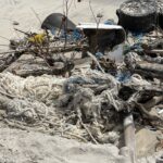
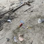
The narrow sidewalks are jammed up with merchandise from the shops so you are forced to walk in the street and dodge all the traffic as well as all sorts of detritus on the street itself. And if all the sensory overload to your eyes were not enough the sounds and smells are just as intense. Street pimps and drug dealers assault you every few steps, store proprietors shout their best offers, cafe and bar girls push menus at you as you pass each new cafe or juke joint, music is in the air from every corner of the world, and the constant blare of car, truck, motorcycle horns, rickshaw and bicycle bells and the constant background murmur of thousands of voices droning in different unrecognizable languages all combine to assault you with a discordant symphony as you make your way across the district.

And the smells: fresh spices – saffron, cumin, turmeric, ginger, garlic, chilies, thyme, cloves, coriander, cinnamon, sandalwood, and mustard seed – fresh baked breads and pastries, newly brewed strong coffee and teas, both the raw earthy smells of fresh butchered flesh and grilled meats – over ripe fruits – tobacco both smoked and yet to be smoked, the sweet fog of incense offered to an assortment of Hindu and Buddhist Gods, auto exhaust, the stale sweat of laborers, the foul odor of the unwashed, drying urine and feces – it all combines into a complex and unique olfactory experience. In short – a walk through the Thamel district is a full all out assault on all your five senses.

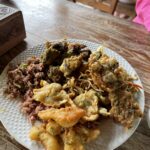
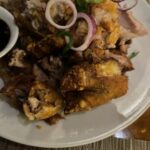
I quickly found and purchased my dry bags and loaded up on trail foods. At least my special mix of trail foods (Oreos, Snickers bars, Twix bars, Kit Kat Bars, Mentos, Raisons, Peanuts and Skittles). Yea, I know kind of a weird mix of trail food for a 70 year old diabetic lol. But I learned from my 2019 trek to the Everest Base Camp that the Tea and Guest House food is extremely limited in scope and boring to the taste buds. After a few days of rice, potatoes, lentils, noodles, yak meat, chicken, and flat bread you crave flavor. So I opt for sweets over nuts, seeds, and tree bark!

Day 1:  Five hour drive on paved roads to Besisharhar then two hour Jeep ride to Dharapani

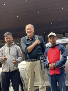
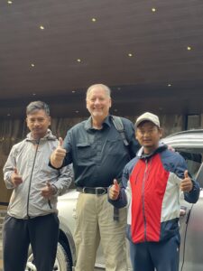
So with all the supplies purchased, and my trekking gear stowed in a waterproof NorthFace haul bag or my day pack we were ready to kick off this year’s trek.

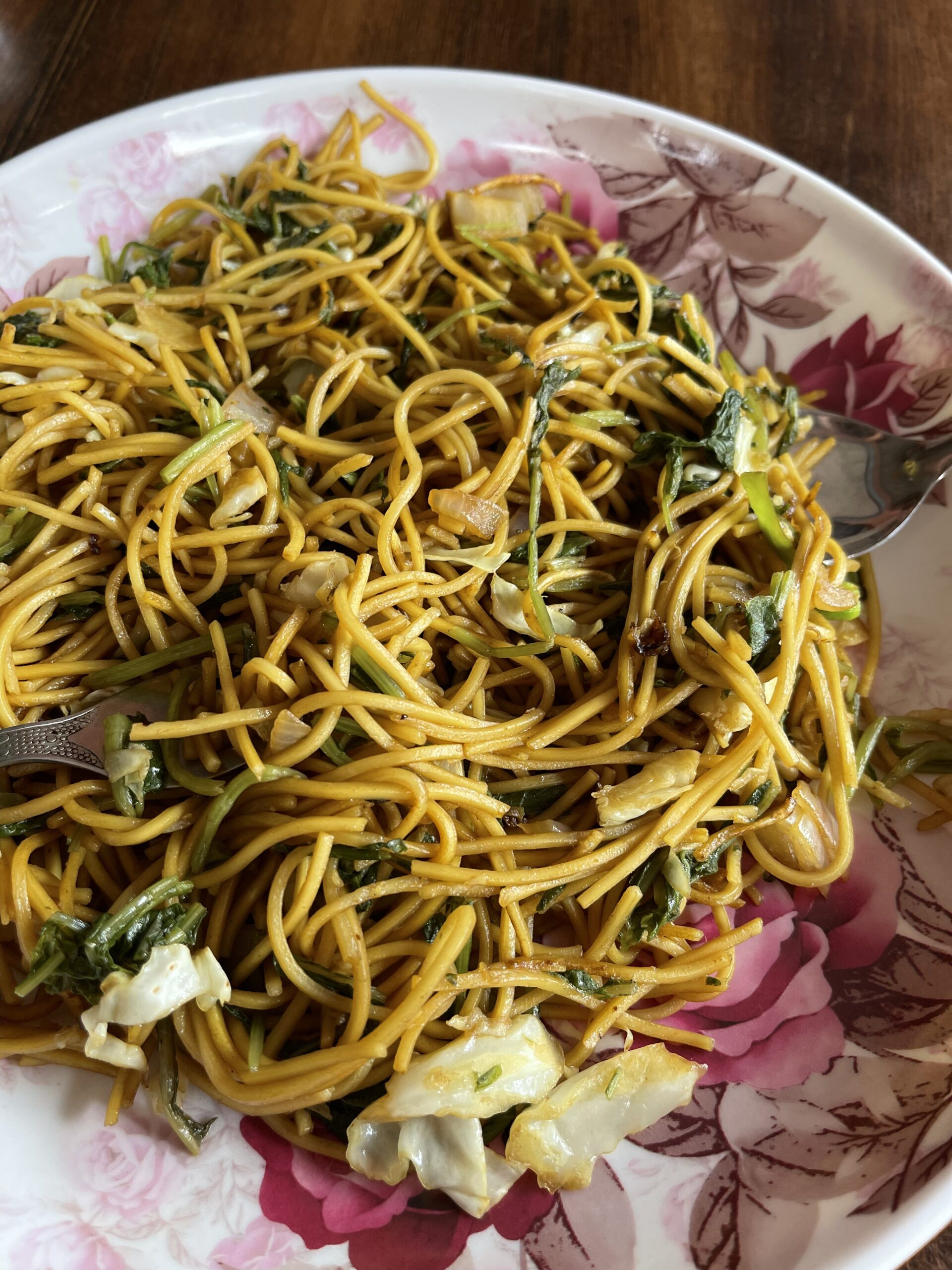
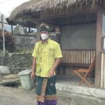
First we drove for five hours to the town of Besishahar.  The ride was hot, dusty and boring but we arrived in one piece.  This would be the end of the paved road and from here we took a two hour jeep ride to the trail head.  While Raju and his younger brother (our porter) found a jeep I ordered a plate of vegetable noodles for lunch.

The nice lady thought she was doing me a favor by loading the noodles up with little one inch green chilies but instead she nearly burnt my tongue, gums, lips, tonsils, esophagus, and stomach to cinders with those little radioactive chilies.  I drank everything she had in her little shop trying to put out the fire.  The poor lady cook and waitress couldn’t decide whether to be distressed or amused by my discomfort and extremely blue language.  One minute they were rushing around filling glasses with the closest liquid at hand and whispering franticly and the next laughing uproariously at the big old gentle foreigner that had transformed from a pasty white face grandfatherly type to beet red fire breathing spitting and cussing dragon.

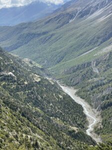
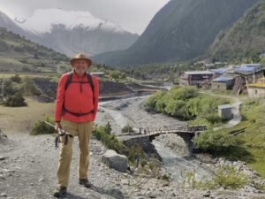
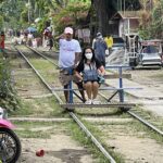
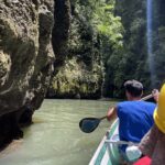
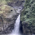
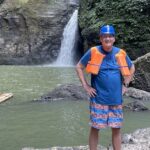
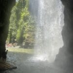
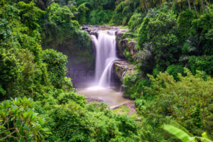
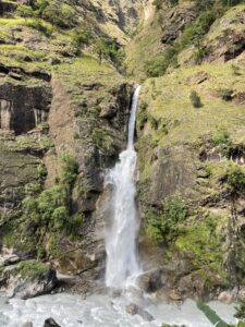
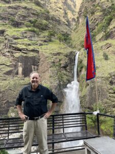
In time I survived the chili eruption and settled into the jeep for what was supposed to be a two hour ride to Jagat.  Raju however had found us a jeep going on to Dharapani so we drove for four hours over a narrow yak track barely wide enough for one SUV with a granite mountain on one side and a thousand feet of air on the other side.  The road carved from the side of the rock face followed the river gorge up the valley as we made our way up rocking, rolling, bouncing and shuttering up one steep grade and down the next following the river valley up stream.  Occasionally we would meet another SUV, bus or large cargo truck coming the other way and have to back up until we could find a place wide enough for both vehicles to pass with at least part of the four wheels on solid ground.  The most interesting part of the jeep ride was a brief stop at the Boong Waterfall for a photo op.  then back into the jeep for more ass pounding, spleen splitting, hair raising miles to reach Dharapani.
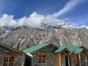
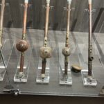
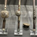
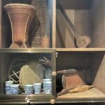
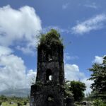
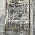
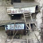
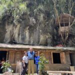
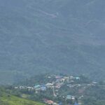
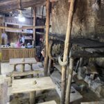
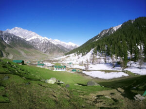
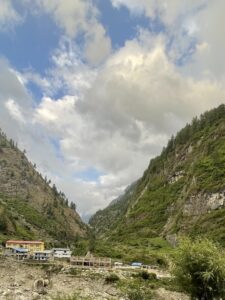
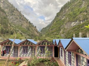
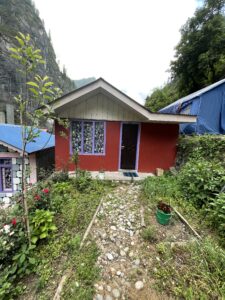
Upon arriving in Dharapani we unloaded the jeep and checked into the guesthouse where I was given their version of the Presidential Suite.  My Suite was special because it had its own in-suite bathroom (squat toilet) instead of an outhouse.  The room was simple wood construction with two twin size home made beds built with 2*4s and plywood with a 4 inch sleeping pad and heavy quilts for warmth.  As I was shaking and spreading the folded quilt out the biggest cock roach I have ever seen fell to the floor.  This guy must have been at least 5 inches long.

As I reached for my boot to do battle it occurred to me I was in Nepal – a Buddhist country.  This big ass roach could be my hosts dead parent or long lost ancestor.  So I put down the shoe, called a truce and offered him the bed near the door and I took the one nearest the bathroom.

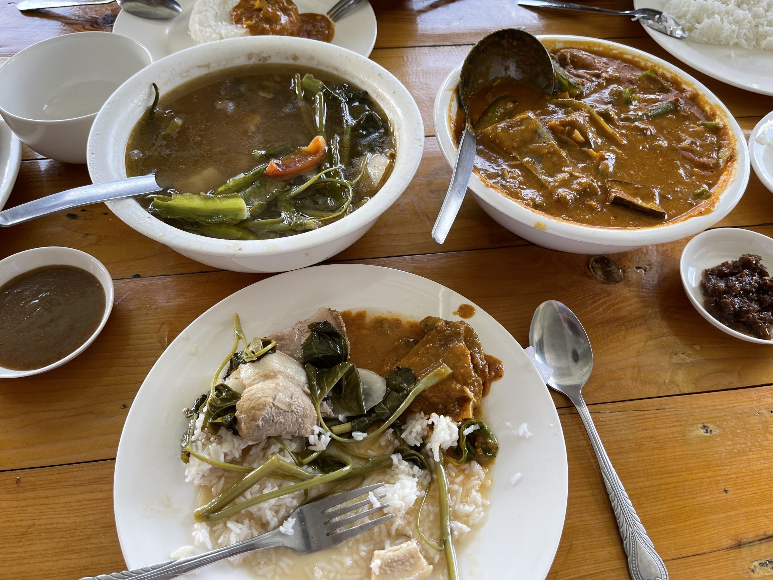
Dinner consisted of a bowl of unrecognizable vegetable soup, a mixture of scrambled eggs, potatoes and boiled greens, sliced bananas and tea.  I passed on the soup, choked down about a third of the eggs and potato, enjoyed the bananas and tea then ate my first Snickers Bar in my room.  And the truce with the monster roach held through the night.  Next morning I had a quick omelette, Roti (Nepalese Flat Bread), honey and tea then we were off for our first day 7 hour trek.

Day 2:  Dharapani (1900 meters to Chame (2610 meters) 2329 feet of theoretical elevation gain

I say theoretical because when you are trekking you rarely go straight up or straight down.

This slideshow requires JavaScript.

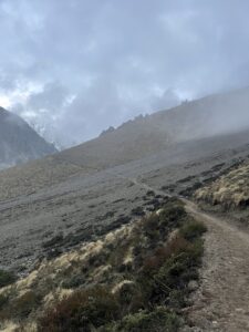
The trail follows the contours of the mountains and fall line of the river so you may gain 500 feet of elevation just to give up 300 feet before climbing the lost 200 plus more.  And this up and down goes on all day and end the end instead of a 2,329 foot elevation day it could have been 6,000 feet of up and down over 10 kilometers.

Today’s trail took us through fir, oak, maple forests and mountain sides covered in

This slideshow requires JavaScript.

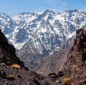
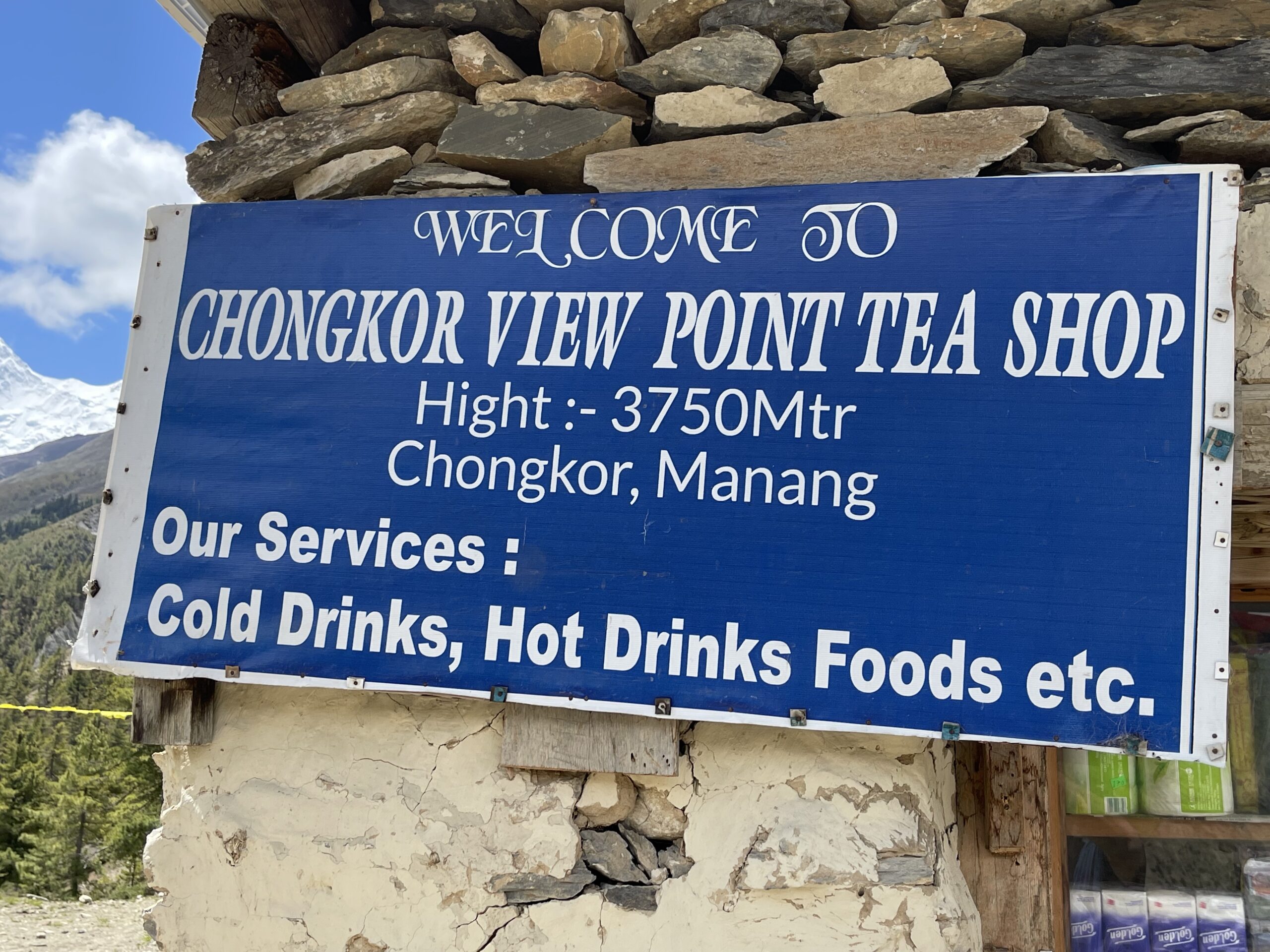
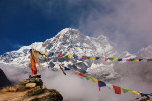
Rhododendron.  Above us we had spectacular views of Mount Manaslu, and Annapurna II while spread out in the valley around us farmsteads of barley, potatoes, cabbages and chilies.

This slideshow requires JavaScript.

We passed through the small settlements of Timang and Thanchawk before spending our final hour of the trek in a pouring rain.  We were supposed to visit a local natural hot springs in Chame but arriving tired, wet and cold I opted for stripping everything off and jumping into my mummy bag for a quick warm nap before choking down a dinner of fried rice and vegetables followed by a plate of sliced apples and bananas and a Twix bar.

This slideshow requires JavaScript.

Day 3:  Chame (2610 meters) to Pisang (3250 meters) 1969 feet of elevation gain and 15 kilometers of trekking

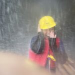
We woke this day to a driving cold rain.  After another boring breakfast we put our rain covers over our packs and our rain gear over us and headed out into the cold wet morning.  Traveling through foreign lands you see some amusing and confusing things – leaving the village I spotted a cafe that advertised free STDs.   Somehow I doubt that helped attract many trekkers.

This slideshow requires JavaScript.

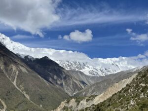
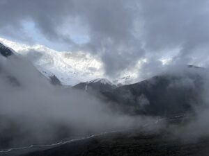
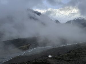
Today we were supposed to be treated to spectacular views of Annapurna II, Pisang peak, and Pungda Dada Rock.  Unfortunately all we could see above us was a solid gray layer of dark cloud about 300 feet above the valley floor.  But the route took us through deep gorges, along a pristine raging river, cascading waterfalls, and lush green pastures and gardens.

A couple of hours into our trek today we stopped at a large apple orchard outside the village of Bhratang where we ate apple fritters and donuts with piping hot tea as we warmed ourselves and dried out around a hot pot belly stove.

This slideshow requires JavaScript.

One interesting observation I made as I trudged along mile after mile in the rain was how the weather really didn’t seem to effect the lives of the locals.  They went about their business of either working with stone, working their fields or tending their herds oblivious to the rain and cold.

The life of the people of these remote villages goes on pretty much the way it has for

This slideshow requires JavaScript.

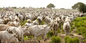
countless centuries.  Their lives are dictated by the seasons and the elements (rock, water, wind and weather).  Rain or shine, warm or cold you see people working with stone.  Breaking large stone into smaller stones, shaping stones, transporting shaped stone, stacking stone, building fences, homes, pens, roads, and paths of stone.  Or tending the fields based on the growing cycle – plowing, planting, hoeing and weeding then harvesting.  Or following their herds of cattle, yaks or goats from summer pastures to winter pastures.  But everyone is working from sun up to sun down 7 days a week 52 weeks each year.

They live in 2022 pretty much the way their grandparents lived in 1922 or their ancestors did in 1422.  The only difference I suppose are now they have cell phones, a few have satellite TV. some have solar electricity and some use propane to cook instead of wood or yak dung but they all live in stone or wooden homes with only one central room heated, eat what they grow or raise and still have to go outside to visit a cold outhouse to answer the call of nature.  The women still have to wash their clothes and dishes by hand in the cold streams and lay the clothes out for the sun to dry them.  They still have to dry or preserve their vegetables and fruits to carry them through the winters and smoke or salt their meats unless they butcher fresh meat for dinner.  But they all seem happy and content living simple lives oblivious to COVID, far away wars, energy crisis, inflation, or arguments over global warming.

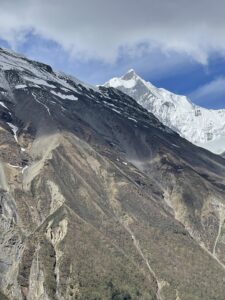
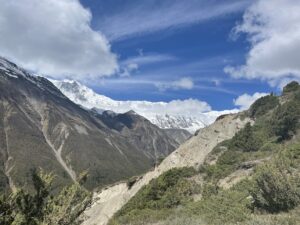
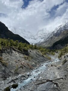
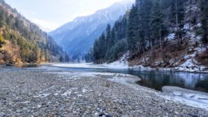
From Bhratang we walked to Dhakur Pokhari following the raging river far below us upstream.  This part of the track is carved right out of the side of the mountain.  Trudging along under leaden crying skies we have a sheer drop of a thousand or more feet of air and unforgiving gravity to our left, a solid weeping wet rock to our right, a sloppy muddy swamp of a road beneath our feet and a massive mountain of solid granite overhead.

This slideshow requires JavaScript.

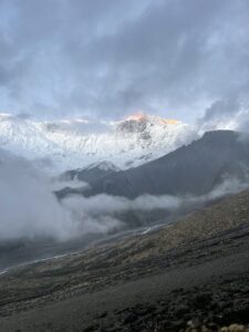
As we walk from beneath the carved road the vista opens before us and we can see the massive and beautiful Swarga Dwari up ahead through the misty clouds and rain.  this massive piece of concaved granite wall is so steep it is barren of any vegetation and looks so smooth that only a god could have created it  with a giant ice cream scoop.  The locals believe this to be a gates of heaven where our soul must climb to reach our next life.

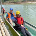
Next we cross a suspension bridge high above the raging waters and begin a steep climb straight up thru dense pine forest until we reach the small settlement of Dhukur Pokhari.

The final stretch of today’s trek took us slightly downhill for about and hour to Pisang.  As we followed the river and neared the village the settlement’s one dog greeting committee braved the rain to come out and greet us and escort us into town.  The little white dog ran back and forth between Raju and I jumping, darting and yapping happily and escorted us into town and right into a guest house that turned out to be where we would spend the night.

But before we could think about sleeping we had to dry out.  And I mean dry everything out.  In spite of  using a pack cover and rain gear the rain managed to penetrate into my pack and my rain jacket and soak everything I was wearing and carrying.  I spent the next four hours sitting by a red hot pot belly stove drying clothes, boots, and gear while drinking tea and munching on snacks.

This slideshow requires JavaScript.

Day 4: Pisang (3250 meters) to Manang (3540 meters) 951 foot elevation and 20 kilometer trek

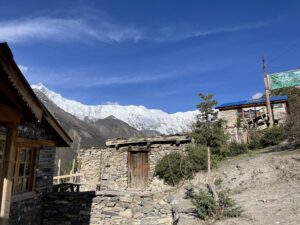
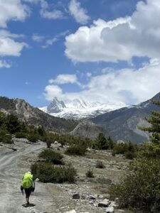
We woke today to mostly blue skies with just a few clouds and enjoyed fantastic views of the majestic snow draped peaks floating high overhead.  Today would be a long day of trekking – 20 kilometers and a charted elevation gain of around 1640 vertical feet.  The trek today would take us through the settlements of Ghyaru, Ngawal, and Braga and took a long 9 hours on the trail.

This slideshow requires JavaScript.

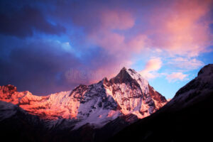
After  a hearty breakfast we set out early leaving Pisang and crossing the bridge over the river on our way out of town.  With the sun’s warm golden rays washing over our upturned faces we had a spectacular view of Annapurna II’s 7937 meter snow capped summit.  This was the best day so far for photographs and we were slowed by our desire to snap photos around each bend in the trail.

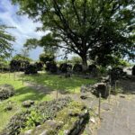
In Ghyaru we passed a large beautiful and well maintained mani wall lined with. ancient mani stone tablets inscribed with Buddhist mantras.  Buddhist custom is that all Mani Walls, prayer wheels, Stupas and Temples must be passed to the left because the Buddhists believe that is the direction (clockwise) the universe spins.

This slideshow requires JavaScript.

I have no interest in converting to Buddhism but I am fascinated by the religion, customs, philosophy, art and icons.  It is interesting to me how the religion is practiced differently in different geographic areas and cultures.  But one thread is consistent rather practiced in Mongolia, Tibet, Nepal, Thailand, or Japan – the followers of the Lord Buddha are devout.  They circle their monasteries and Temples three times clockwise saying their mantras, caressing their payer beads or turning their prayer wheels.  They remove their shoes and prostrate themselves on the cold stone floors before images of Buddha.  They light candles, incense, and butter lamps to beseech the Lord Buddha for  blessings for themselves, family members past and present.  And they practice their faith 24/7 not just on Sundays like many Christians.

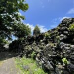
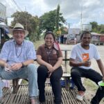
Most of today’s elevation gain was in reaching Ghyaru.  After arriving at this picturesque village surrounded by enormous stone citadels we enjoyed a nice light snack and cup of hot tea.  It was nice just to take off the pack and sit in the warm sun enjoying tea and chatting with fellow trekkers about the trail, their lives back home and past adventures.  One thing interesting about travel and trekking in particular is that you never meet a stranger.

This slideshow requires JavaScript.

People you would walk past without even a nod on any street in America you readily offer a smile, warm greeting and engage in conversation as if you have known them your entire life.  And even language barriers don’t seem to hinder communication.  It is a strange phenomenon I have noticed no matter what corner of the world or width of the. trail.  Fellow travelers share a kindred spirit and seem to bond instantly only to separate after a brief conversation or few days together on a trail never to see each other again except in memories and old photographs.

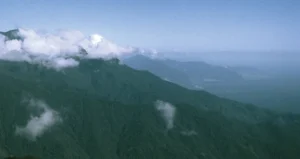
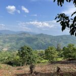
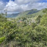
From Ghyaru we traveled to Ngawal.  The beginning of this section is a steep series of switchbacks to complete today’s elevation gain.  But once on top we were treated to a spectacular view of a wide long valley protected on all sides by steep beautiful mountains with their lower flanks covered in lush green forests and tops a sparkling white with granite and quartz occasionally protruding from the snow and ice.

James Hilton imagined a fictional Shangri-La in Lost Horizon but I doubt  he ever dreamed the place could have really existed in this beautiful valley between Ghyaru and Ngawal.  The river, the forested valley floor, the protective surrounding mountains all combine to make this place truly special – A modern day garden of Eden or Lost Horizon’s Shangri-La.

This slideshow requires JavaScript.

The walk from Ghyaru and Ngawal was without a doubt the best two hours of the trek so far.  My words, photos and video simply do not do the scenery justice.  This little slice of heaven on earth has to be seen and felt to be appreciated.  But after 10 kilometers of hiking  and photographing I was ready for lunch and a nice rest off my feet and sans a pack.  I enjoyed a nice tomato based soup with a few vegetables and garlic thrown in for flavoring, Tibetan bread and a Sprite for lunch and food never tasted so good!

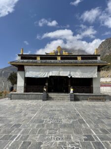
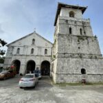
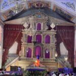
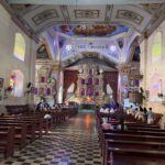
From Ngawal we hiked to the small Monastery Village of  Braga about 8 kilometers.  The Braga Monastery is one of the oldest in the entire region and is beautiful and serine tucked in beneath a towering mountain.  We rested here a bit and took some photos and video.  Manang would be just a short 2 kilometers and 30 minute walk away.

This slideshow requires JavaScript.

Manang is the largest settlement on this side of the pass and offers guesthouses with real beds, western toilets, hot showers, laundry service, edible food, cold beer, and shopping stalls for snacks, souvenirs  and needed trekking supplies.  Our guesthouse for the next two nights was the Four Seasons. lol. And while not as opulent as the better known Four Seasons Chain it was heaven to my tired old bones and filthy dirty and sweat dried hair and body.  After a hot shower, freshly laundered clothes and a hot meal of a bean and rice burrito and a cold beer I felt like a new man.

This slideshow requires JavaScript.


Day 5:  Manang Rest and Acclimatization Day

The one hazard of climbing or trekking at altitude is altitude sickness that can be either just an uncomfortable nuisance or in extreme cases life threatening.  AMS or Acute Mountain Sickness can occur as you climb to a higher elevation too quickly.  The pressure of the air around you or barometric pressure drops when there is less oxygen available.  In truth there is just as much oxygen – the problem is that the oxygen molecules are further apart and less available to you.  Given time your body can adjust to the difference in atmospheric pressure and your body will suffer no symptoms.  If you climb to fast your body can not adapt and this is when you have problems

People normally begin to feel the effects of AMS above 8000 feet.  In its mildest form you just feel like you have a bad hangover after too many Tequila Shots (headache, dizziness, muscle aches and nausea.  More severe cases involve a build up of fluid in the lungs that can be life threatening and need to be treated immediately and not ignored.  This condition is called High-altitude pulmonary edema (HAPE).  The most severe manifestation of altitude sickness is a buildup of fluid in the brain also known as High-altitude cerebral edema (HACE).  This condition requires immediate medical attention and can quickly lead to death.

This slideshow requires JavaScript.

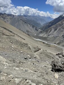
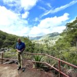
To date we had traveled from 5000 feet to 11,500 feet in just 4 days so we needed to take a day to let our bodies catch up to the altitude gain.  One way to enhance the body’s adjustment is to climb higher on your rest day then return lower to sleep the night and let your body adjust as you rest.  Manang is our designated rest and acclimatization day.  To facilitate the process we climbed a 1000 foot shelf on the far side of the valley.

After a hearty breakfast of scrambled eggs, fried rice, and Tibetan bread we shrugged on our day packs and wove our way through the narrow lanes and passages between rock homes and shops, then made our way down several hundred feet to the valley floor.  It was still early and all across the valley there were farmers plowing fields with oxen, hoeing, planting and watering crops.  Most of the village had long since left their one room rock. homes hoe or spade in hand and made the trek to the valley floor for a day of hard labor in their fields.

This slideshow requires JavaScript.

Watching the villagers as we walked across the valley floor took me back 60 years to my life as a boy on the farm in West Virginia.  My day back then began as theirs – up at 5am to gather the cattle to feed, milk my pet cow Goldie, feed the hogs and chickens, get my own quick breakfast then spend the day driving a team of horses pulling a plow, disk, planter, mowing machine, rake or sled or planting, hoeing, stacking hay or harvesting crops.  Back then I could have never dreamed my life would turn out as it did.  Lol I didn’t even know their was such a place as Nepal.

As we approached the far side of the valley our objective for the day loomed high above us. Basically we would climb up 1000 uninterrupted feet of elevation to a large shelf of pastures and forests that followed the mountain all the way down the valley sitting high above the valley but far below the towering mountain ridge above.

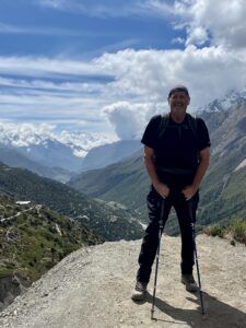
I decided this unforgiving stretch of trail would be a good test to see if my body had been trying to tell me it is time I gave up my outdoor life.  Back on Mount Apo in the Philippines my body failed me and I failed to summit – turning back beaten 500 feet from the summit. That was back in April and for the last month I have been wondering if at 70 my body was no longer capable of this kind of adventure.  I have been going back and forth between, I just had an off day compounded by bad food and poor conditions and thinking I am getting too old and weak for this.  My best days are behind me.  Today I would test my body and mind on this mountain.  My goal was to climb as hard and fast as I could without stopping to rest before reaching the top.

This slideshow requires JavaScript.

And I am happy to report the old man still has a few miles left in him!  I made the 1000 vertical feet in 45 minutes carrying a 20lb pack without stopping to rest and passing hikers half to a third my age on the way up.  And I don’t mind confessing that it was a relief to know that Father Time was not tapping me on the shoulder to tell me it was time for a rocking chair and drool cup.

Back in my 40s and 50s I could count on being able to climb about 1200 feet in an hour carrying a 50 – 60lb pack.  I have lost a step or two but I was still comfortable with the test results and feeling pretty good when I topped out and found to my surprise a small stone store/tea house!  And to celebrate my personal victory I enjoyed a Sprite, Sneakers Bar, a small pack of Oreos and a cup of Seabuck Thorn Juice.  Sitting there in the warm sun enjoying my guilty pleasures and chatting with fellow trekkers I thought – does life get any better than this?  ( I would find out 3 days later yes it does.)

This slideshow requires JavaScript.

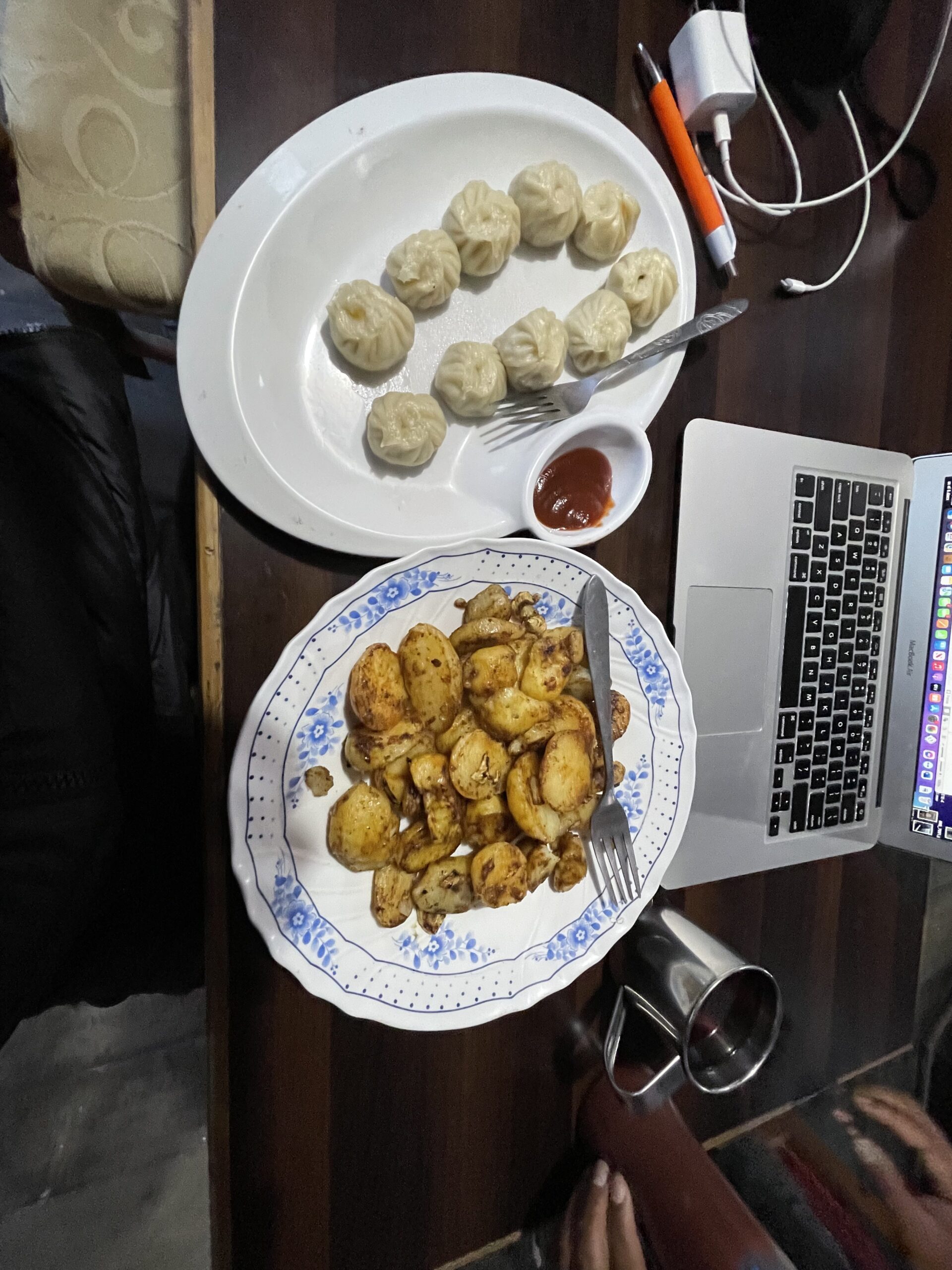
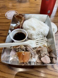
After an hour of exploring the shelf, taking tons of photos and video we hustled back down the mountain to get back to Manang in time for lunch and an afternoon nap.  Returning to the Four Seasons Guesthouse I found all my laundry had been freshly cleaned, dried and folded and ready for the rest of the trek.  Amazing how a hot shower and clean clothes can so dramatically improve your attitude.  For lunch I enjoyed a traditional Nepalese meal of dal bat (rice and lintel soup and momos.  Mo Mos are dumpings similar to Russian or Ukrainian Pierogi.  They can be either steamed or fried and can be either vegetable or minced meat based.  And they are delicious.  After lunch I wandered around the village and purchased a few more snacks to refill my supplies and found a nice warm knit hat for the higher altitudes.

Day 6:  Manang (3500 meters) to Siri Kharka (4060 meters) 1837 feet of elevation gain and a 9 kilometer trek

Today’s trek would be a shorter day at only 5 hours but still tough in that the 9 kilometers would involve a steep 1837 foot elevation gain going from 11,500 feet to 13,200 feet.  Between the effects of altitude and the steep terrain on the cardiovascular and respiratory systems and the need to quickly cross a series of notorious landslide zones on very narrow and shifting trails the day still provided plenty of chills and thrills.

We began our day by working our way through the lower village’s small stacked stone stores, guesthouses, teahouses and homes then on to the upper village where most of the locals live.  Passing stupas and prayer wheels we leave the village behind us, cross the river on a suspension bridge, work our way up a steep incline passing farmers in their fields and driving livestock along the trail.

This slideshow requires JavaScript.

After a few hours we arrive in the Tibetan Village of Khangsar and stop for a cup of tea and a snack of momos.  The teahouse had excellent WIFI and I took the opportunity to download a couple of new albums and a audio book for the next few nights.  Unfortunately, Raju failed to mention this would be the last place with WIFI for 6 days so I didn’t alert my family and friends I would be radio silent for nearly a week,  This left everyone to wonder if I had fallen off a mountain, been kidnapped by rouge Buddhist Terrorist Monks (there is no such thing), dismembered by an irate Yeti(maybe no such thing), suffered a heart attack (always a possible assuming I have a heart), or fallen madly in love with a lovely sultry brown eyed donkey (no comment)

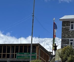
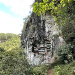
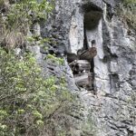
After relaxing for an hour and enjoying my last internet browsing we headed out to Siri Kharka.  This was probably the most scenic section of the trail to his point.  The trail followed the contour of the mountain high above a raging river.  Eventually we rounded a bend in the trail and saw the small red old monastery about a kilometer ahead and several 100 meters above and beyond the Village of Siri Kharka.  Soldiering on we passed the monastery and climbed the last incline into the village and found our Guesthouse ,ate a hot dinner, and settled in for our last full night of sleep for several nights.

This slideshow requires JavaScript.

The Trek continues to Tilicho Lake then on and over Throng La Pass in Part II of the Annapurna Circuit Trek


Posted in Uncategorized | 1 Comment

Return to Thailand

Thailand Land of Beautiful Buddhist Temples and Extravagant Palaces

By the time I landed, passed through COVID protocols, purchased a visa on arrival, passed through immigration, collected my bags, hit the ATM to get a supply of Thai Baht, and found a taxi most of my day was shot. But there is always plenty of interesting things to see and do in Bangkok after the sun goes down.

I chose to return to Saxophones’, one of Bangkok’s best Jazz/Blues Clubs for dinner and a night of listening to a Thai band cover a host of American artists. I was surprised to find they had a scam running at the door. They were requiring a PCR test to enter. And they just happened to have a portable setup to test me. So I forked over 200 Baht, exposed my brainpan to another swab scraping and learned I was negative for COVID without anyone even analyzing the swab.

This slideshow requires JavaScript.

Once inside I scored a spot in the balcony overlooking the stage and ordered pork, potato and leek soup, a T-Bone Steak with French fries, steamed vegetables and a mug of Chang Beer. The soup was good the steak was okay and the beer was great. At 9pm the band fired up and I enjoyed a pleasant hour and half of good music and great beer.

Next morning I was off to visit three locations I had visited before but felt were worth another visit. I have found many of the most interesting cultural sites around the world require more than one visit to both see and absorb all they have to offer. So this day I would visit the Bang Pa – In Palace, the Wat Yai Chaimongkol, and the Wat Maha That.

The Bang Pa – In Palace also referred to as the Summer Palace was originally constructed by King Prasat Thong between 1629 and 1656 on Bang Pa – In Island in the Chao Phraya River. Thong was the illegitimate son of the previous king who had been ship wrecked on the island as a young man. While stranded there he befriended a local girl and knocked her up. The bastard boy grew up to become Chief Minister and later usurped the throne of his father.

The bastard king first built the Wat Chumphon Nikayaram monastery on his mother’s property on the island and then dug a pond and built a palace on the island. Sometime after his death the Palace was abandoned by a future king and the site laid neglected and overgrown until 1851 when King Mongjut built his own palace on the island and when his son became king built another monastery on the island.

Today the Palace is occasionally used by the king and queen as a residence, for holding receptions and banquets, and as a tourist destination. There are six beautiful buildings surrounded by five large ponds and acres of manicured gardens.

This slideshow requires JavaScript.

Next up after the Palace was Wat Yai Chai Mongkol. It is believed that this site was originally an important Khmer temple complex. When King U-thong established Ayutthaya as the capital of Siam in 1350 he also proclaimed the site as the royal temple. In 1593 King Naresuan repelled a Burmese invasion and a major restoration effort began, the chedi was enlarged and the temple was renamed Wat Yai Chai Mongkhon which means the “Great Monastery of Auspicious Victory.

In 1767 the Burmese conquered Ayutthaya and the temple complex was looted and abandoned. A monastery was reestablished on the site in the 1950s and most of the stone images of Buddha are recent additions. The centerpiece of the complex is the large bell shaped Chedi.

This slideshow requires JavaScript.

Just a short drive away I entered the Wat Mahathat Complex which means “The Temple of Great Relic”. The Wat Mahathat was considered one of the most important temples in the Ayutthaya Kingdom. Constructed in 1374 it originally consisted of a large prang (tower) built to protect valuable Buddha relics. Later kings built viharns (assembly halls) and chedis or stupas.


Though the Central Prang and the four smaller ones located at the corners of the central prang would be considered the most important relics of the site to visit. Most people make a bee line for a sandstone head of a Buddha statue embedded in the roots of a tree.

This slideshow requires JavaScript.

Next day may have been my favorite of this trip. I took a taxi to visit the Damnoen Saduak Floating Market. This is one of the famous floating markets of Bangkok and I had not made it here on my previous trip. You tour canal after canal in a long tail boat passing by open air stalls lining both sides of the river selling everything from cheap mass produced souvenirs made in China masquerading as Thai handcrafts, to paintings being sold by the artist as he works, to clothes, to electronics. And if that was not enough eye candy to overload your senses there is a complex bouquet of interesting smells from incense, to cooked street food, to the flowers lining the canals to freshly baked coconut cookies and pastries.


And as you cruise down canal after canal you pass ladies wearing traditional blue dresses and big straw hats paddling their little sampans loaded high with fresh vegetables and fruits. And of course you pass tourists in boat after boat. All of this made for a very interesting and entertaining morning and a pleasant way to see a different side of busy Bangkok. I think I took some of my favorite photos and videos in the market.

This slideshow requires JavaScript.

I spent my final day in Bangkok revisiting the Grand Palace. I spent an entire day here in 2019 but knew I had only scratched the surface of all that it has to offer. On my visit in 2019 I just wandered through the Palace Complex on my own but this year I wanted some background and color commentary on the things I would see so I hired a local guide to tour the complex with me.

The Grand Palace complex was established in 1782 and contains the royal and throne halls, the Wat Phra Kaew, the Phra Maha Montian (grand residence), Dusita Phirom Hall (Royal Changing Room with a platform for the king to mount an elephant, and Chakri Maha Prasat Hall (royal residence).

The first building upon entering the complex is the Wat Phra Si Satsadaram (Wat Phra Kaew). The beautiful temple sits on the east side of the outer royal court and was built under the royal order of King Rama the First between 1782 an 1784. This is more than just a single building housing a temple. This walled compound contains numerous çhedi, phra (holy statues), a model of Angkor Wat a Bell Tower, and dozens of statues of mythical figures.


This slideshow requires JavaScript.

The main exhibit Is the central temple also called the ubosot or the ordination hall. This building has been consecrated and designated for the performance of the Buddhist ordination ritual and the reciting of the Patimokkha. The outside of the ubusot temple is beautiful but inside takes your breath away. Brilliantly rich gold leaf and shimmering gems everywhere, walls are covered in painted murals showing the life of Buddha, but the main attraction is a 26 inch high sculpture of Buddha sitting in the lotas position clothed in gold carved from a single piece of jade. The Emerald Buddha is considered the most sacred Buddha image in Thailand.

After I exited the Ubosot and collected my shoes and hat I was surprised when my guide dipped a lotas bulb and stem in water and used it to tap my head and heart in a Buddhist blessing.

After leaving the temple complex we strolled along the main street and my guide explained the history and purpose of each building. Entering any of the buildings is prohibited so I just took photos of the exteriors. Notice the height in the photo of the gate. Before automobiles the king rode on an elephant and the gate was built to accommodate the height of an elephant plus the king. Now days the king travels in a Rolls Royce and the height is no longer needed.

This slideshow requires JavaScript.

Next day I flew to Chiang Mai to catch a tour taking me to Chiang Rai and the Golden Triangle in Northern Thailand. Frankly I found Chiang Rai and the Golden Triangle to be major disappointment. First let me describe what not to waste your time doing.

The White Temple, Blue Temple and Black Temple are not temples at all. They are art projects by Thai Artists with over inflated egos that created temples to themselves and their self-perceived talent.

The White Temple is privately owned by the artist Chalemchai Kosipipat. He designed, built and opened the edifice to his ego in 1997. I have to admit the structures are very dramatic and intricate but I am not much interested in modern art and could not get passed all of the self-portraits, elaborately framed media clippings, and even life size card board cutouts of the dude posing dramatically and staring into god knows where – perhaps his own navel. The weirdness of the place has to be seen to believed. You will find creepy looking mythical figures alongside pop art representations of Batman, Spiderman, Angry Bird and other contemporary cultural icons. Definitely not my cup of tea!

Next we visited the Blue Temple only to find this fantasy temple was only built six short years ago. While not as schizophrenic as the White Temple you can immediately see a pattern. This temple was designed and built by a student of Charlermhai Kositpipat (the ego manic that built the White Temple). And while this temple is far from the ancient religious sights I enjoy exploring, I have to admit it was interesting and the eye popping blue and gold are very pleasant to the eye. But again, not my cup of tea and another wasted hour of my day.

Finally we visited what was billed as the Black Temple which again turned out not to be a temple at all but the home of a famous Thai artist turned into a museum and art gallery. I will be honest I only toured through the initial building and left the other 39 buildings and gardens for others more interested in modern and surreal art. I found his art bizarre – one painting had George W Bush and Osama Bin Laden riding a rocket ship out of some death star. While others were very sexually explicit.

My guide was very proud to tell me the artist once claimed he could create a masterpiece in just 10 seconds. Basically these masterpieces looked like he used a Home Depot 5 inch semi-gloss paint brush to slap four strokes of black paint on a white canvas and call it a day. Again not my cup of tea. So I told my guide to stop wasting my time and take me somewhere interesting.

Mae Fa Luang in the highlands above Chiang Rai was our next stop. These beautiful gardens set atop Doi Tung mountain were inspired by the late Princess Mother of the present king of Thailand and she has been the project’s chief patron. All the flowers grown in this 10 acre garden are grown and lovingly cared for by local villagers who benefit from the tourist dollars spent in the area and job opportunities provided by the garden and other projects begun by the Princess Mother.

This slideshow requires JavaScript.


Before the Princess Mother took a personal interest in this remote part of northern Thailand the impoverished area was populated by ethnic hill tribes that received little to no support from the national government for things like education, health care or infrastructure like roads, water and electricity. Now through the development foundation she spearheaded and the king took up after her death the area is thriving and opium fields are now beautiful flower gardens or have been restored to natural forests.

This slideshow requires JavaScript.

And yes this area known as the Golden Triangle once was the heart of the opium trade. I am told that more than 90% of all the opium produced in the world at one time was produced in this small area where Thailand, Burma and Laos come together. And even though it is illegal to grow opium in Thailand now many of the Hill People of the Golden Triangle still grow and export it. In fact both my guide and driver admitted they still grew opium for their own use and to sell for extra money during the pandemic.

Our next stop after the Gardens was a quick visit to the Opium Museum. The museum was small but very well done offering excellent exhibits on the history, economy, medicinal uses, recreational drug uses and societal effects of the opium trade.

Next it was time to visit two different viewpoints where you can see the boundaries where Thailand, Myanmar and Laos come together. The first view point was high up on a hill overlooking where the Mae Kong and Roak Rivers meet. Everything left of the Ruak River is Thailand, the land between the two rivers is Myanmar (Burma) and everything across and on the far side of the Mae Kong River is Laos.

This slideshow requires JavaScript.

After taking a few photos we drove down to the Mae Kong River and took a long tail boat for a short and quite boring cruise up the river. I’m not sure why my guide thought I would be interested in seeing a Chinese Casino on the Laos side of the river or a Thai Casino built on the Myanmar side of the river but he felt that seeing the casinos from the river was worth the boat trip. He even stopped the boat for photos of the casinos which of course I declined. Interestingly gambling is illegal in Thailand so the Thai people (who love to gamble) travel to the casinos in Laos and Myanmar.

This slideshow requires JavaScript.

After a quick pass through a local open air market to buy a replacement comb and look at all the weird foods –

This slideshow requires JavaScript.

we drove up to the border of Myanmar and Thailand for a cup of tea. The border tea house was a little surreal in that it was right next to a sandbagged border post with concertina wire stretched for as far as the eye can see. And off in the distance maybe a mile away on another ridge was the mirror image border post manned by the Myanmar army.

And my final visit in the Golden Triangle was to a terraced tea planation for a tour of the fields and a tea tasting. I tasted several green, black and even white teas before buying several boxes of my favorite to take home with me.


This slideshow requires JavaScript.

I was supposed to visit several ethnic hill tribes but after a rather serious disagreement with the tour guide and near physical altercation with the obnoxious driver I demanded they drive me back to Chiang Mai and refund the money for the unused portion of the tour. I learned later that because of the pandemic tours to visit the Hill Tribe villages have been suspended as had the other items on the program. I am not sure whether the tour operation was just a scam or they were so new and inexperienced they had failed to nail down all the details of the tour ahead of time.

Whichever the reason I was left with two days to kill in Chiang Mai so I revisited five of my favorite temples from my previous trip. These included the Mueang Chiang Mai, Wat Phra Singh Waramahavihan, Wat Chedi Luang, Wat Prathat Doi Suthep and San Phi Suea.

This slideshow requires JavaScript.

After touring the temples I still had a little time left so I hired a long tail boat for a two hour tour up the San Phi Suea River.

This slideshow requires JavaScript.

Next morning I caught a flight back to Bangkok and spent my final days in Thailand visiting seven more ancient and culturally significant temples. They included the Talat Noi, Wat Saket Ratchswora Mahawihan, Golden Mount, Wat Phra Chetuphon Wimon Mangkhalaram Rajwaramahawihan, Phra Borom Maha Ratchawang, Bawan Niwet, and Wat Arun Ratchawaramahawihan.

This slideshow requires JavaScript.


Posted in Uncategorized | Comments Off on Return to Thailand

Seven Days in Bali

I added Bali to my schedule primarily to see a young friend of mine I had met back in 2019. Back then Risky was a 16 year old island girl taking an English Emersion class in Yogyakarta. Her assignment that day was to find an English speaking tourist and be their volunteer tour guide to the Pramanan Hindu Temple Complex. We had a great day together and have maintained a friendship on line as I helped her practice her English with weekly Video Chats.

Three years later and Risky is about to begin her third year of University in Tourism. She has spent the last two months working on an internship with the Pusat Pendidikan Turtle Conservation and Education Center on Bali. My trip coincided with the conclusion of her internship so I had a ready-made tour guide and she had her first client.

Risky developed and excellent itinerary of some places I visited in 2019 plus some new sites. In addition to Risky being an excellent and enthusiastic tour guide she also has an interesting hobby shooting video on her smart phone and editing short quick moving high quality video vlogs. So Bali will feature my first ever video series embedded into my written narratives. I hope you enjoy this new feature and that Risky will continue to teach me how to edit my videos remotely.

Our first day began with a tour of the Turtle Conservation Center where she has worked for the last several months diving for seaweed to feed the turtles, cleaning their tanks and showing foreign tourists around the compound. The Center has two very important missions: first they work to help protect nesting sea turtles and their eggs and second rescuing sea going turtles trapped in fishing nets, plastics, fishing line or injured by boat propellers.

I enjoyed seeing the fruits of her labor and the progression from eggs nestled in sand nests to 3 day old tiny turtles, to 3 week old turtles to turtles ready for release into the sea. The compound has mostly green and loggerhead turtles.

This slideshow requires JavaScript.

After touring the Turtle Compound and leaving a small donation we were off to Ubud to visit the Monkey Forest. I passed on this tourist site in 2019 but Risky promised I would enjoy the visit so away we went. And I’m glad we did – the forest was made up of beautiful virgin trees with massive vines and tons of klepto-monkeys.

This slideshow requires JavaScript.

After a pleasant walk through the Monkey Forest we made a bee line for the Bebek Tepi Sawah. This wonderful restaurant is not to be missed. Every table in the outdoor pavilion overlooks the rice patties and make for a perfect setting to enjoy authentic great tasting traditional Balinese cuisine and ambience.

As you might expect of a Restaurant with the name “Duck” in its name features mostly duck dishes. Fortunately I love duck and enjoyed a nice crispy half duck with rice, salad, spring rolls and a nice local beer. The food was delicious to the taste buds but the view across the rice patties were just as delicious to the eyes.

This slideshow requires JavaScript.

After lunch we traveled a little ways north to visit nearby rice terraces but they were small and a bit of a disappointment so we called it a day and headed back to the hotel and dinner.

Next day we were up bright and early for a full day of sites and driving. We began our journey with a visit to the ancient Hindu pilgrimage Pura Luhur Tanah Lot (Temple). I visited this temple in 2019 and received a blessing from the Hindi priests.

This slideshow requires JavaScript.

This time high tide prevented any actual visit to the small island temple. But I did take some nice photos from the mainland and as usual there was a line of local women wanting photos with me lol.

This slideshow requires JavaScript.

The temple complex is very interesting in that the entrance, most of the grounds and most of the structures and satellite temples are on the mainland but the important temple and small alter is actually on this little island that you can wade out to during low tide and pray and be blessed by the holy men.

This slideshow requires JavaScript.

The three acre island temple is a short 20 meters from the mainland but only accessible during low tide. This is one of seven sea temples that the locals have for centuries believed protects Bali from negative sea spirits.

This slideshow requires JavaScript.

One interesting oddity is that although the island is surrounded by seawater there is a fresh water spring in the small cave that provides a constant pool of cool sweet fresh water. In 2019 I tasted the water for myself before I was sprinkled with it, blessed, had rice stuck to my forehead, a flower placed behind my ear and 100 rupees lifted from my wallet . lol

We left the coast to drive north into the island’s highlands to visit the Jatiluwih Rice Terraces and eat lunch. The terraces have been a work in progress since the 9th century and stretch across 600 hectors of rolling green hills. And when I say green I mean a vibrant and contrasting green to the beautiful blue sky. As you look across the waist high rice stands dropping to the valley below then marching up the far hills they look like giant green staircases built for an ancient race of colossal men.

This slideshow requires JavaScript.

Since we arrived in time for a late lunch we found a nice table at an open air café overlooking the terraces. My driver took advantage of the all you could eat buffet and enjoyed a massive plate of mystery meats and unrecognizable vegetables. In fact the only thing on his plate I was sure of was the rice. Risky and I ordered from the menu and I have to admit the view was better than the food. Lol

Later as I walked through the rice terraces I learned that there are two types of rice grown here – white and red rice. I didn’t even know there was such a thing as red rice. I also learned that this is one of the few places in the world that the farmers get three harvests each year from their terraces.

From the Rice Terraces we continued further north to the Ulun Dani Baratan Temple. The temple is situated on Lake Baratan in the highlands at about 1500 meters above sea level. The crisp cool air contributes to the lake’s calm mirror like surface which reflects the temple’s image in its clear surface.

The temple complex consist of four sacred buildings. Linga Pura stands three levels high, and it is devoted to the god Shiva. Pura Puncak Mangu stands 11 levels high and was built to honor the god Vishnu. Prua Teratai Bang is the main temple and devoted to Brahma. The fourth temple is Pura Dalem Purwa was built to worship to Sang Hyang WIdhi and is used to pray for fertility, prosperity and well-being.

This slideshow requires JavaScript.

The temples were first built in 1556 but the site has had religious significance as early as 500 BC evidenced by a sarcophagus and stone slate near the temples dated to that period.

After visiting the temples our drivers took us to an incredible venue for lunch.  The cafe sat on the edge of a high hill overlooking lush green farm terraces with Kodak worthy photo opportunities in every direction.  While waiting for lunch Risky and I played movie makers and professional photographers (lol we came up short on both but hope you enjoy our efforts).  Oh and the food was fabulous here too!  and their specialty was – you guessed it crispy duck.  MMMM Good!

This slideshow requires JavaScript.

My third day in Bali turned into a total bust. Our driver suggested we visit a nearby island that was supposed to be the most beautiful spot in the hemisphere. Spoiler alert it wasn’t. in fact it was a total scam! After paying thousands of rupees we waited an hour and half in the hot son for the boat to arrive. Then 200 of us were crammed into this packed unairconditioned boat version of a ghetto bus shoulder to shoulder like sardines in a tin. An hour later we make landfall on this island disguised as a trash dump called Nusa Penida. Everywhere I looked there was either garbage floating in the surf or knee deep in the sand.


As we waded ashore through floating plastic bottles and discarded food cartons we could see our seedy looking driver waving to us. I’m not sure what I was expecting but I was surprised when we walked past parking lot after parking lot and nice SUV after SUV to finally reach a shabby alley and find of all things a 1970s era Scooby Van. No Shit!!! The van looked like the Scooby Doo Mystery Machine. Except one of the passenger doors did not open, the orange and yellow plastic covered seats were stained with what I hoped were not body fluids and the floormats were rubber. Oh and to make things the perfect shit show the van was unairconditioned and had absolutely no suspension.

So off we went against my better judgement to what was supposed to be a 5 star restaurant overlooking the beautiful Diamond Beach. Two hours later after a harrowing bone jarring ride along a narrow winding pot hole filled beach and mountain road we pulled up to this large open air pavilion crammed full of rows of picnic tables packed with 200 sweaty people with another 50 waiting outside for seats to open for their turn at the buffet line of unrecognizable 3 day old left over magot covered dumpster finds.

And there was no beach in site. In fact the pavilion was perched on the side of a waist high weed covered hillside overlooking a drainage or maybe even open sewer ditch nowhere near anything resembling sand, surf, or the ocean. By this time I had spent 90 minutes in the hot sun waiting for the floating sardine can, an hour in the sardine tin, and 2 hours in the unairconditioned Mystery Machine and I was out of patience. It was now 2pm and our sardine can back to Bali was scheduled to depart in 3 hours.
So under threat of dismemberment our idiot driver finally agreed to just turn his piece of crap van around and take us back to where he picked us up without subjecting my system to food poisoning or driving another hour to this so called Diamond Beach.

Arriving back at the garbage strewn beach at 4pm every café was closed until 5pm. So no lunch for me and back into the sardine can with the rest of the sweltering foul smelling sardines. So my message to anyone who reads this blog – DO NOT GO TO NUSA PENIDA OR PAY A SINGLE RUPEE TO ANY OF THE TOUR OPORTORS TRYING TO SCAM YOU. THERE IS NO DIAMOND BEACH, THERE IS NO 5 STAR RESTARUANT AND THE ISLAND IS A GARBAGE DUMP!

After the miserable day I decided to take the next day off and work on catching up on my Philippine blogs and working with Risky on creating some videos for future blogs. The day off gave me time to cool off and allow my blood pressure to drop back to normal and mentally prepare myself to once again give Bali another chance.


We began our next day with a visit to Panglipuran Village – a beautiful traditional village protected from development and modernization. The entire village has remained in a state of suspended animation for centuries. All houses and the small lanes they surround are just as they were hundreds of years ago.

This slideshow requires JavaScript.


The village and homes follow a Balinese concept of Tri Hita Karana – balancing the relationship between the Gods, man and the environment surrounding them. The entire village is 112 hectors and sits at about 2000 cool and comfortable feet above sea level.

According to Tri Hita Karana the land is divided into three areas based on purity and value. The Utama Mandala is the northern most part of the village and considered the most sacred. This is where the village Pura (temples) are located. Pura Puseh Desa to worship Brahma (the creator god) and Pura Bale Agung to worship God Wisnu (God of Preservation). The main part of the village flows south and is called the Madya mandala or area for humans. Here you will find the hundreds of homes. And finally on the southernmost part of the village is the impure zone known as Nista mandala. This area is reserved for the graveyard and Pura Dalem for the worship of Shiva the destroyer.

This slideshow requires JavaScript.

Each home, like the entire village follow the Tri Hita Karena and is divided into three distinct zones. Each home will have a Utama Mandala containing a family temple to worship their god and ancestors. Then the home will have a Madya Mandala consisting of a kitchen, bedroom sitting area where the family lives. Finally every home has a Nista Mandala that is used for drying clothes and to house livestock.

This slideshow requires JavaScript.

There are approximately 850 people living full time in the village. I found it interesting that during the day many of these people go off to work or their business in the modern world but at the end of the day they return to the village and a life that has been lost in time. They practice their own kind of time travel without even the benefit of a DeLorean or a flux capacitor.

Next we visited Bali’s Mother Temple. Besakih Temple is a huge and sprawling temple complex consisting of 86 temples and shrines constructed over the centuries beginning in 1007 AD and flowing down the southwest slopes of Mount Agung.


This slideshow requires JavaScript.

The temple complex is built on six levels terraced up the slope with an entrance marked by the standard Canid Bentar (split gateway) followed by the Kari Agung or gateway to the second courtyard.

In 1963 a series of eruptions of Mount Agung killed nearly 2000 people but the lava flows missed the Pura Besakih by just meters. Of course the locals took this as a sign from the gods that they wanted to flex their muscles but not destroy the monument the faithful had erected in their honor.

This slideshow requires JavaScript.

After finishing our tour of the Temple and descending the six levels back to the SUV we headed for our next objective for the. Day the Tirta Gangga (Water Palace). The Water Palace was built in 1946 by the late King of Karangasem. And when I say built by the king I mean he actually helped dig the pools and ponds and design the palace himself. This project was a personal hobby and labor of love for him so he worked side by side with the low class laborers in the mud and hot sun day after day.

This slideshow requires JavaScript.

And his labors are truly beautiful and a nice diversion on a hot summer afternoon. The gardens consists of three parts each with its own ponds, fountains, statuary and gardens. The first level consists of a fountain and two large ponds overlooking the swimming pools on the mid-level part. The highest and largest complex is the King’s country house which is now a restaurant and small hotel.

Our final stop of the day was to visit was to what was referred to as the Virgin Beach. I’m not sure why they call this place Virgin Beach. It couldn’t be because it is remote and devoid of crowded beach goers because the beach was packed. And I am sure it has nothing to do with the virginal purity of the young ladies sunning themselves on the white sands. Mostly I’m betting it just sounded good to some marketing type at the local Chamber of Commerce.

This slideshow requires JavaScript.

But it was a nice beach and everyone seemed to be enjoying the day swimming, snorkeling, sunning or just people watching. I wasn’t dressed for beach day and just stayed long enough to take some photos then back in the SUV for the 2 hour drive back to my hotel for dinner.

On my final day In Bali I began by searching for a place to get a PCR test. And just like in the Philippines the first half dozen places advertising fast PCR tests and results turned out not to actually provide the service. Eventually I ended up getting the test done at the hospital and then Risky suggested we visit the Gwk Statue.

Turned out that the Gwk Statue is just the 122 meter tall center piece of the Kencana Cultural Park. The statue was inspired by a Hindu story about how Garunda’s search for the elixir of life. The fable goes that Garunda agreed to be ridden by Vishnu in return for the right to use the elixir to free his enslaved mother.

This slideshow requires JavaScript.

It took 28 years and 100 million dollars to build the statue. In addition to the statue of Gwk there are other statues including one of Vishnu plus a large collection of Ogoh-Ogoh. The Ogoh-Ogoh are statues representing demons built for the Ngrupuk parade.

The Ogoh-Ogoh are mythological beings, primarily demons constructed to purify the natural environment of spiritual pollutants created by human activity. These fantasy figures are designed and constructed by each town and paraded through the city streets carried by 8 strong towns men.

It was a hot day to be trapsing around this large unshaded park and the sun was brutal but I got some great photos and video to share with you. Hope you enjoy both the photos and Risky’s new addition to my blogs – the short video clips. Before returning to the hotel we stopped and enjoyed Balinese Barb B Que.

And boy did I enjoy!!! Pork Ribs, French fries, cole slaw and lemon ade. The meal was perfect for the afternoon. In fact I enjoyed most of my meals in Bali. I like the food in Bali and I especially enjoyed our daily afternoon run to Maximo’s for three scoops of gelato (chocolate, caramel, and cherry). I will miss my daily gelato fix and my good friend Risky but time to move on to Thailand and trade my visits to Hindu Puras for Buddhist Wats and Stuppas.

Posted in Uncategorized | 1 Comment

My 2022 Philippine Adventure Part IV – Puerto Princesa & Legazpi

This slideshow requires JavaScript.

The fourth and final leg of my four part adventure in the Philippines began by lucking into and finding a great taxi driver at the Puerto Princesa Airport. John was young, cheerful, and above all honest. So by the time he delivered to my hotel Honest John had become my new best friend and my driver and tour guide for my few days in town.

Honest John picked me up next morning bright and early for the 76k drive to the Puerto Princesa Underground River National Park. This 8.2k underground river empties directly into the sea and is the Palawan’ Provence’s most treasured tourist attraction. The river boasting both A UNESCO World Heritage Site designation as well as listed as one of the New 7 Wonders of Nature is stunningly beautiful.

The cave’s jaw dropping limestone formations of stalactites and stalagmites form wild and fanciful images that with just a little imagination look like actual sculptures of animals, people and other objects from the surface world. But even before you enter the elaborate cave system your eyes feast upon beautifully clear blue green waters, pristine beaches and dramatic limestone cliffs dropping from the blue skies to the blue waters in one continuous ribbon of glittering limestone.

This slideshow requires JavaScript.

Honest John drove me to the pier where the Underground River tours are booked and depart. He helped me purchase my ticket and got me a seat on a boat to ferry me 30 minutes to the beach and entrance to the cave system. The boat ride to the beach was spectacular eye candy offering views of crystal blue waters, cobalt blue skies for as far as the eye could see, pristine white sandy beaches, and dramatic limestone sea cliffs plunging into the sea topped by eye popping green vegetation. A scene totally devoid of pastels or dull colors. Everywhere your eye roamed the colors were bold and vivid.

This slideshow requires JavaScript.

And just as you think “can it get any better than this” the boat rounded a cliff jutting out into the sea to enter a beautiful cove tucked away between the massive cliffs with broad sandy beaches shaded by massive coconut trees and another much larger and expansive type of trees that grow both horizontally as well vertically
with big broad green shady leaves.

Once ashore we left the large sea going boat to collect a hard hat audio recorder headset and life vest and then make our way down a sandy forest trail to a picturesque boat landing to take photos and wait for a small skiff seating 10 guests and a boatman to take us 4.3 kilometers into the underground river.

This slideshow requires JavaScript.

The trip into the river is surreal. It begins with a short paddle across a natural inlet and bay area and as you near the cliffs and the entrance to the subterranean part of the river the audio guide explains the ground rules. No talking, no noise, no touching, no lights except the boatman’s headlamp, and for god’s sake no looking up with your mouth open – lots of bats hanging from the ceiling dropping gifts from above. Lol

This slideshow requires JavaScript.

As we entered the cave and left the bright sunlight of the surface we gradually moved from twilight to total darkness and with each stroke of the paddle the cave became darker and more quite. Quite except for a weird clicking and high pitched squealing sound which we learned from our audio guide were bats zipping by using these sounds to bounce off of the walls and other objects as a sort of radar/sonar to keep them from flying into a limestone wall or my face.

The boatman would shine his headlamp on interesting formations as we glided along as the audio guide quietly explained what we were seeing into our earphones. Off in the inky black distance you could see pinpricks of light from the headlamps of other boatmen ferrying their boatload of stunned tourists. The entire scene was so foreign – no sound, almost no light, a place where time seemed to stand still provided fuel to supercharge the imagination. For a moment I felt like I might be a lost soul on Charon’s ferry in Hades on my final journey across the River Styx crossing from the world of the living to the world of the dead. But then I felt the plop of a bat dropping on my shoulder and knew I was still among the living. Souls don’t get crapped on – that is a privilege reserved for the living.

This slideshow requires JavaScript.

And as we gradually emerged from the inky black monochrome world to twilight then to bright sunlight I felt as if I had just drifted into a canvas of a Paul Gauguin tropical island paradise painting.

This slideshow requires JavaScript.

After a few strokes of the paddle we were back across the quite pool between the cave entrance and small dock where we unloaded, walked back through the woods, dropped off our helmets and head sets and reboarded our boat to transport back to the landing where my taxi and Honest John waited.

I was ready for lunch so we hit a Filipino all you could eat buffet. One look at the options and all I could eat was watermelon. The rest of the crap looked like someone else had already eaten and regurgitated it. So once again I ate melons and water for lunch. How I wished I could eat a Baby Ruth again. Lol

Returning to Puerto Princesa I found a KFC in the mall and enjoyed a two piece original with mash potatoes and cole slaw – real food for real people! It is interesting Filipinos and I guess all Asians crave rice like we crave potatoes or fresh baked bread. They eat rice and dried fish for breakfast, rice and pigs ears or feet for lunch and rice and pig fat, or baby duck fetuses still in the boiled egg or Kari Kari for dinner. Asians have no interest in bread or potatoes and I have never seen ribs or pork chops on a menu here.

Next day Honest John drove me to what he said was a nearby and very nice beach. It turned out not to be so near and not so nice. I took as 2 hours to reach the beach and the first place we went had a beach but no amenities. No lounges, tents, or towels for rent and no cold drinks or hot food to eat. I had John ask where the umbrellas and lounges were. Answer – they blew away in the typhoon.

This slideshow requires JavaScript.

The second beach we visited at least had umbrellas and chase lounges for rent so I bought a warm soda and laid down on the lounge. I’m not sure if I was attacked by some kind of tiny insect at that beach or from the sleeping bag on Mount Apo but by next morning I was itching with bites all over – and I mean ALL Over! Honest John stopped at a pharmacy on the way to the airport and bought me something for the bites but I couldn’t get relief until much later in the day after flying to Manila transferring planes and then on to Legazpi.

In keeping with this cosmic joke played on big fat ass American men the clerk working the Cebu Pacific ticket counter grinned and told me he was giving me a special seat because of the size. When I boarded the plane I found that the first two seats faced backwards and were half the size of regular seats. Had I been able to lift the arm rest and use both seats I might have been comfortable but I had to not only squeeze my ass into a seat only wide enough for an anorexic, heron addicted New York fashion model but had to turn slightly sideways and curl my shoulders in so as not to hang over half way into the poor guy’s seat next to me. Maybe the longest two hours of my long life.

The Legazpi airport is small and they roll portable stairs to deplane on the tarmac and walk across the tarmac to the baggage claim in the departure terminal. Normally it is a pain doing this because it is hot and windy but today it was perfect because there wasn’t a cloud in the sky and a perfect kodak moment with Mount Mayon.

After collecting my bags I found a taxi driver that looked honest and I was off to my hotel. On the way we discussed and made an agreement on a rate for him being my driver for the next 48 hours. We started the next morning by driving to a place that offers ATV tours from town to the 2006 lava wall on Mount Moran. I used to ride motorcycle when I was young but never an ATV. Turns out there is nothing to driving one and away we went.


Our route took us through some pretty rough terrain through flooded streams, up over rock piles and into thick soupy muddy bogs but it was a blast and sure as hell beat walking. We stopped and parked our ATVs at an outdoor center and hiked the rest of the way to the 2006 lava wall. And that is as far as is legal to go on Mount Mayon which is still an active volcano that erupts every few years and sends then local running for their lives. Hiking is now prohibited because a group of hikers got caught in an eruption a few years back and all died – a group of par boiled Italian trekkers makes for really lousy tourism advertising so the lava wall is as close to the summit as you can get.

This slideshow requires JavaScript.

There was a zip line back down to the outdoor center that I was hoping to try but it started raining and I was told the don’t operate in the rain. I guess maybe the break on the cable doesn’t work so well wet so I had to walk back down. Bummer – I’ve never experienced a zip line. After another hour of racing around on the ATV’s scaring the hell out of a bunch of cows we made it back to the rental shop and loaded up for the next location.

That location turned out to be a very nice waterfall that we hiked down to and then crossed the stream and continued downstream to a little café for a cup of tea and some conversation with the locals.

This slideshow requires JavaScript.

It seems after a lifetime in politics I can’t seem to get away from it. The national election here is May 9 and everyone wants to talk about their favorite candidate. Most people seem to be favoring BongBong Marcos (son of the former dictator Ferdinand and Amelda Marcos) a few the current female vice president and my porter on Mount Apo is all in for boxing champion Manny Pacquiao.

After our tea we made tracks back to the car and drove to the very interesting Hoyop-hoyopan (blow of the wind in the local dialect) Cave. The 280 square meter cave with 3 separate tiers was formed sometime around 4000BC and has been used as a refuge of last resort during typhoons and volcanic eruptions through the ages.

                                                                         During the Japanese occupation of the Philippines in WW II Filipino gorillas and over 1000 locals hid in the cave for 3 years before the Japanese occupiers located the cave. The cave hideout included both a hospital and orphanage. During Ferdinand Marcos’ rule and martial law the locals built a concrete dance floor in the room they call the cathedral so they could drink, dance, sing karaoke and party all night despite the curfew.

Stalactites and Stalagmites form interesting formations resembling a chicken drumstick, statue of the Blessed Virgin, a hanging snake, a hand formation, sexy lady with long hair, hanging man, and statue of Moses.

This slideshow requires JavaScript.

One strange moment occurred when a group of local women asked my driver if I would have a photo made with them. This happens a lot to me in both Asia and Africa and I usually try to accommodate and stand for photos even though it makes no sense to me. As we began taking photos even a couple of guys not even with the women jumped into the pictures. Lol. But the amusing thing was once I entered the cave for the tour the lady in the red pants in the photo asked my driver to tell me that she would like to be my wife for the night if I was so inclined. Obviously I was not so inclined but I was amused!

Next day we spent half the day trying to get a PCR test for my flight to Bali. Despite advertising claiming dozens of places offered PCR test nowhere in the city actually offered them. I had to get on line and make an appointment in Manila at the airport the next day to get a rapid test and pay extra to get my results in three hours.

After the PCR disaster of a morning I spent the afternoon visiting local landmarks. First stop was the Simbahan Ng Daraga (Our Lady of the Gate Parish Church in English) built in 1773 in the Baroque style. It’s walls are constructed from huge volcanic rock which is found everywhere in the area then coated with lime to protect from deteriorating. The arch over the entrance has an inscription in Latin which once interpreted reads “Well founded is the house of the Lord on firm rock”. The octagonal belfry has carved images of the twelve apostles.

This church was built on a hill overlooking the active Mount Mayon Volcano after the Spanish settlers in the nearby settlement became concerned about the danger of increasing volcanic activity. And when the church of Cagsawa and community was destroyed in 1814 this church replaced Cagsawa.

Next we visited the ruins of the Church of Cagsawa originally built in 1587 but burnt to the ground by Dutch pirates in 1636. It was rebuilt by Franciscan friars in 1724 but destroyed for good along with the entire town of Cagsawa in the 1814 eruption of the Mayon volcano. After the eruption covered the entire area in hundreds of million cubic meters of molten lava killing thousands only the belfry and parts of the convent survived. More of the structure was damaged collapsed during the earthquake that hit the region in the 1950s.

And the last things I did while here in Legazpi was eat the Filipino delicacy Lechon (whole cooked pig). It lived up to its billing and was delicious even though the crispy hide was a little hard to chew lol. Second thing was I got to try out a Jitney.

The jitney is a unique form of public transportation only found in the Philippines and again is a testament to the locals ingenuity. After World War II the locals took old U.S. Army and Marine Jeeps welded on a longer body, moved the back axle and had a vehicle that could carry 20 people comfortably on two long bench seats running the length of the Jitney. People hop on and off pulling a string connected to a bell to get the driver’s attention. Pesos are passed from one rider to the next forward to the driver. The vehicles are covered in bright colors and chrome and built with the sides open for maximum airflow since they are not air conditioned.

This slideshow requires JavaScript.

And having completed my bucket list of drinking the night away in a karaoke bar, eating lechon, riding in a Jitney, seeing the Hanging Coffins of Sagada for myself, visiting the famous and beautiful rice terraces, hiking to Mt Pinatubo’s crater lake, touring the WWII sites, shooting the rapids and crashing through a raging waterfall on a bamboo raft, canyoneering down a raging river, attempting and failing to climb Mt Apo, visiting the famed (not so brown) chocolate hills of Bohol, floating 2 kilometers into the subterranean river of Puerto Princesa and visiting the waterlogged beaches of Boracay it is now time to move on to Bali and visit my little friend Risky who I met when she was just 16 and was my volunteer tour guide for a day at the Hindu Temple complex of Prambanan back in 2019.

But I can’t leave the Philippines without once again noting the way everything here is built for small people – airplane seats, tricycles, tables/chairs, tents, sleeping bags, boats even the toilets are all miniature or kid size. I felt like Gulliver amongst the Lilliputians.


Posted in Uncategorized | 1 Comment

My Most Wonderful Philippine Adventure Continues – Part 2…

The Philippines Adventure Continues – Part 2: Boracay – Cebu – Bohol

After a week of perfect weather exploring Luzon I hit a patch of rain as I flew into Boracay. Several low pressure systems had developed off shore building into a Typhoon and settling over the islands of the central Philippines. So I arrived in Kalibo to a steady but light rain. Unfortunately I had booked a flight into the wrong airport. I didn’t realize that there was no airport on the island of Boracay and there were two different airports listed as serving the island. The Caticlan airport is just a short tuk tuk or tricycle ride to the port then a 20 minute ferry ride to Boracay and another tuk tuk to the hotel. The alternative is to fly into Kalibo then take a 2 hour van ride, hour ferry to Boracay then 10 minute tuk tuk to the hotel. I chose the long way of course!

So after a long day of travel I arrived at my hotel around 10pm in the steady rain. Checked into my room quicky ate my first meal of the day choosing what I thought would be a safe choice -meat lover’s pizza. I should mention that Filipinos love the more exotic parts of animals like pigs ears, nose, tongue, tail, penis ,hide, fat, and intestines. I laid in bed one

whole night wondering what they did with the hams, shoulders, pork chops, ribs, and loin. For some reason these more civilized cuts of meat never appear on Filipino menus – so what do they do with the rest of the animal after they take his ears, lips, feet, tail and penis? No one would tell me! Maybe you will have better luck finding out.

Next morning and the morning after I woke to a steady drizzle of rain ruining my planned two day of lounging on Boracay’s famed white sandy beaches resting my old bones after a very active week of hiking, drinking Red Horse beers and watching the lovely bikini clad natives frolic in the surf. Instead I sat at a small seaside café crowded with other rained out beach bums drinking Red Horse and eating very good calamari. But I would have to say the best part of my time in Borocay was eating the nicest big red juicy melons I’ve ever tasted. LOL I couldn’t get enough of those melons. And unfortunately that was the highlight of my short visit to the Philippines most famous beach. But I will be back if not just for the melons!


This slideshow requires JavaScript.

Leaving a water soaked Boracay behind I made for Cebu City where upon landing discovered another rainy day. I spent my first day in Cebu City visiting the traditional sites of Magellan’s Cross, the Basilica Minore del Sto. Nino de Cebu, and the 1565 Fort San Pedro. I tried to visit the Taoist Temple but it is closed to all but Chinese due to COVID. Can you imagine the nerve! First the damn Chinese manufacture and release this biological weapon on the world then they restrict their temples to just Chinese. Clearly an issue for the World Court.


This slideshow requires JavaScript.

Finally the weather broke next day for my planned trip to Bohol to see the famed Chocolate Hills. I booked a one day tour that included the hour ferry ride across to Bohol and back, a private guide and driver for the day, a buffet lunch cruise on the Loboc River, a visit to see the tarsier- world’s smallest primate, the beautiful man made mahogany forest, the Chocolate Hills, and a historic Cathedral.


The river cruise was pleasant and the homesteads along the river bank were interesting. The food on the other hand was not so good. Again lots of strange and less than appealing cuts of meat, rice and more rice, and thankfully watermelon and bananas.


This slideshow requires JavaScript.

After the River Cruise we drove up into the interior mountains and stopped a beautiful man made forest of mahogany. Back in 1972 the island elected a governor whose profession had been in agriculture and forestry. Recognizing that the clearcutting of highland forest was causing mudslides he developed a program of planting Red Mahogany trees and 44 years latter there is an entire forest of beautiful mature mahogany trees covering 2 kilometers.

Our next stop was to get my first glimpse of a Tarsier the world’s smallest primate. These little guys grow no bigger than the palm of your hand. And at birth no bigger than your thumb. The little guys are nocturnal, eats insects, has huge creepy eyes and have the world’s fastest sex. Apparently the copulation time for a tarsier couple is a mere 3 seconds. So ladies stop complaining about your minute man – you could be a lady tarsier!

And finally the big finish – the Chocolate Hills of Bohol. News Flash!!!! They are not chocolate year round. During my visit they were more pistachio green. Seems they are only chocolate hills during summer. The rest of the year vegetation grows quickly in this warm humid tropical climate covering the hills with leafy vegetation. But when summer arrives and the sun is at its hottest the limestone hills heat up and cook the vegetation turning the hills from a pistachio green to a Hershey Kiss brown. Interesting side note – these hills were once coral reefs in a shallow sea. Today they are at least 1,260 chocolate hills covering 20 square miles and one of the Philippines major tourist attractions and natural oddities.

This slideshow requires JavaScript.

We had a little extra time before the ferry back to Cebu so we made a quick detour to visit an old colonial era Catholic Cathedral.  The structure was built from which limestone and coral blocks with beautiful artwork.

My last day for this portion of my Filipino adventure turned out to be my most fun, interesting and exhausting. Canyoneering through the Kawasan Canyon for 5 hours to reach first the Kawasan Falls then the mouth of the river as it empties into the sea. I was a little apprehensive about taking this project on since I can’t swim and am a bit intimidated by deep and fast water. But since you only live once and I don’t want to be laying on my death bed a few years from now thinking “I wonder what it would have been like doing something stupid like throwing my body into raging rapids or jumping off of a 20 foot boulder into a pool of ice cold water and hoping the life vest would lift my fat old ass back to the surface before I drowned.” I just went for it!

And now I can lay there and think “What the hell was I thinking, I was a fat old man, I couldn’t swim, my knees were shot, and I am terrified of water. What about that sounded fun?” Was this an early symptom of senility or just the same old bad case of stupid that I’ve been afflicted with all my life?

But I paid my money so no turning back so I strapped on my life vest and helmet and prepared myself mentally for the day. Unfortunately due to either a little confusion in translation or just outright misinformation to ensure the sale of a tour I was led to believe the canyoneering experience involved a 45 minute stroll through a canyon with a little wading to a peaceful serine waterfall then 45 minutes back down the same lazy river.


This slideshow requires JavaScript.

But no, the experience began with a 20 minute ride on the back of a Filipino Evel Knievel wantabe’s motorcycle, then a 45 minute hike along the canyon wall and into the canyon to a raging river, then five hours of hiking, wading, bouldering, jumping off house sized rocks, and swimming. And as much as I am bitching about it now you could not have wiped the smile off my stupid face with a brillo pad for the 5 hours.


This slideshow requires JavaScript.

Except for the few times I lost my balance on uneven underwater rocks and fell skinning my legs or moments of terror as I tried to muster the courage to jump from a bus sized boulder into water of unknown depth, or a few seconds of gasp producing pain as I plunged into the water with my 230 pounds being forced down my gravity and momentum and my life vest wanting to shoot in the opposite direction from its buoyant material. And the only the groin straps of the Vest and my testicles left to decide which force of nature won out. After the first jump I learned not to test my new soprano voice while still under water.


This slideshow requires JavaScript.

Five hours later I finished the Canyon from Hell and emerged to slowly make my way along a much more peaceful stretch of river making its way to the sea. Tired, wet, triumphant and questioning my sanity once again I limped to the SUV, crawled in the back seat and directed my driver with “Home James or Paco, or Raul” or whatever his name was.

And that ended the second part of my Philippines Adventure without still accomplishing any of the three must do things I have set out to do here. I still need to spend a night drinking Red Horse Beer listening to people screech to a karaoke machine thinking they sound like Celine Deon or Kenny Rogers when they actually sound like cats mating. Ride in a packed Jitney. And eat lechon (a hole suckling pig). But hope springs eternal and I have another 14 days to sing, ride and eat a pig…

Posted in Uncategorized | 1 Comment

Philippines Part I -Luzon


My last visit to the Philippines was limited to just 5 days and spent entirely in the Old Intermural or Old Walled Colonial City of Manila exploring the historical sites. This year I decided to begin my 2022 adventure exploring the country’s many beautiful natural blessings as well as visit the infamous World War II tragedies of Bataan and Corregidor.

I will divide my Philippines blog into 4 chapters because there is just so much to share about this beautiful country, the happy and generous people who live here and their very rich and vibrant culture. This installment will provide a brief overview of my general impressions of the country, a short history and explanation of the geography of the country and a generalized impression of the wonderful people who live here.

First you should know that the Philippines is made up of over 7600 separate islands and is the world’s second largest archipelago. Though there are many island there are only four major ones – Luzon,
Mindanao, Samar, and Negros.

Historically the country has been invaded and ruled by 4 separate colonial powers. The first, the Spanish invaded and ruled for nearly 400 years and did as most European Colonial powers – enslaved the people, raped the land of resources and justified their actions by claiming the inhabitants were savages and barbarians little above animals.

In truth the people the Spanish found here were a thriving and mature culture with their own written language, laws, culture and civil structure. And in the 400 years of Spanish control – they did little to improve the lives of the local inhabitants.

As a result of the Spanish American War (1898) the United States routed the Spanish and Cuba, Porta Rico and the Philippines all became part of the US spoils of war. The Philippines became a US Protectorate and the new colonial power set out immediately developing a nation-wide free public education system, built transportation networks and set the country on a path to self-governance. In a very short time elections were held and a national congress of Filipino citizens were elected and eventually a Filipino Presidency was established and Manuel L. Quezon was elected to serve as the first Filipino President in 1935. In fact the timetable had been set for the Philippines complete independence by 1942.

Then in December of 1941 eight hours after Pearl Harbor the Japanese invaded. The combined forces of the Americans and Filipino forces fought off the invading forces for four long months before being overwhelmed by the Japanese. But it was a costly and only temporary victory for the Rising Sun and the Americans led by General Douglas MacArthur came back in 1945 with a vengeance and wiped out the Japanese and put an end to their bloody and savage rule.

You have probably noticed that I have only mentioned 3 invaders not four. The fourth is hardly worth mentioning because the rule of the British was short and uneventful. The British briefly vanquished the Spanish and laid claim to the island for 20 short months (1763 -1764) and had very little lasting impact before the Spanish reclaimed the Philippines for their own.

As I mentioned before the Filipino people have a rich and vibrant culture based on family and very conservative catholic adherence. The people are incredibly happy, friendly and industrious. They love to eat (6 times a day), sing (karaoke is practically the national past time), dance, and party. They work hard with the tools they have available or make their own out of necessity and when the work is done they play just as hard.

I found the people here to be very happy, welcoming and kind to strangers. Filipinos once called our little brown cousins by a less than politically correct Teddy Roosevelt may be small in stature but have oversized hearts, smiles and attitude. All they need to prosper in the future is a government as honest, caring and good as the country’s people.

So let’s move on to my tour of Luzon. I spent my first 6 days on the island of Luzon visiting the Pagsanjan Waterfall, Corregidor, the Pinatubo Volcano’s Crater, the Hanging Coffins of Sagada and the ancient 2000 year old rice terraces of Batad and Banaue.

Day one began by a brief side trip to what my terrific guide, MJ promised would be an interesting visit to see the old historical and first train tracks in the Philippines still in use as a “Trolly Line”. What she failed to tell me “Trolly” is a Filipino trolly (and I use the term loosely).

Industrious locals have built small lightweight backed benches on wheels to ferry passengers up and down the old rail line propelled by men on foot. If you look closely at the photos and short video you will notice the passengers sit on the bench seating as a young man propels the contraption down the track with one foot resting on the back of the bench’s back wheel and the other running along the track like he’s traveling on a kids scooter.

This form of locomotion actually moves down the track very quickly and when it is time to stop the breaking system involves dropping the heel and using the friction from the operators rubber flip flop against the metal wheel and track to slow then stop the rolling bench. There is only one track so if another bench trolly is met going the opposite direction the passengers from one bench disembarks, the train operator picks up his bench and steps aside until the other passes then resets the bench on the rails and the passengers reboard and continue the journey.

This trains line only extends about 3 kilometers from one end to the other and then the bench is lifted turned around for the return trip. The locals will pay 10 or 20 pesos for a quick ride from one part of the community to the next. As I would learn with each new day – Filipinos are quite ingenious and find interesting ways to solve daily problems with what they have at hand.

PAGSANJAN FALLS

So after our quick 6 kilometer “train ride” we were back on track to visit Pagsanjan Falls. To reach the falls requires a 45 minute dugout canoe trip up the Bumbungan River and over 6 sets of rapids in a bangka propelled by two barefooted boatmen. The bangka is a canoe like light plywood boat but with a flat bottom and longer length. The unsteady boat was a little disconcerting at first but in time I got use to the feeling of regular near capsizing and released my death grip on the sides of the craft (have I mentioned I can’t swim).

The boatmen propel the boat with pie-plate shaped paddle’s through the calm waters but as they reach the rapids they jump out while still moving forward leaving one leg and foot in the boat and running again scooter style propelling the boat by running along the bottom of the river or when there are boulders or even small river rocks along the route using them to expertly kick off by placing their feet expertly in the exact best place for leverage at full speed and explosively extending their cocked leg shooting the boat forward. The motion is so fast and so precise the boat never looses momentum.

Amazingly the boatmen gracefully jump from one side of the boat to the other as boulders present themselves to best steer and propel the boat forward without ever making a misstep which would result in broken bones. In places the water is too shallow or the rapid’s incline too great and the boatmen would resort to dragging my fat ass and boat over the rocky bottom.

Eventually we recached the falls and transferred to a bamboo raft called a Balsa where we were pulled by an anchored rope across the falls pool and under and through the falls itself and into the grotto behind the falls known as the Devil’s Gate. I have been behind falls before but never in a raft directly through the teeth of the cascading water. A very exhilarating and soaking experience.


After a second drenching on the way out of the Devil’s Gate we reboarded our bangka for the trip back down river and shooting the 6 rapids traveling with the current and much faster. But again the boatmen are experts and navigated between car sized boulders not more than 3 feet apart traveling at speed through the zig zagging watercourse of the rapids.

After reaching our starting point we quickly changed into dry clothes and enjoyed a traditional a Filipino lunch of Pork Sinigarg (sour pork), Kare-Kare, , Pork Liempo and rice. Sour Pork consists of cubes of pork that have three layers (the hide, half inch of fat, and half inch of meat). I cut off the leathery hide and gelatinous fat and ate only the meat. This is cooked in a clear broth with some type of greens or weeds. The Kare-Kare is inspired by Indian cuisine but since they lack the spices of India they use a peanut base with eggplant, cow hide and I’m sure other ingredients best left unknown. This I didn’t care for nor did I care for the deep fried pig fat dish. But I was satisfied with the boiled pork and rice.


CORREGIDOR

My second day began at 3am with a long drive up to the famed Bataan Peninsula and down along the Manila Bay coastline to reach the tip of the Peninsula to catch our bamboo outrigger motor boat for the 20 minute ride across Manila Bay to the Island of Corregidor.

Local guide and military historian Marianito (Mar) Malacaman (09283827334) explained the history of the islands and specifically the Japanese invasion and American/Filipino Defense of the Luzon.

I, of course, knew a little about Hollywood’s version of the Battle of Manila Bay and Luzon from watching the old black and white movies like “They Were Expendable” and “Corregidor” as well as a later movie “The Great Raid” about the rescue of POWs in a daring raid deep behind Japanese lines. But Mar offered a lot more detail as well as actual truth behind Hollywood’s fictionalizing for entertainment effect.

The Japanese plan was to take the Philippines in 50 days but the stiff resistance tied the Japanese up for 4 months and forced them to bring troops planned for the invasion of Papua New Guinea, back to the Philippines to reinforce the stalled Luzon invasion force. The stiff opposition and sacrifice of the American and Filipino forces at Luzon doomed the Invasion of Papua New Guinea and Australia.

The battle for Corregidor was more than just an artillery battle on the island itself. The defenders had set up three lines of defense across the Bataan Peninsula using the mountains running down its spine to best hold their lines. The Filipino troops made the Japs pay dearly for every inch of territory gained in massive causalities. But as brave as the defenders were they were out gunned and out maned and eventually had to fall back from one line of defense to the next until finally out of ammo and overwhelmed were forced to surrender and endure the infamous Bataan Death March and three long years as prisoners of war.

But while taking the fight to the invading Japanese there were small victories and huge instances of incredible personal bravery. The world’s last successful carvery charge occurred on Bataan against the Japanese forces. And many instances of smaller Filipino units repelling much larger Jap infantry charges and tank assaults before being overrun.

Once the battle reached the island of Corregidor or as it was known before the war, Little America the battle became one of attrition. And after 4 months of continuous artillery and air bombardment and once supplies and ammo ran out General Wainwright was forced to surrender and spend the next 3 years as a prisoner of war along with his surviving men.


In 1945 General MacArthur returned and with the might of an awakened sleeping giant overpowered the Japanese and liberated both the Philippines and the surviving prisoners of war in quick order.

But it was too late for many prisoners of war and civilians. The Japanese were cruel and sadistic conquerors bayoneting prisoners of war with little to no provocation. And the civilian population endured even worse with mass executions of men and women, mass rapes and babies thrown into the air only to be caught on the points of bayonets as sport for the Japanese soldiers.

As I listened to all of this and thought about what I had just read about the Russian War Crimes in Ukraine I just wonder what it is about war that brings the most evil and demonic nature out in men. Is it simply the nature of men attracted to war or is it the brutality and senseless slaughter that turns decent men into brutal blood thirsty animals enjoying the suffering and pain of others. Hard to say but as old as the nature of war itself.

MOUNT PINATUBO CRATOR TREK

On the third morning I rose at 2am for the early morning drive to Mount Pinatubo. We began the trek at 6:30am and followed the river basin’s meandering path for 7 kilometers crossing the stream multiple times before beginning the climb up Mount Pinatubo. Eventually we reached the highpoint overlooking the crater lake covering the volcano’s caldera. Pinatubo is a still active volcano and you may remember its last major eruption in the early 1990s when the U.S. Air Force’s Clark Base had to be evacuated and eventually abandoned.

I’ve included photos of the route (notice several photos with large yellow stones and boulders – these were ejected kilometers from the caldera during the eruption) as well as the beautiful crater lake from the rim observation point where we enjoyed a nice picnic brunch of salty chicken teriyaki and rice before heading back down for the long 10 hour drive to Sagada.

This slideshow requires JavaScript.

We reached Sagada after midnight and fortunately found my lodging for the night and after a cold shower got a good 6 hours sleep after being up and on the move for 24 hours straight.

SAGADA

Certainly one of the strangest burial customs I have come across is that of the Igorot People of the central Highlands of the Cordillera Mountains in northern Luzon. The Igorot have been burying their dead in coffins hung from the side of a mountain or stacked in the entrance of one of the many limestone caves dotting the cliff faces for at least 2000 years.

The coffins are hand carved by the deceased before they pass or relatives and then are tied or nailed to the cliff face. The practice is based on the belief that the burial in sunlight brings the dead closer to their ancestral spirits and their pagan gods.

The process begins long before death as each full blooded Igorot selects the cliff face they wished to be attached to. And I should mention, only full blooded Igorots that have adhered to the old religion may be buried in this manner. Once the person passes – a funnel and hose is used to fill the body with water (the Igorot do not believe in embalming). Then the body is placed in a chair and a small fire is ignited beneath the chair to heat the body and encourage evaporation. Once the body has steeped overnight then the corpse is ready to be transported to the cliff face.

All the men of the village line up in a long procession and walk with the body from the home of the deceased down the mountain into the valley, across the valley floor, and up to scaffolding that has been erected on the cliff face on the far side of the valley for the burial.

At the top of the mountain at a view point before descending and crossing the valley the procession halts while the village elder shouts across the valley to the spirits inhabiting previously placed coffins. He introduces the newest spirit to the elder spirits by shouting something like the following: “Elders – this is Dawuani she was a good woman and an expert tour guide in this life and she will make a fine guide for you through eternity.” Or “this is Brenda and she was a wonderful seamstress and she can make you beautiful clothes in the afterlife.”

After the introductions and the echoes recede the procession continues the precarious trek down the narrow, steep, winding path and across the valley to the foot of the chosen cliff. Once there several of the strongest men will climb the scaffolding and secure a chair to the side of the cliff. The body is then passed forward from the back of the procession. With each man holding the body in a bear hug and passing it forward to the next one after another until the body is at the face of the cliff. I’m told that each man squeezes the body tightly to encourage the spillage of body fluids on them. Supposedly the more body fluids leaking onto a man the better his fortunes so they each squeeze very hard.

Once the body reaches the cliff face the strongest of the villagers lifts the body up into the scaffolding and ties it securely to the chair where it will stay bound in a blanket with leaves and vines and smoked for several days to delay decomposition and to allow the family to say their good byes. Then in a few days the villagers will come back and fold the body(breaking bones) into fetal position and place it into the small hand hewn coffin and then secure the coffin to the cliff face with either ropes/cables or spikes.

As I mentioned before some coffins are placed in the entrances of caves. There are separate caves for men, women, bachelors and even women who died in child birth. Also I should note that only people who have died of natural causes may be buried in the old way. A person that has been murdered or committed suicide may not be buried in the valley.

One interesting side note, while I was taking a brief break at a small café at the coffee plantation at the head of the valley I had an interesting conversation with several of the older female guides. They showed me the fertility room in a traditional Sagada house and explained that large families are desired in their culture. Each woman proudly told me how many children they had. The most fertile proudly told me she had 11 children. Then proudly explained her husband is an excellent shooter and she is an excellent catcher. I have to admit I never considered the act of procreation as sporting event but the description does seem appropriate for their proven success at repopulating the tribe.


This slideshow requires JavaScript.

BATAD AND BANAUE RICE TERRACES

High up in the mountains of northern Luzon lies ancient rice terraces built over 2000 years ago and in continuous use all throughout the melena. In the rest of the Philippines rice cultivation all occurs down in the flatlands where the farmers can harvest two crops a year using traditional planting methods employed throughout Asia. Only in parts of China, Indonesia and this remote mountain settlement in northern Luzon will you find rice cultivated in stepped terraces carved into the mountain with rock sides and employing an elaborate irrigation system that systematically moves water down the terraces flooding each subsequent terrace.

This slideshow requires JavaScript.

Unfortunately one dimensional photos fail to capture the grand scale or richness of color that the eye sees. But if you wish to experience this beauty first hand you should be prepared to pay a physical price. The village for the terraces begins about half way down the mountain and spills out far below on the valley floor. This requires a long walk down the side of the mountain to any number of transit or guest houses and I will be generous and just describe them as primitive.

After nearly an hour down hill trek we arrived at my hovel of a guesthouse which was basically constructed of plywood walls, an ill fitted window, flimsy door with a small block of wood for a lock, no electric outlets to charge electronics, a naked bulb in the ceiling, no internet, no heat, no in suite bathroom, no screens to keep out the mosquitoes, no sink or shower facilities, only a communal totterers toilet and no edible food.

This slideshow requires JavaScript.

Oh and also you have to share the hovel with a pig, chickens, geese, and half a dozen dogs. The only thing this place has going for it is the view and the fact that it would require another hour walk straight up if you rejected the s___ hole of an accommodations and went searching for more civilized sleeping quarters.

But I learned later that the only way building materials as well as supplies reached the village is in the hands or on the backs of the villagers themselves. Every bag of cement, every cinder block, every sheet of plywood, every 2 X 4, every toilet, tool and store bought food had to be carried by a local villager. So maybe that cast iron bath tub or full size refrigerator, or deluxe toilet didn’t actually make practical sense.

While there my guide MJ took me on a tour of a traditional village house and showed me how rice is dried, stored, separated from the husks and prepared for meals using a shallow ratan separating basket, a stone mortar and huge heavy wooden pestles, and lots of child labor (it is the job of the children to prepare the rice for meals while the parents are working in the fields).

This slideshow requires JavaScript.

I would like to strongly recommend two guides should you decide to visit Luzon.

First Marjorie Joyne Zamudio was my general guide for the entire 6 days in Luzon and is a true professional. Always on time, attentive to details, knowledgeable about the history, culture, foods, geography, and current affairs of the island. Additionally MJ is a happy soul and an absolute pleasure to be around. She can be reached via Whats App 63 917 560 6687

Second my guide for the WW II sites Marianito (Mar) Malocaman is an excellent guide for the Island of Corregidor or all things relating to the history of the island. He was knowledgeable, engaging and extremely funny and likeable. He can be reached via Whats App at63 092 838 273 34.

Next stop Boracay, Cebu City and the Chocolate Hills of Bohol…

Posted in Uncategorized | 2 Comments

If it’s April, It Must Be Rockieontheroad Time!!!!

Thursday March 31st begins this year’s installment of “On The Road Again” version 2022. I will begin in the Philippines hiking volcanoes, paddling down an underground river, rafting over waterfalls, hanging out on world famous Boracay’s white sandy beaches, visiting terraced rice paddies, and viewing the macabre site of occupied coffins hanging off the side of a mountain cliff.

Then back to Bali for more Hindi Temples, more terraced rice paddies, hiking up more volcanoes, exploring hidden waterfalls, and loafing on more tropical beaches.

From Bali I will travel to Bangkok and hangout for a few days before traveling north to the Golden Triangle where Thailand, Myanmar and Laos all meet then float south back down the Mekong River.

This slideshow requires JavaScript.

From Thailand I will fly to Katmandu for 14 days of trekking along the 140 mile Annapurna Circuit reaching altitudes of over 16,000 feet in elevation. The trek offers beautiful views of the 8,000 meter Annapurna mastiff as well as well as other lesser but also beautiful mountains and alpine lakes.

Then on to New Delhi for a few days rest before a 17 day trek/tour through Kashmir located in the northwest Himalaya area of India. On this trek we will visit and explore the Himalaya towns, villages and lakes of Srinagar, Dal Lake, Pahalgam, Pampore (The Saffron Valley), Gulmarg, Doodpathri, Naranag, Tronkholi, Gangabal, Narangag, Sonmarg, Kargil, Leh, Magnetic Hill, the Nubra Valley, Pangong Lake, Aru Valley, Betaab Valley, and Chandanwari. During the trek/tour we will visit several ancient monasteries, stupas, floating gardens, floating markets, Regional Bazars, and visit with Shepards in their mud huts.

From India I will fly to Khartoum, Sudan to explore and tour the pyramids of the lower Nile Kingdom and follow the Nile south through Sudan to South Sudan where I will visit with the five major tribes that make up most of the population of South Sudan and spend a day and night in each of the village with the tribes. After leaving Juba I will travel further south to Uganda following the Nile to its source in Northern Lake Victoria.

In Uganda I will visit and raft the Nile below the Murchinson Falls then travel west and south to Queen Elizabeth National Park in search of the famous tree climbing Lions and to make a chimpanzee trek to spend part of a day photographing chimpanzees up close and personal. From there I will venture further south and spend a day/night in with the Batwa tribe of forest pigmy in southern Uganda.

This slideshow requires JavaScript.

Crossing the border into Rwanda then on to the border town of Gisenyi to transfer to a boat to cross over to the Tchegera Island Camp in the Democratic Republic of Congo.

After spending a few days on Tchegara Island and canoeing the waters of Lake Kivu I will fly to Nairobi then Mombassa to spend four nights resting and relaxing on the beach at the Swahili Beach Resort. After I recharge my batteries in Kenya I will fly to Malawi and spend a week touring Lilongwe, the Chongoni Rock Art Paintings, Mpalale Dance Village, Zaburi Beach, hiking Mulanje Mountain, touring the Satemwa Tea Estates and visiting the sites in Blantyre.

From Malawi I will fly to Matupo, Mozambique and tour the south half of the country before spending the month of September exploring the sites and delicacies of South Africa from Cape Town to Johannesburg, to Durbin and the Kruger National Park.

In October I intend to return to Kenya to trek up Mount Kenya (17,000 feet). Then if I have any energy left I will cross the border into Tanzania to make a second attempt at climbing Mount Kilimanjaro (19,341 feet).

This slideshow requires JavaScript.

I may have a couple of weeks left before returning to the United States – anyone have any suggestions of where I should go or things I should do to finish this years adventure? Open to suggestions.

Watch for future blogs of my travels and adventures….

Posted in Uncategorized | 4 Comments

Egypt – Part One of my Covid Plan B Detour

It is May 11th and I should be in exotic Katmandu again preparing for a new trek from Luckla along the same route I took in 2019 through Namchae Bazar, over the Mongla Pass to Dole, then at some point veering off the route to Everest base camp and instead trekking to Cho Yu base camp at 5200 meters.

This slideshow requires JavaScript.

Instead, I am arriving in hot, dirty, muggy Cairo because five days ago Nepal closed their borders due to a serious Covid outbreak.

So here I am back in Cairo wondering what there is to see and do that I haven’t already done.  After a little research and a lot of badgering by a tour operator I stumbled across as I was settling in I have decided to put my time here to good use visiting two places I have not seen – Aswan and the Sinai.  Additionally, I will revisit the National Museum in Cairo during the morning before the heat builds and try to enjoy the unairconditioned museum more than I did in the hot August afternoon in 2019 and visit the new Museum of Egyptian Civilization just opened which is displaying all of the mummies that were not looted by the Brits and French for their museums.

This slideshow requires JavaScript.

My first full day in Egypt started as an absolute nightmare.  The small SUV’s air conditioner was worthless and my driver was an absolute idiot who drove around in circles for 4 friking hours with no idea where he was going.  We were supposed to be traveling 120 kilometers South West of Cairo into the Sahara Desert to the El Fayoum Oasis to see Qarun Lake, a beautiful waterfall, Wadi Al Rayyan, Wadi Al-Hitan (Whale Valley), take a Jeep tour out into the dunes and visit a Bedouin village for a barbbque lunch.

I became suspicious that we were wandering aimlessly when I noticed I was taking the same photo of the same butcher stall hour after hour.  In fact, we passed the damn place so many times the sheep carcass hanging from the rack went from freshly butchered to mostly bare bones between our many passes.  I had weirdly taken my own version of a slow motion time lapse photo without even trying.  

This slideshow requires JavaScript.

After a sustained loud blast of obscenities from me the driver broke down and began asking every other person how to get to the Oasis.  I don’t speak a word of Egyptian but just from the looks on peoples’ faces and the body language I could tell that I wasn’t alone in thinking this guy should have been riding on the short bus instead of driving an SUV through the desert!

Eventually we found the lake and it was a huge disappointment.  The 78 square mile salt water lake was once a 550+ square mile fresh water lake that provided the area with water for irrigation that made the region a fertile bread basket for ancient Egyptians.  We simply zipped by at 80 kilometers an hour without even wasting space in my I Phone with a photograph.  From the lake we drove on to Magic Lake and the highly touted “magnificent “waterfall.  

The lake was far from magic and the magnificent waterfall turned out to be a five foot cascade from a drainage ditch on its way to the less than magic lake.  The lake gets its misleading name from a claim that it changes colors with the light.  Spoiler alert – It Doesn’t.

This slideshow requires JavaScript.

At this point I was rescued from the half-witted. SUV driver by a Bedouin that traded in his camel for a Toyota Sequoia with leather seats (in lieu of the jeep).  The plush Sequoia makes a very strange sand yacht but at least it was air conditioned and comfortable.  And this driver knew what he was doing and where the hell he was going.  First he drove me across the desert with the peddle to the metal to reach Wadi Al-Hitan (Whale Valley).  

This slideshow requires JavaScript.

Incredibly archeologist have found the vertebra of a pod of ten whales in the middle of the vast Sahara desert.  And I guess I am just geeky enough to think that was pretty cool.  They have reassembled the skeletons and left them as an open air museum where each was found,

From Whale Valley we sped across up and over huge 100+ foot dunes in this luxury SUV climbing near perpendicular walls of sand then shooting across the table top mesas only to fly off the other side sliding down loose sand to the valley floor only to speed up to catch the next sand wave.  The ride was the highlight of the day and my hat is off to the Bedouin Evil Knievel – this camel jockey was also an expert off road driver.

We finished the off road tour by going to the driver’s home for a fantastic lunch of grilled chicken, desert salad, rice, potatoes cooked in a tomato stock and flat bread washed down by cool sweet hibiscus juice served in a large tent.  Then it was back to the miserable little crappy AC SUV with Sling Blade as my driver for a two hour drive back to Cairo.  

This slideshow requires JavaScript.


One interesting tidbit – we stopped at an agricultural water wheel (photo included).  This is exactly the same self-propelled waterwheel design invented and employed by the Romans over 2000 years ago to move water through a vast network of canals and channels to irrigate huge square miles of acres of lands for crops which were used to supply Rome and the Roman legions with all of the empire’s food stuff.


Day 2 in Cairo was devoted to first visiting the National Museum.  This visit at 9am was much more comfortable than my last visit in 2019.  Unfortunately many of the exhibits are in the process of being moved to the new museum scheduled to open in the 4th quarter of 2021.  Fortunately many of the best exhibits and pieces were still in place and I had an excellent guide (Emad Mamdouh) who did a wonderful job of explaining the many artifacts and weaving the history of ancient Egypt together in both an interesting and informative way without overwhelming me.

This slideshow requires JavaScript.


Next up we visited the new Museum of  Egyptian Civilization in its brand new beautifully designed and air conditioned building.  The primary purpose of this museum is to house the many mummies in climate controlled environments. The mummies are a bit creepy and to be honest – you only really need to see one.  They all look alike – shriveled, brown, leathery and small.  But I soldiered on and passed through room after room of human jerky.

This slideshow requires JavaScript.


This might be a good time to gross you out and tell you how the mummification process works.  First they remove all the vital organs from the body. Part of the brain is removed by using a hook through the nose and the remainder is removed via a small hole drilled thru the back of the scull.  Next they make a 13 inch slice down the left side of the torso and use this to extract, the heart, lungs, stomach, liver, etc….

The body is drained of all fluids then it is filled with salt and covered in salt and let set for weeks on end.  The organs are all placed in alabaster jars and placed in an alabaster carrier for safe keeping until the organs and body are reunited in the afterlife.  

The heart is set aside for judgement day.  Thoth , the god of judgement, will place the heart upon a scale and upon the other tray of the scale he will place an ostrich feather.  If the heart is lighter than the feather the man led a good life and would be rewarded in the afterlife.  If his heart was heavier than the feather that meant the heart was dark with past sins and deeds and the person was doomed to a miserable afterlife.

After leaving the Museum we grabbed a quick lunch of grilled lamb and rice in the Souks wandered around a bit then back to the hotel to prepare for my flight to Aswan.

This slideshow requires JavaScript.


To my surprise Aswan may be my favorite city in all of Egypt.  It is no-where near as crowded or dirty as Cairo and the atmosphere seems much more laid back. There are plenty of temples, tombs, and monasteries to entertain plus the very interesting Nubian Village and the very elegant Old Cataract Hotel.  But if I am totally honest I loved the place so much because l absolutely loved my tour guide.  The lovely and enthusiastic Miss Do Aq (Whats App # +201221849297) was fantastic!  She was informative, attentive, entertaining and fun.  I highly recommend her!

While in Aswan we visited the High Dam, Unfinished Obelisk, Philae Temple, Abu Simbel Temples, Kom Ombo Temple, the EdfuTemples, the Nubian Village, Tombs of the Nobles, Nubian Museum,  the Archeological Site on Elephantine Island, the Aswan Botanical Garden, Monastery of St. Simeon, and the Old Cataract Hotel.  

And for good measure we enjoyed a Nile sunset dinner cruise on a Felucca (a traditional wooden sailing boat) and used the Felucca instead of a car to tour the Tombs of the Nobles, St. Simeon Monastery, the Botanical Gardens, Elephantine Island and the Cataract Hotel.

Interesting fact about the Temples in and around Aswan – none of them are where the Pharaohs left them.  If you guessed Aliens moved them you would be wrong.  The governments of the world joined forces and moved them when they were all submerged under Lake Nasser and the Nile after the Aswan High Dam was completed in 1971.  The engineering involved in creating temporary dams around each temple then disassembling each temple block by block and each huge statue in giant chunks then reassembling them correctly without disturbing the many reliefs and statues is amazing.  And they did such an incredible job of using sandstone to hide the cut marks between stones that it is nearly impossible to tell it is a giant granite lego set.  In fact the only way you can tell the temples are not perfect is that the colors of the reliefs have all faded from decades under water before the rescue effort.

This slideshow requires JavaScript.

And the temples were not the only thing displaced by the 1971 high dam.  The entire Nubian Village was submerged and had to be relocated on the west bank of the Nile across from Elephantine Island.  To be honest the Village has the most interesting buildings in the entire city and worth spending a half day and lunch there.

This slideshow requires JavaScript.


And speaking of an interesting building and food – the Old Cataract Hotel is without a doubt the best place to stay in all of Egypt and if you can’t afford to stay there at least have lunch or High Tea there.  The elegant old historic British Colonial era 5-star hotel was originally the palace of King Fouad.

In 1899 Thomas Cook built the hotel around the old palace and the grand dame’s guest list includes; Tsar Nickolas II, Winston Churchill, Howard Carter, Princess Diana, and Agatha Christie.  In fact, portions Christie’s novel Death on the Nile take place in the hotel.  I have included photos that don’t really do the old girl justice.  The place would be worth the price just for the ambiance but the food is fantastic and the service is top notch.  Take it from a chronic complainer this is worth a visit!

This slideshow requires JavaScript.


So to sum up!  Spend three days in Aswan.  Stay at the Old Cataract Hotel.  Hire my friend DOAA as your tour guide.  And be sure to schedule a sunset dinner felucca cruise along the Nile.

This slideshow requires JavaScript.


Next stop was a long drive down the Sinai to walk in the footsteps of Moses. I flew back to Cairo spent the night and rose bright and early for the long drive to Mount Sinai.  Imagine my surprise when the same idiot driver met me in the hotel lobby.  I immediately knew this was not going to be good.  This guy would  have screw up written all over him if he could write.  And sure enough, we had not traveled an hour before he ran over something on the four lane interstate and caused a flat tire.  So I killed an hour sitting by the interstate basting in the hot Sinai sun as the banjo player from Deliverance tried to figure out how a jack worked.  


Tire changed we were back on the road when I got my second surprise of the day. We weren’t driving over the Suez Canal – we were going under it in a tunnel. So I didn’t even get to see the famed Canal.  Once on the Sinai our first stop was to see Moses Springs.  This is where Moses and his followers fleeing Egypt were in desperate need of water.  According to the Old Testament Moses struck the ground with his staff and up popped a bubbling spring of fresh water.  In fact he must have struck the ground 11 times because there are 11 large wells – one for each tribe.


From Moses Springs it is still another four hours to the little town of St. Katherine’s and my supposed 4 star hotel.  The drive was interesting in that there were military checkpoints all along the route requiring inspection after inspection of my passport and quick searches of our car for explosives.  And the last hour and 30 minutes we drove in an escorted convoy to discourage any would be terrorists from separating my head from my shoulders.


We finally arrived at the “4 star hotel” which was about as plush as a Nepalize village  guesthouse.  The TV was from the 1950s, the bed was just a pad over plywood, the shower was a two by two foot corner of the small bathroom with just a naked bulb for light.  Fortunately I spent very little time in the room.  We arrived late in the afternoon just in time for dinner.  I was actually only in the room from 8pm until 12:45am when I left to trek up Mount Sinai to catch sunrise from the summit.

I began the trek around 1:30am and arrived at the summit at 5:30am just ahead of the sunrise.  The hike up was just under 6 miles from the car park/army checkpoint and included just over a 6,000 vertical feet elevation gain.   As you might guess a hike up the mountain to catch a sunrise by definition is mostly in the pitch black of night.  A nice feature of the trek is that enterprising Bedouins have built stone tea houses/stores spaced just to the correct distance and elevation gain to provide a nice place to rest and drink a cup of sweet Bedouin tea or purchase a bottle of water or soda and a snack.

This slideshow requires JavaScript.

I was surprised by the number of people on the trail to the summit.  In spite of the Covid fears and difficult terrain there were probably a hundred other insomniacs groping through the dark in Moses’ footsteps to meet the sun.  All ages, shapes and sizes slowly making their way toward the top and when someone could go no further a johnnie on the spot Bedouin would be there with a camel to rent to carry them the rest of the way.

Several decades ago I spent a lot of time climbing mountains all across North and South America as well as Europe.  And I always looked forward to seeing the sunrise from the summits I climbed.  But I have to say watching the sun come up over this desolate baron land was very special.  Maybe because I am 20 years older and the effort is much harder giving me a better appreciation for the struggle to reach the summit or maybe it was because of the summit’s special place in Christian mythology but I smiled as the sun made its way into the sky.

But I couldn’t help wonder if I was going to receive a new set of instructions for mankind chiseled into stone tablets.  But alas, no divine moment for me.  I did get an orange Fanta and Snickers Bar from a Bedouin though.   The coolest thing at the summit was a small Orthodox Chapel for the Cristian faithful as well as a small Mosque for those of follow the tenets of Islam.

This slideshow requires JavaScript.

All the photos of the route were actually taken on the way down the mountain.  And I can report that the hot desert landscape begins to cook as early as 7am.  The trek back down was easier on the body but the temperature made it just as brutal it its own way.

This slideshow requires JavaScript.

On the way down we stopped at Saint Katherine’s Monastery to see what the Greek Orthodox Monks claim is the original burning bush that spoke to Moses and the well where Moses first met his wife Zipporah – daughter of Jethro.  Unfortunately most of the rest of the Monastery was closed due to Covid.  So I missed what I was told is a beautiful basilica as well as the bone room that houses all the skulls and bones of past monks.

This slideshow requires JavaScript.


Saint Katherine’s is said to be the oldest continuously inhabited  monastery in the world founded as a small church in 330 AD by Saint Helena, Emperor  Constantine’s mother.  The monastery’s library has the second largest religious collection in the world with over 6,000 manuscripts and volumes.  And its Icon Collection is said to be the single most important in the world with works dating back to the 5th century.  Fortunately the library and Icon Collection was open so I spent a good hour looking at all the incredible old volumes written in both Greek and Syrian.

And after the Monastery visit it was back to the hotel to check out, eat breakfast then reconnect with my slow witted driver for the long 6 hour drive back to Cairo.

Next morning I was off to Tunisia to begin Phase 2 of Plan B to fill the time I am locked out of Nepal and India due to Covid outbreaks.

Again I would like to offer a sincere testimonial for one of my favorite guides ever DOAA.  She was my guide in Aswan but she is an expert on Egyptian history and culture with a degree in Archeology and Hieroglyphics and can serve as a guide in Aswan, Luxor, Giza, Cairo, Alexandria, or the Sinai.  She is smart, energetic, and enthusiastic and does not overwhelm you with dry facts and dates.  And by dealing with her directly you can cut out the tour operator and save considerable money.  Should you be interested in her services she can be reached on Whats App at +20 122 184 9297 or by email at [email protected].

Posted in Uncategorized | 1 Comment